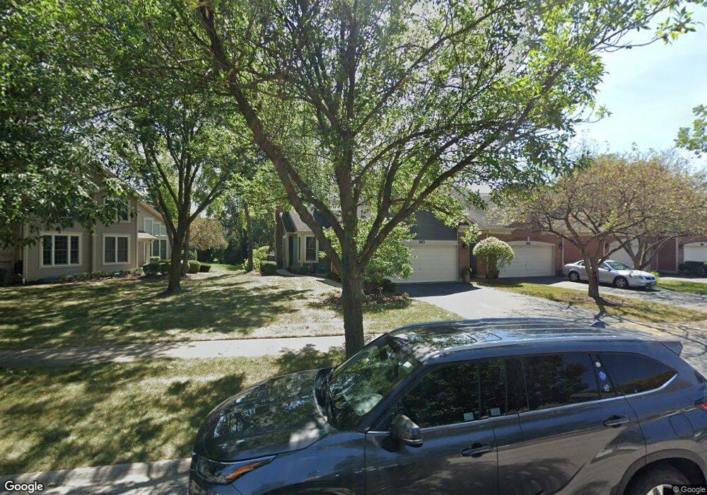
910 Heathrow Ln Naperville, IL 60540
West Wind NeighborhoodEstimated Value: $419,502 - $497,000
2
Beds
2
Baths
1,522
Sq Ft
$297/Sq Ft
Est. Value
About This Home
This home is located at 910 Heathrow Ln, Naperville, IL 60540 and is currently estimated at $451,626, approximately $296 per square foot. 910 Heathrow Ln is a home located in DuPage County with nearby schools including May Watts Elementary School, Thayer J. Hill Middle School, and Metea Valley High School.
Ownership History
Date
Name
Owned For
Owner Type
Purchase Details
Closed on
Aug 28, 2019
Sold by
Goraiski Peggy H and Goralski Peggy A Hester
Bought by
Goralski Peggy A Hester and Goraiski Family Trust
Current Estimated Value
Purchase Details
Closed on
Aug 22, 2017
Sold by
Ruzicks Richard R and F B O Richard R Ruzicks Trust
Bought by
Goralski Mark and Goralski Peggy H
Create a Home Valuation Report for This Property
The Home Valuation Report is an in-depth analysis detailing your home's value as well as a comparison with similar homes in the area
Home Values in the Area
Average Home Value in this Area
Purchase History
| Date | Buyer | Sale Price | Title Company |
|---|---|---|---|
| Goralski Peggy A Hester | -- | Attorney | |
| Goralski Mark | -- | Wheatland Title Guaranty |
Source: Public Records
Tax History
| Year | Tax Paid | Tax Assessment Tax Assessment Total Assessment is a certain percentage of the fair market value that is determined by local assessors to be the total taxable value of land and additions on the property. | Land | Improvement |
|---|---|---|---|---|
| 2024 | -- | $134,271 | $37,204 | $97,067 |
| 2023 | $6,997 | $120,650 | $33,430 | $87,220 |
| 2022 | $7,308 | $117,930 | $32,430 | $85,500 |
| 2021 | $7,404 | $113,720 | $31,270 | $82,450 |
| 2020 | $7,394 | $113,720 | $31,270 | $82,450 |
| 2019 | $7,098 | $108,160 | $29,740 | $78,420 |
| 2018 | $6,066 | $91,690 | $24,750 | $66,940 |
| 2017 | $6,322 | $88,580 | $23,910 | $64,670 |
| 2016 | $6,219 | $85,010 | $22,950 | $62,060 |
| 2015 | $6,176 | $80,710 | $21,790 | $58,920 |
| 2014 | $6,013 | $75,860 | $20,330 | $55,530 |
| 2013 | $5,998 | $76,390 | $20,470 | $55,920 |
Source: Public Records
Map
Nearby Homes
- 1269 Rhodes Ln Unit 1306
- 1246 Ardmore Dr
- 854 Raintree Dr
- 816 S River Rd
- 808 Shiloh Cir
- 840 Mobile Ct
- 1033 Emerald Dr
- 833 Havenshire Rd Unit 833
- 7S410 Arbor Dr
- 731 S River Rd
- 316 Hemlock Ln
- 817 Cardiff Rd
- 845 Tulip Ln
- 534 Grimes Ave
- 1095 Devonshire Ave
- 615 Windridge Ct
- 1447 Baldwin Ct
- 1028 Whitewater Ln
- 1524 Oswego Rd
- 7S146 Wild Cherry Rd
- 912 Heathrow Ln
- 908 Heathrow Ln
- 914 Heathrow Ln
- 906 Heathrow Ln
- 916 Heathrow Ln
- 904 Heathrow Ln
- 900 Heathrow Ln
- 934 Heathrow Ln
- 1107 Tennyson Ln
- 1109 Tennyson Ln
- 936 Heathrow Ln
- 1105 Tennyson Ln
- 1105 Tennyson Ln Unit 1105
- 917 Heathrow Ln
- 915 Heathrow Ln
- 919 Heathrow Ln
- 1103 Tennyson Ln
- 913 Heathrow Ln
- 1111 Tennyson Ln
- 911 Heathrow Ln
Your Personal Tour Guide
Ask me questions while you tour the home.