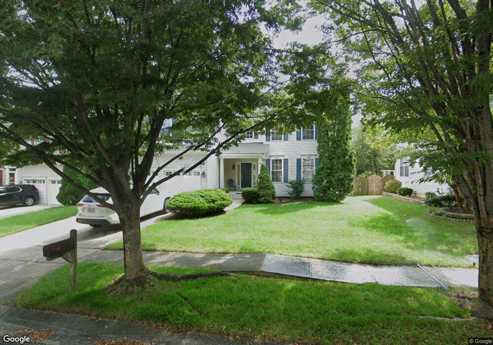
911 Forksbridge Ct Gambrills, MD 21054
Estimated Value: $875,861 - $982,000
--
Bed
4
Baths
3,490
Sq Ft
$267/Sq Ft
Est. Value
About This Home
This home is located at 911 Forksbridge Ct, Gambrills, MD 21054 and is currently estimated at $932,965, approximately $267 per square foot. 911 Forksbridge Ct is a home located in Anne Arundel County with nearby schools including Nantucket Elementary School, Crofton Middle School, and Crofton High School.
Ownership History
Date
Name
Owned For
Owner Type
Purchase Details
Closed on
Feb 20, 2023
Sold by
Kurniawan Daniel
Bought by
Kurniawan Setiabudi Family Revocable Trust
Current Estimated Value
Purchase Details
Closed on
Aug 31, 2004
Sold by
Ramirez Phillip D
Bought by
Kurniawan Daniel and Setiabudi Inez M
Purchase Details
Closed on
Mar 14, 2002
Sold by
U S Home Corporation
Bought by
Ramirez Phillip D and Ramirez Vicki Ann
Create a Home Valuation Report for This Property
The Home Valuation Report is an in-depth analysis detailing your home's value as well as a comparison with similar homes in the area
Home Values in the Area
Average Home Value in this Area
Purchase History
| Date | Buyer | Sale Price | Title Company |
|---|---|---|---|
| Kurniawan Setiabudi Family Revocable Trust | -- | None Listed On Document | |
| Kurniawan Setiabudi Family Revocable Trust | -- | None Listed On Document | |
| Kurniawan Daniel | $585,000 | -- | |
| Ramirez Phillip D | $422,530 | -- |
Source: Public Records
Mortgage History
| Date | Status | Borrower | Loan Amount |
|---|---|---|---|
| Closed | Ramirez Phillip D | -- |
Source: Public Records
Tax History Compared to Growth
Tax History
| Year | Tax Paid | Tax Assessment Tax Assessment Total Assessment is a certain percentage of the fair market value that is determined by local assessors to be the total taxable value of land and additions on the property. | Land | Improvement |
|---|---|---|---|---|
| 2025 | $7,168 | $729,767 | -- | -- |
| 2024 | $7,168 | $677,933 | $0 | $0 |
| 2023 | $6,948 | $626,100 | $232,600 | $393,500 |
| 2022 | $6,511 | $618,067 | $0 | $0 |
| 2021 | $12,792 | $610,033 | $0 | $0 |
| 2020 | $6,246 | $602,000 | $212,600 | $389,400 |
| 2019 | $3,683 | $591,133 | $0 | $0 |
| 2018 | $5,884 | $580,267 | $0 | $0 |
| 2017 | $5,765 | $569,400 | $0 | $0 |
| 2016 | -- | $550,233 | $0 | $0 |
| 2015 | -- | $531,067 | $0 | $0 |
| 2014 | -- | $511,900 | $0 | $0 |
Source: Public Records
Map
Nearby Homes
- 2359 Putnam Ln
- 902 Gunnison Ct
- 1007 Carbondale Way
- 2408 Wentworth Dr
- 2425 MacAllister Ln
- 2539 Vineyard Ln
- 2429 Lizbec Ct
- 1955 Pawlet Dr
- 1516 Marlborough Ct
- 1438 Orleans Ct
- 1448 Orleans Ct
- 1523 Ashburnham Dr
- 930 Truro Ln
- 1454 Vineyard Ct Unit 111XC
- 1405 Wigeon Way Unit 206
- 2610 Chapel Lake Dr Unit 112
- 2173 Johns Hopkins Rd
- 1221 Orchid Rd
- 2713 Lady Slipper Rd
- 2762 Lady Slipper Rd
- 909 Forksbridge Ct
- 913 Forksbridge Ct
- 907 Forksbridge Ct
- 910 Forksbridge Ct
- 908 Forksbridge Ct
- 912 Forksbridge Ct
- 905 Forksbridge Ct
- 2400 Powderhorn Way
- 906 Forksbridge Ct
- 2404 Powderhorn Way
- 911 Briggsdale Ct
- 2406 Powderhorn Way
- 904 Forksbridge Ct
- 913 Briggsdale Ct
- 903 Forksbridge Ct
- 909 Briggsdale Ct
- 2402 Powderhorn Way
- 907 Briggsdale Ct
- 901 Forksbridge Ct
- 905 Briggsdale Ct