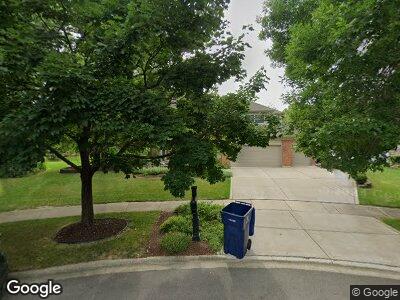
912 Brocks End Ct Naperville, IL 60540
West Wind NeighborhoodEstimated Value: $857,000 - $1,058,000
4
Beds
3
Baths
3,825
Sq Ft
$238/Sq Ft
Est. Value
About This Home
This home is located at 912 Brocks End Ct, Naperville, IL 60540 and is currently estimated at $909,325, approximately $237 per square foot. 912 Brocks End Ct is a home located in DuPage County with nearby schools including May Watts Elementary School, Thayer J. Hill Middle School, and Metea Valley High School.
Ownership History
Date
Name
Owned For
Owner Type
Purchase Details
Closed on
Feb 4, 2003
Sold by
Kirchner William F and Kirchner Lisa M
Bought by
Kirchner William F and William F Kirchner Revocable Trust
Current Estimated Value
Create a Home Valuation Report for This Property
The Home Valuation Report is an in-depth analysis detailing your home's value as well as a comparison with similar homes in the area
Home Values in the Area
Average Home Value in this Area
Purchase History
| Date | Buyer | Sale Price | Title Company |
|---|---|---|---|
| Kirchner William F | -- | -- |
Source: Public Records
Mortgage History
| Date | Status | Borrower | Loan Amount |
|---|---|---|---|
| Closed | Kirchner William F | $412,000 | |
| Closed | Kirchner William F | $454,900 | |
| Closed | Kirchner William E | $312,000 | |
| Closed | Kirchner William F | $51,000 |
Source: Public Records
Tax History Compared to Growth
Tax History
| Year | Tax Paid | Tax Assessment Tax Assessment Total Assessment is a certain percentage of the fair market value that is determined by local assessors to be the total taxable value of land and additions on the property. | Land | Improvement |
|---|---|---|---|---|
| 2023 | $15,132 | $234,310 | $53,520 | $180,790 |
| 2022 | $14,517 | $218,420 | $49,480 | $168,940 |
| 2021 | $14,065 | $210,620 | $47,710 | $162,910 |
| 2020 | $14,046 | $210,620 | $47,710 | $162,910 |
| 2019 | $13,502 | $200,330 | $45,380 | $154,950 |
| 2018 | $13,307 | $193,990 | $43,810 | $150,180 |
| 2017 | $12,946 | $187,410 | $42,320 | $145,090 |
| 2016 | $12,717 | $179,850 | $40,610 | $139,240 |
| 2015 | $12,608 | $170,770 | $38,560 | $132,210 |
| 2014 | $12,375 | $162,120 | $36,310 | $125,810 |
| 2013 | $12,346 | $163,240 | $36,560 | $126,680 |
Source: Public Records
Map
Nearby Homes
- 1507 Ada Ln
- 828 Sanctuary Ln
- 1163 Whispering Hills Dr Unit 127
- 1532 Sequoia Rd
- 1212 Denver Ct Unit 26
- 631 S Whispering Hills Dr
- 1245 Rhodes Ln Unit 1102
- 1161 Ardmore Dr
- 1352 Goldenrod Dr Unit 1
- 902 Heathrow Ln
- 2135 Schumacher Dr
- 880 S Plainfield Naperville Rd
- 2003 Schumacher Dr
- 1040 Sanctuary Ln
- 624 Joshua Ct
- 1164 Lakewood Cir Unit 2
- 978 Merrimac Cir
- 833 Manassas Ct
- 829 Shiloh Cir
- 7S410 Arbor Dr
- 912 Brocks End Ct
- 916 Brocks End Ct
- 908 Brocks End Ct
- 906 Brocks End Ct
- 1352 Ada Ln
- 1348 Ada Ln
- 1404 Ada Ln
- 1408 Ada Ln
- 1344 Ada Ln
- 920 Brocks End Ct
- 1411 Saranell Ave
- 915 Brocks End Ct
- 1407 Saranell Ave
- 1412 Ada Ln
- 1415 Saranell Ave
- 911 Brocks End Ct
- 1419 Saranell Ave
- 1403 Saranell Ave
- 1340 Oakton Ln
- 907 Brocks End Ct