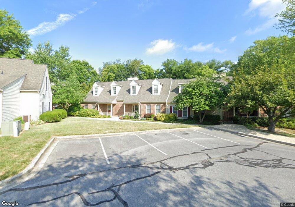
912 Mclendon Dr Frederick, MD 21702
Villa Estates NeighborhoodEstimated Value: $299,000 - $316,000
Studio
3
Baths
1,442
Sq Ft
$211/Sq Ft
Est. Value
About This Home
This home is located at 912 Mclendon Dr, Frederick, MD 21702 and is currently estimated at $303,754, approximately $210 per square foot. 912 Mclendon Dr is a home located in Frederick County with nearby schools including Parkway Elementary School, West Frederick Middle School, and Frederick High School.
Ownership History
Date
Name
Owned For
Owner Type
Purchase Details
Closed on
Aug 10, 2020
Sold by
Burns Patricia
Bought by
Burns Patricia and Romano Lisa Marie
Current Estimated Value
Purchase Details
Closed on
Jun 24, 2004
Sold by
Dahlgren Charles M and Dahlgren Shirley P
Bought by
Burns Patricia
Purchase Details
Closed on
May 5, 1994
Sold by
Cuff Est J D
Bought by
Dahlgnen Charles M
Purchase Details
Closed on
Sep 25, 1989
Sold by
Winchester Homes Inc.
Bought by
Cuff Jean D
Create a Home Valuation Report for This Property
The Home Valuation Report is an in-depth analysis detailing your home's value as well as a comparison with similar homes in the area
Home Values in the Area
Average Home Value in this Area
Purchase History
| Date | Buyer | Sale Price | Title Company |
|---|---|---|---|
| Burns Patricia | -- | None Available | |
| Burns Patricia | $175,000 | -- | |
| Dahlgnen Charles M | $125,000 | -- | |
| Cuff Jean D | $137,600 | -- |
Source: Public Records
Mortgage History
| Date | Status | Borrower | Loan Amount |
|---|---|---|---|
| Closed | Burns Patricia | -- |
Source: Public Records
Tax History
| Year | Tax Paid | Tax Assessment Tax Assessment Total Assessment is a certain percentage of the fair market value that is determined by local assessors to be the total taxable value of land and additions on the property. | Land | Improvement |
|---|---|---|---|---|
| 2025 | $4,073 | $268,700 | $75,000 | $193,700 |
| 2024 | $4,073 | $245,767 | $0 | $0 |
| 2023 | $3,764 | $222,833 | $0 | $0 |
| 2022 | $3,566 | $199,900 | $65,000 | $134,900 |
| 2021 | $3,231 | $189,633 | $0 | $0 |
| 2020 | $3,231 | $179,367 | $0 | $0 |
| 2019 | $3,078 | $169,100 | $60,000 | $109,100 |
| 2018 | $2,964 | $161,467 | $0 | $0 |
| 2017 | $2,799 | $169,100 | $0 | $0 |
| 2016 | $2,872 | $146,200 | $0 | $0 |
| 2015 | $2,872 | $146,200 | $0 | $0 |
| 2014 | $2,872 | $146,200 | $0 | $0 |
Source: Public Records
Map
Nearby Homes
- 833 Waterford Dr
- 116 Whiskey Creek Cir
- 104 Mercer Ct
- 104 Mercer Ct
- 306 Baughmans Ln
- 111 Cavenrock Ct
- 1601 Colonial Way
- 120 Burgess Hill Way Unit 207
- 1864 Murdock Ct
- 750 Carroll Pkwy
- 404 Biggs Ave
- 11 Norva Ave
- 502 Military Rd
- 328 Lindbergh Ave
- 401 Linden Ave
- 1191 Codorus St
- 13 Consett Place
- 317 W College Terrace
- 44 Vienna Ct
- 1204 Conewago Dr
- 910 Mclendon Dr
- 914 Mclendon Dr
- 906 Mclendon Dr
- 908 Mclendon Dr
- 107 Butler Dr
- 916 Mclendon Dr
- 904 Mclendon Dr
- 101 Butler Dr
- 902 Mclendon Dr
- 105 Butler Dr
- 918 Mclendon Dr
- 900 Mclendon Dr
- 103 Butler Dr
- 174 Baughmans Ln
- 106 Butler Dr
- 109 Charleston Ln
- 111 Charleston Ln
- 922 Mclendon Dr
- 920 Mclendon Dr
- 104 Butler Dr
Your Personal Tour Guide
Ask me questions while you tour the home.