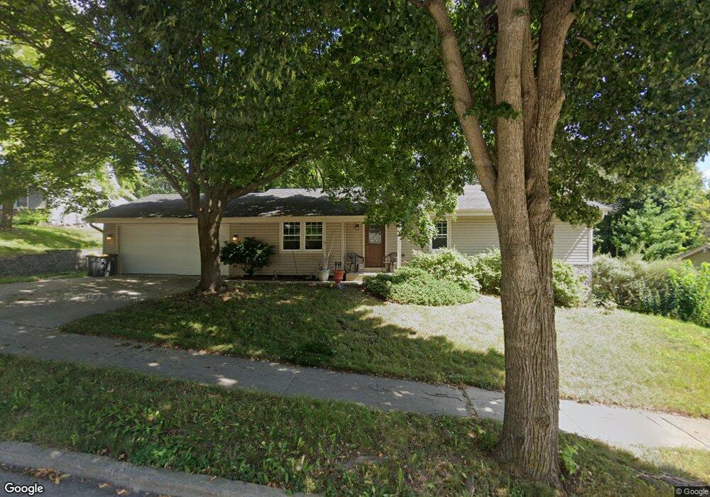
913 Burrie Ln Waukesha, WI 53188
Estimated Value: $377,000 - $424,000
3
Beds
2
Baths
1,250
Sq Ft
$314/Sq Ft
Est. Value
About This Home
This home is located at 913 Burrie Ln, Waukesha, WI 53188 and is currently estimated at $392,340, approximately $313 per square foot. 913 Burrie Ln is a home located in Waukesha County with nearby schools including Bethesda Elementary School, Butler Middle School, and West High School.
Ownership History
Date
Name
Owned For
Owner Type
Purchase Details
Closed on
Mar 28, 2012
Sold by
Ziegler William M
Bought by
Majerus Christopher L
Current Estimated Value
Home Financials for this Owner
Home Financials are based on the most recent Mortgage that was taken out on this home.
Original Mortgage
$135,000
Outstanding Balance
$93,422
Interest Rate
3.95%
Mortgage Type
New Conventional
Estimated Equity
$298,918
Create a Home Valuation Report for This Property
The Home Valuation Report is an in-depth analysis detailing your home's value as well as a comparison with similar homes in the area
Home Values in the Area
Average Home Value in this Area
Purchase History
| Date | Buyer | Sale Price | Title Company |
|---|---|---|---|
| Majerus Christopher L | $175,000 | None Available |
Source: Public Records
Mortgage History
| Date | Status | Borrower | Loan Amount |
|---|---|---|---|
| Open | Majerus Christopher L | $135,000 |
Source: Public Records
Tax History Compared to Growth
Tax History
| Year | Tax Paid | Tax Assessment Tax Assessment Total Assessment is a certain percentage of the fair market value that is determined by local assessors to be the total taxable value of land and additions on the property. | Land | Improvement |
|---|---|---|---|---|
| 2024 | $4,436 | $300,400 | $72,500 | $227,900 |
| 2023 | $4,310 | $300,400 | $72,500 | $227,900 |
| 2022 | $3,915 | $205,900 | $63,300 | $142,600 |
| 2021 | $4,002 | $205,900 | $63,300 | $142,600 |
| 2020 | $3,874 | $205,900 | $63,300 | $142,600 |
| 2019 | $3,750 | $205,900 | $63,300 | $142,600 |
| 2018 | $3,614 | $194,200 | $58,100 | $136,100 |
| 2017 | $3,608 | $194,200 | $58,100 | $136,100 |
| 2016 | $3,556 | $179,800 | $58,100 | $121,700 |
| 2015 | $3,537 | $179,800 | $58,100 | $121,700 |
| 2014 | $3,542 | $172,900 | $58,100 | $114,800 |
| 2013 | $3,542 | $172,900 | $58,100 | $114,800 |
Source: Public Records
Map
Nearby Homes
- 901 Canterbury Ln
- 2150 Kensington Dr
- 1050 S Grandview Blvd
- 605 Rawlins Dr
- 505 Everett Dr
- 2734 Field Dr
- 410 S Grandview Blvd
- 802 S Comanche Ln
- 2909 W View Ct
- 2202 Lander Ln
- 503 S Comanche Ln
- 3726 Madison St
- 3710 Madison St
- 3816 Madison St Unit Lt165
- 2712 Madison St
- 2808 Madison St Unit C
- 2907 Cone View Ln
- 3041 Minot Ln
- 102 E Sutton Place Unit B
- 2508 Manchester Ct
- 909 Burrie Ln
- 917 Burrie Ln
- 905 Burrie Ln
- 912 Burrie Ln
- 904 Burrie Ln
- 908 Burrie Ln
- 916 Burrie Ln
- 2330 Kensington Dr
- 944 Canterbury Ln
- 920 Burrie Ln
- 948 Canterbury Ln
- 952 Canterbury Ln
- 938 Canterbury Ln
- 901 Burrie Ln
- 900 Burrie Ln
- 924 Burrie Ln
- 949 Canterbury Ln
- 945 Canterbury Ln
- 908 Canterbury Ln
- 941 Canterbury Ln