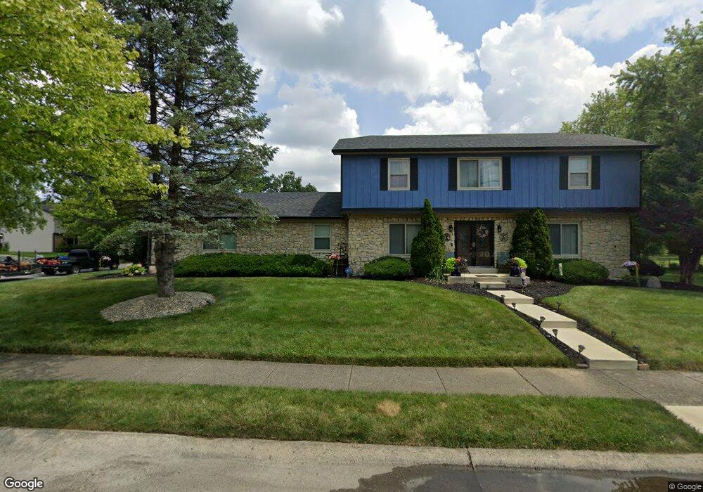
9131 Bristol Rd Indianapolis, IN 46260
Saint Vincent-Greenbriar NeighborhoodEstimated Value: $346,000 - $372,210
5
Beds
3
Baths
2,515
Sq Ft
$143/Sq Ft
Est. Value
About This Home
This home is located at 9131 Bristol Rd, Indianapolis, IN 46260 and is currently estimated at $358,803, approximately $142 per square foot. 9131 Bristol Rd is a home located in Marion County with nearby schools including Spring Mill Elementary School, Westlane Middle School, and North Central High School.
Ownership History
Date
Name
Owned For
Owner Type
Purchase Details
Closed on
Aug 17, 2005
Sold by
Rawlings Eustace and Rawlings Naomi
Bought by
Smith Charley and Smith Cheri
Current Estimated Value
Home Financials for this Owner
Home Financials are based on the most recent Mortgage that was taken out on this home.
Original Mortgage
$180,000
Outstanding Balance
$94,739
Interest Rate
5.69%
Mortgage Type
New Conventional
Estimated Equity
$264,064
Create a Home Valuation Report for This Property
The Home Valuation Report is an in-depth analysis detailing your home's value as well as a comparison with similar homes in the area
Home Values in the Area
Average Home Value in this Area
Purchase History
| Date | Buyer | Sale Price | Title Company |
|---|---|---|---|
| Smith Charley | -- | None Available |
Source: Public Records
Mortgage History
| Date | Status | Borrower | Loan Amount |
|---|---|---|---|
| Open | Smith Charley | $180,000 |
Source: Public Records
Tax History Compared to Growth
Tax History
| Year | Tax Paid | Tax Assessment Tax Assessment Total Assessment is a certain percentage of the fair market value that is determined by local assessors to be the total taxable value of land and additions on the property. | Land | Improvement |
|---|---|---|---|---|
| 2024 | $4,493 | $344,300 | $59,900 | $284,400 |
| 2023 | $4,493 | $341,000 | $59,900 | $281,100 |
| 2022 | $4,233 | $341,000 | $59,900 | $281,100 |
| 2021 | $3,795 | $277,100 | $32,500 | $244,600 |
| 2020 | $3,453 | $266,900 | $32,500 | $234,400 |
| 2019 | $3,109 | $256,000 | $32,500 | $223,500 |
| 2018 | $2,777 | $234,100 | $32,500 | $201,600 |
| 2017 | $2,667 | $227,600 | $32,500 | $195,100 |
| 2016 | $2,561 | $233,800 | $32,500 | $201,300 |
| 2014 | $2,136 | $215,300 | $32,500 | $182,800 |
| 2013 | $2,124 | $209,000 | $32,500 | $176,500 |
Source: Public Records
Map
Nearby Homes
- 9210 Brantford Ct
- 958 Tamarack Circle Dr N
- 9271 Spring Lakes Dr
- 9263 Spring Forest Dr Unit 7
- 9503 Huntington Ln
- 9321 Spring Forest Dr
- 1310 Kings Cove Ct
- 1642 Misty Lake Dr
- 9556 Drakeford Dr
- 8661 Williamshire Dr W
- 8649 Cricket Tree Ln
- 9514 Cadbury Cir
- 9797 Ditch Rd
- 10132 Summerlakes Dr
- 542 Braeside Dr N
- 1053 Millwood Ct Unit 3
- 1151 Canterbury Square S
- 445 Pine Dr
- 1131 Canterbury Square S
- 1113 Canterbury Square S
- 1237 Selkirk Ln
- 9132 Bristol Rd
- 1231 Selkirk Ln
- 1302 Selkirk Ln
- 1308 Selkirk Ln
- 1236 Selkirk Ln
- 1214 Woodbridge Ln
- 1319 Selkirk Ln
- 1314 Selkirk Ln
- 1208 Woodbridge Ln
- 1227 Selkirk Ln
- 1230 Selkirk Ln
- 1202 Woodbridge Ln
- 9114 Bristol Rd
- 1320 Selkirk Ln
- 1224 Selkirk Ln
- 1213 Woodbridge Ln
- 9113 Williston Ct
- 1203 Woodbridge Ln
- 1122 Woodbridge Ln