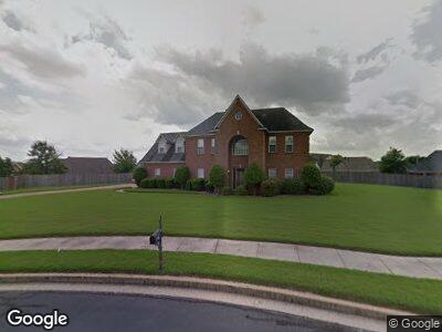
9134 Joe Lyon Blvd Olive Branch, MS 38654
Estimated Value: $312,000 - $440,000
5
Beds
3
Baths
3,323
Sq Ft
$115/Sq Ft
Est. Value
About This Home
This home is located at 9134 Joe Lyon Blvd, Olive Branch, MS 38654 and is currently estimated at $383,715, approximately $115 per square foot. 9134 Joe Lyon Blvd is a home located in DeSoto County with nearby schools including Overpark Elementary School, Center Hill High School, and Power Center Academy - Southeast.
Ownership History
Date
Name
Owned For
Owner Type
Purchase Details
Closed on
Oct 28, 2022
Sold by
Moore Candace Baker
Bought by
Bruce Sharla Johnson
Current Estimated Value
Purchase Details
Closed on
Feb 18, 2005
Sold by
Federal Home Loan Mortgage Corporation
Bought by
Baker Wilma A
Home Financials for this Owner
Home Financials are based on the most recent Mortgage that was taken out on this home.
Original Mortgage
$46,900
Interest Rate
5.62%
Mortgage Type
Stand Alone Second
Create a Home Valuation Report for This Property
The Home Valuation Report is an in-depth analysis detailing your home's value as well as a comparison with similar homes in the area
Home Values in the Area
Average Home Value in this Area
Purchase History
| Date | Buyer | Sale Price | Title Company |
|---|---|---|---|
| Bruce Sharla Johnson | -- | -- | |
| Baker Wilma A | -- | None Available |
Source: Public Records
Mortgage History
| Date | Status | Borrower | Loan Amount |
|---|---|---|---|
| Open | Baker Wilma A | $187,600 | |
| Previous Owner | Baker Wilma A | $46,900 |
Source: Public Records
Tax History Compared to Growth
Tax History
| Year | Tax Paid | Tax Assessment Tax Assessment Total Assessment is a certain percentage of the fair market value that is determined by local assessors to be the total taxable value of land and additions on the property. | Land | Improvement |
|---|---|---|---|---|
| 2024 | $2,945 | $21,581 | $3,000 | $18,581 |
| 2023 | $2,945 | $21,581 | $0 | $0 |
| 2022 | $2,945 | $21,581 | $3,000 | $18,581 |
| 2021 | $2,945 | $21,581 | $3,000 | $18,581 |
| 2020 | $2,743 | $20,095 | $3,000 | $17,095 |
| 2019 | $2,729 | $19,997 | $3,000 | $16,997 |
| 2017 | $2,371 | $35,932 | $19,466 | $16,466 |
| 2016 | $2,371 | $19,466 | $3,000 | $16,466 |
| 2015 | $2,671 | $35,932 | $19,466 | $16,466 |
| 2014 | $2,496 | $20,381 | $0 | $0 |
| 2013 | $2,563 | $21,381 | $0 | $0 |
Source: Public Records
Map
Nearby Homes
- 9100 Champlain Dr
- 9064 Champlain Dr
- 8992 Gavin Dr
- 9908 Vista Ridge Dr
- 9387 Joe Lyon Blvd
- 9192 Rachel Shea Ave
- 9416 Geneva Loop E
- 9320 Lacee Ln
- 5627 Millers Cove
- 7350 Hunter Ridge
- 7206 State Line Rd
- 8321 Waverly Cove
- 9476 Plantation Rd
- 9240 Huron Dr
- 9181 Waterpointe Cove
- 7317 Patsy Cir N
- 5474 Stone Arch Place
- 5450 Stone Arch Place
- 5456 Stone Arch Place
- 9081 Lakeside Dr
- 9134 Joe Lyon Blvd
- 9131 Gavin Dr
- 9143 Gavin Dr
- 9138 Tahoe Dr
- 9144 Tahoe Dr
- 9144 Tahoe Dr
- 9155 Gavin Dr
- 9132 Tahoe Dr
- 9170 Joe Lyon Blvd
- 9141 Tahoe Dr
- 9167 Lorrie Ln
- 9119 Gavin Dr
- 9150 Tahoe Dr
- 9167 Gavin Dr
- 9162 Tahoe Dr
- 9171 Joe Lyon Blvd
- 9135 Tahoe Dr
- 9179 Gavin Dr
- 9188 Joe Lyon Blvd
- 9174 Tahoe Dr