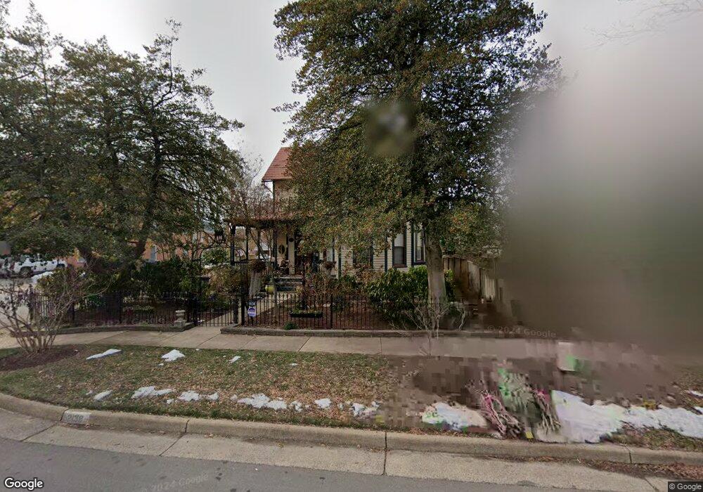
9138 Grant Ave Manassas, VA 20110
Old Town Manassas NeighborhoodEstimated Value: $676,115 - $756,000
3
Beds
2
Baths
2,007
Sq Ft
$350/Sq Ft
Est. Value
About This Home
This home is located at 9138 Grant Ave, Manassas, VA 20110 and is currently estimated at $702,279, approximately $349 per square foot. 9138 Grant Ave is a home located in Manassas City with nearby schools including Richard C. Haydon Elementary School, Mayfield Intermediate School, and Grace E. Metz Middle School.
Ownership History
Date
Name
Owned For
Owner Type
Purchase Details
Closed on
Jul 13, 1998
Sold by
Roop David A
Bought by
Meyer Richard and Meyer Ann
Current Estimated Value
Home Financials for this Owner
Home Financials are based on the most recent Mortgage that was taken out on this home.
Original Mortgage
$170,000
Outstanding Balance
$34,850
Interest Rate
7.02%
Mortgage Type
New Conventional
Estimated Equity
$667,429
Create a Home Valuation Report for This Property
The Home Valuation Report is an in-depth analysis detailing your home's value as well as a comparison with similar homes in the area
Home Values in the Area
Average Home Value in this Area
Purchase History
| Date | Buyer | Sale Price | Title Company |
|---|---|---|---|
| Meyer Richard | $230,000 | -- |
Source: Public Records
Mortgage History
| Date | Status | Borrower | Loan Amount |
|---|---|---|---|
| Open | Meyer Richard | $170,000 |
Source: Public Records
Tax History Compared to Growth
Tax History
| Year | Tax Paid | Tax Assessment Tax Assessment Total Assessment is a certain percentage of the fair market value that is determined by local assessors to be the total taxable value of land and additions on the property. | Land | Improvement |
|---|---|---|---|---|
| 2024 | $7,917 | $628,300 | $170,000 | $458,300 |
| 2023 | $7,628 | $605,400 | $165,500 | $439,900 |
| 2022 | $7,522 | $560,500 | $143,500 | $417,000 |
| 2021 | $7,304 | $511,100 | $128,000 | $383,100 |
| 2020 | $7,245 | $496,200 | $124,500 | $371,700 |
| 2019 | $7,125 | $481,400 | $121,000 | $360,400 |
| 2018 | $6,624 | $453,700 | $115,000 | $338,700 |
| 2017 | -- | $439,100 | $115,000 | $324,100 |
| 2016 | $6,064 | $432,200 | $0 | $0 |
| 2015 | -- | $389,300 | $115,000 | $274,300 |
| 2014 | -- | $0 | $0 | $0 |
Source: Public Records
Map
Nearby Homes
- 9040 Grant Ave
- 9105 Ewell St
- Seneca Plan at Independent Hill - Independent Hill Single-Family Homes
- McPherson Grand - End Unit Plan at Independent Hill - Independent Hill Townhomes
- Lehigh Plan at Independent Hill - Independent Hill Single-Family Homes
- Schubert Plan at Independent Hill - Independent Hill Townhomes
- Hudson Plan at Independent Hill - Independent Hill Single-Family Homes
- 9229 Prince William St
- 9204 Douglas St
- 9523 Center St
- 9557 Center St
- 9561 Center St
- 9583 Center St
- 8941 Quarry Rd
- 9319 Woodlea Ct
- 9413 Stonewall Rd
- 9433 Stonewall Rd
- 9469 Stonewall Rd
- 9520 Barnes Loop
- 9524 Barnes Loop
- 9136 Grant Ave
- 9240 Mosby St
- 9240 Mosby St Unit B
- 9251 Mosby St
- 9238 Mosby Street B
- 9242 Mosby St Unit B
- 9242 Mosby St Unit A
- 9238 Mosby St Unit 9
- 9238 Mosby St Unit A
- 9238 Mosby St Unit B
- 9238 Mosby St
- 9300 Grant Ave Unit 300
- 9300 Grant Ave Unit 201
- 9300 Grant Ave Unit 204
- 9300 Grant Ave Unit 200/204
- 9300 Grant Ave Unit 103
- 9300 Grant Ave Unit 101
- 9300 Grant Ave Unit 101/103
- 9234 Mosby St
- 9244 Mosby St Unit B