
Seller's Agent in 2025
Paul Kopetsky
CENTURY 21 New Heritage West
(847) 346-6633
46 Total Sales
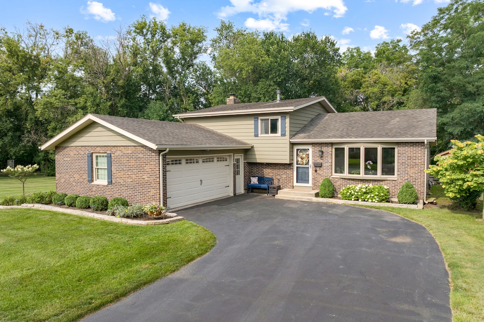

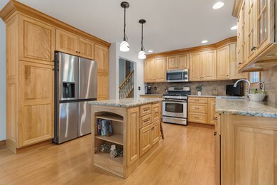
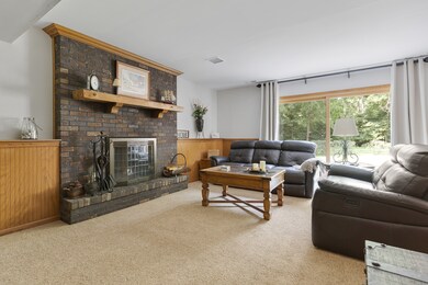
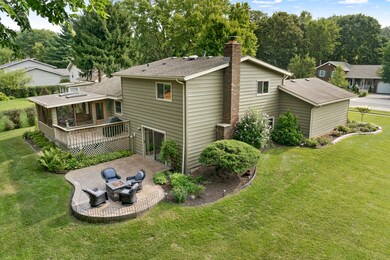
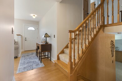
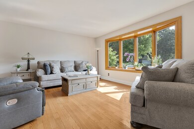
METICULOUSLY MAINTAINED 3 BATHROOM 3 BEDROOM SPLIT LEVEL * * RENOVATED KITCHEN WITH RED BIRCH CABINETRY, GRANITE COUNTERTOPS, AND STAINLESS STEEL APPLIANCES * MAIN LEVEL HARD WOOD FLOORS * AMAZING 3 SEASON ROOM WITH LOWER LEVEL STAMPED CONCRETE PATIO * UPDATED 3 FULL BATHROOMS * THERMOPANE WINDOWS * EXPANDED OVERSIZED LOT BACKING UP TO THE FOX RIVER TRAIL * READY TO MOVE RIGHT IN
Last Agent to Sell the Property
CENTURY 21 New Heritage West License #475182935 Listed on: 08/06/2025
| Date | Type | Sale Price | Title Company |
|---|---|---|---|
| Warranty Deed | $412,500 | None Listed On Document | |
| Quit Claim Deed | -- | None Listed On Document |
| Date | Event | Price | List to Sale | Price per Sq Ft |
|---|---|---|---|---|
| 09/02/2025 09/02/25 | Sold | $412,001 | +4.4% | $221 / Sq Ft |
| 08/11/2025 08/11/25 | Pending | -- | -- | -- |
| 08/06/2025 08/06/25 | For Sale | $394,500 | -- | $212 / Sq Ft |
| Year | Tax Paid | Tax Assessment Tax Assessment Total Assessment is a certain percentage of the fair market value that is determined by local assessors to be the total taxable value of land and additions on the property. | Land | Improvement |
|---|---|---|---|---|
| 2024 | $6,969 | $105,093 | $15,080 | $90,013 |
| 2023 | $6,529 | $93,992 | $13,487 | $80,505 |
| 2022 | $6,384 | $80,443 | $16,092 | $64,351 |
| 2021 | $6,118 | $74,943 | $14,992 | $59,951 |
| 2020 | $5,952 | $72,290 | $14,461 | $57,829 |
| 2019 | $5,802 | $69,190 | $13,841 | $55,349 |
| 2018 | $5,520 | $63,917 | $12,786 | $51,131 |
| 2017 | $5,399 | $60,214 | $12,045 | $48,169 |
| 2016 | $5,308 | $56,475 | $11,297 | $45,178 |
| 2013 | -- | $62,830 | $10,539 | $52,291 |
Seller's Agent in 2025
Paul Kopetsky
CENTURY 21 New Heritage West
(847) 346-6633
46 Total Sales
Seller Co-Listing Agent in 2025
Jasmine Meunekithirath
CENTURY 21 New Heritage West
(847) 426-6800
4 Total Sales
Buyer's Agent in 2025
Sabrina Glover
Platinum Partners Realtors
(630) 523-9989
312 Total Sales
Source: Midwest Real Estate Data (MRED)
MLS Number: 12439977
APN: 19-34-382-006
Disclaimer: Certain information contained herein is derived from information provided by parties other than Homes.com. All information provided is deemed reliable, but is not guaranteed to be accurate and should be independently verified.
![]() Based on information submitted to the MLS GRID. All data is obtained from various sources and may not have been verified by broker or MLS GRID. Supplied Open House Information is subject to change without notice. All information should be independently reviewed and verified for accuracy. Properties may or may not be listed by the office/agent presenting the information. Some IDX listings have been excluded from this website.
Based on information submitted to the MLS GRID. All data is obtained from various sources and may not have been verified by broker or MLS GRID. Supplied Open House Information is subject to change without notice. All information should be independently reviewed and verified for accuracy. Properties may or may not be listed by the office/agent presenting the information. Some IDX listings have been excluded from this website.
Based on information submitted to the MLS GRID
Ask me questions while you tour the home.