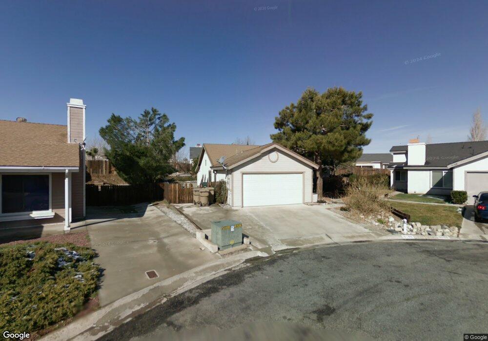
9146 Mapleleaf Ct Hesperia, CA 92344
High Country NeighborhoodEstimated Value: $352,000 - $377,588
3
Beds
2
Baths
1,159
Sq Ft
$319/Sq Ft
Est. Value
About This Home
This home is located at 9146 Mapleleaf Ct, Hesperia, CA 92344 and is currently estimated at $369,647, approximately $318 per square foot. 9146 Mapleleaf Ct is a home located in San Bernardino County with nearby schools including Cottonwood Elementary School, Cedar Middle School, and Oak Hills High School.
Ownership History
Date
Name
Owned For
Owner Type
Purchase Details
Closed on
Jul 28, 2010
Sold by
The Bank Of New York Mellon
Bought by
Rad Steven
Current Estimated Value
Home Financials for this Owner
Home Financials are based on the most recent Mortgage that was taken out on this home.
Original Mortgage
$56,700
Interest Rate
4.38%
Mortgage Type
New Conventional
Purchase Details
Closed on
Apr 22, 2010
Sold by
Wax Norman L
Bought by
The Bank Of New York Mellon and The Bank Of New York
Create a Home Valuation Report for This Property
The Home Valuation Report is an in-depth analysis detailing your home's value as well as a comparison with similar homes in the area
Home Values in the Area
Average Home Value in this Area
Purchase History
| Date | Buyer | Sale Price | Title Company |
|---|---|---|---|
| Rad Steven | $71,000 | None Available | |
| The Bank Of New York Mellon | $67,500 | Landsafe Title |
Source: Public Records
Mortgage History
| Date | Status | Borrower | Loan Amount |
|---|---|---|---|
| Previous Owner | Rad Steven | $56,700 |
Source: Public Records
Tax History
| Year | Tax Paid | Tax Assessment Tax Assessment Total Assessment is a certain percentage of the fair market value that is determined by local assessors to be the total taxable value of land and additions on the property. | Land | Improvement |
|---|---|---|---|---|
| 2025 | $989 | $90,805 | $17,937 | $72,868 |
| 2024 | $966 | $89,024 | $17,585 | $71,439 |
| 2023 | $955 | $87,278 | $17,240 | $70,038 |
| 2022 | $932 | $85,567 | $16,902 | $68,665 |
| 2021 | $915 | $83,890 | $16,571 | $67,319 |
| 2020 | $904 | $83,030 | $16,401 | $66,629 |
| 2019 | $885 | $81,402 | $16,079 | $65,323 |
| 2018 | $867 | $79,806 | $15,764 | $64,042 |
| 2017 | $851 | $78,241 | $15,455 | $62,786 |
| 2016 | $833 | $76,707 | $15,152 | $61,555 |
| 2015 | $822 | $75,554 | $14,924 | $60,630 |
| 2014 | $810 | $74,074 | $14,632 | $59,442 |
Source: Public Records
Map
Nearby Homes
- 0 Tamarisk Ave Unit HD23052637
- 9105 Aspenwood Ln
- 9329 Sable Ridge Ave
- 14131 Desert Rose St
- 14152 Nantucket St
- 8910 Glenwood Ave
- 8910 Newcastle Ave
- 14134 Hartford St
- 8874 Tamarisk Ave
- 14194 Hartford St
- 9426 Tamarisk Ave Unit 21
- 9426 Tamarisk Ave Unit 62
- 14148 Hartford St
- 14191 Hartford St
- 0 Olive St
- 14122 Hartford St
- 14424 Plymouth St
- 9476 Plum Ct
- 9519 Maple Ave
- 0 Orange St Unit CV25173962
- 9158 Mapleleaf Ct
- 14285 Pinewood Dr
- 14273 Pinewood Dr
- 14291 Pinewood Dr
- 14288 Poplar St
- 9122 Mapleleaf Ct
- 14293 Pinewood Dr
- 9159 Mapleleaf Ct
- 14284 Poplar St
- 14295 Pinewood Dr
- 9147 Mapleleaf Ct
- 9135 Mapleleaf Ct
- 14297 Pinewood Dr
- 14272 Poplar St
- 9123 Mapleleaf Ct
- 14299 Pinewood Dr
- 9148 Orangeleaf Ln
- 14260 Poplar St
- 14293 Poplar St
- 14291 Poplar St
Your Personal Tour Guide
Ask me questions while you tour the home.