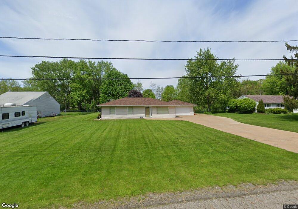
9157 Root Dr Streetsboro, OH 44241
Estimated Value: $193,000 - $206,783
3
Beds
1
Bath
1,092
Sq Ft
$182/Sq Ft
Est. Value
About This Home
This home is located at 9157 Root Dr, Streetsboro, OH 44241 and is currently estimated at $198,946, approximately $182 per square foot. 9157 Root Dr is a home located in Portage County with nearby schools including Campus Intermediate Elementary School, Henry Defer Intermediate Elementary School, and Streetsboro Middle School.
Ownership History
Date
Name
Owned For
Owner Type
Purchase Details
Closed on
Feb 14, 2001
Sold by
Kittelson Eric
Bought by
Bokshon Gary M
Current Estimated Value
Home Financials for this Owner
Home Financials are based on the most recent Mortgage that was taken out on this home.
Original Mortgage
$81,000
Interest Rate
7.1%
Purchase Details
Closed on
Oct 9, 1987
Bought by
Kittelson Eric
Create a Home Valuation Report for This Property
The Home Valuation Report is an in-depth analysis detailing your home's value as well as a comparison with similar homes in the area
Home Values in the Area
Average Home Value in this Area
Purchase History
| Date | Buyer | Sale Price | Title Company |
|---|---|---|---|
| Bokshon Gary M | $90,000 | Insured Title | |
| Kittelson Eric | -- | -- |
Source: Public Records
Mortgage History
| Date | Status | Borrower | Loan Amount |
|---|---|---|---|
| Previous Owner | Bokshon Gary M | $81,000 |
Source: Public Records
Tax History
| Year | Tax Paid | Tax Assessment Tax Assessment Total Assessment is a certain percentage of the fair market value that is determined by local assessors to be the total taxable value of land and additions on the property. | Land | Improvement |
|---|---|---|---|---|
| 2024 | $2,510 | $60,730 | $15,720 | $45,010 |
| 2023 | $2,431 | $48,160 | $14,630 | $33,530 |
| 2022 | $2,434 | $48,160 | $14,630 | $33,530 |
| 2021 | $2,444 | $48,160 | $14,630 | $33,530 |
| 2020 | $2,328 | $42,110 | $14,630 | $27,480 |
| 2019 | $2,350 | $42,110 | $14,630 | $27,480 |
| 2018 | $1,930 | $38,050 | $14,630 | $23,420 |
| 2017 | $1,888 | $38,050 | $14,630 | $23,420 |
| 2016 | $1,889 | $38,050 | $14,630 | $23,420 |
Source: Public Records
Map
Nearby Homes
- 9088 State Route 14
- 9344 Dorothy Dr
- 9431 Briar Dr
- 1413 Colony Dr Unit J5
- 1678 Sugar Maple Ct
- 1616 Crescent Dr
- V/L State Route 14
- 1625 Flannery Ct
- 9542 Page Rd
- 1485 Pike Pkwy
- 1595 Leslie Dr
- 9741 Eagle Ln Unit 9741
- 1678 Duncan Way
- 1013 Ashwood Ln
- 1011 Ashwood Ln
- 9247 Chestnut Ct
- 9251 Chestnut Ct
- 939 State Route 303
- 9859 State Route 43
- 9979 Lady Catherine
- 9167 Root Dr
- 1690 Manor Dr
- 9147 Root Dr
- 9177 Root Dr
- 1689 Manor Dr
- 1700 Manor Dr
- 1673 State Route 303
- 9187 Root Dr
- 1663 State Route 303
- 1691 Ohio 303
- 1699 Manor Dr
- 1691 State Route 303
- 9156 Briar Dr
- 9166 Briar Dr
- 9146 Briar Dr
- 1710 Manor Dr
- 9176 Briar Dr
- 1701 State Route 303
- 9197 Root Dr
- 1653 State Route 303
Your Personal Tour Guide
Ask me questions while you tour the home.