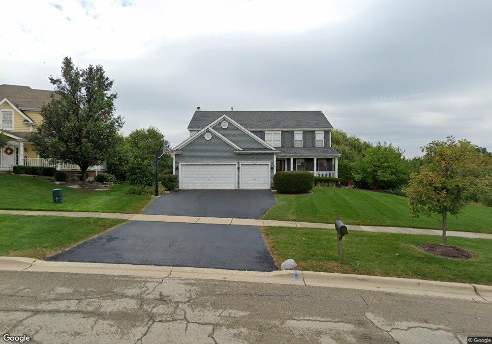
917 Hodge Ln Batavia, IL 60510
Southeast Batavia NeighborhoodEstimated Value: $600,875 - $659,000
4
Beds
3
Baths
2,997
Sq Ft
$211/Sq Ft
Est. Value
About This Home
This home is located at 917 Hodge Ln, Batavia, IL 60510 and is currently estimated at $633,469, approximately $211 per square foot. 917 Hodge Ln is a home located in Kane County with nearby schools including J B Nelson Elementary School, Sam Rotolo Middle School, and Batavia Sr High School.
Ownership History
Date
Name
Owned For
Owner Type
Purchase Details
Closed on
Oct 7, 2008
Sold by
Wielbik William J and Wielbik Fama J
Bought by
Ernst Philip and May Ernst Kathleen R
Current Estimated Value
Home Financials for this Owner
Home Financials are based on the most recent Mortgage that was taken out on this home.
Original Mortgage
$417,000
Outstanding Balance
$277,030
Interest Rate
6.41%
Mortgage Type
Purchase Money Mortgage
Estimated Equity
$356,439
Purchase Details
Closed on
Aug 27, 1999
Sold by
Dh Davey Farm Inc
Bought by
Wielbik William J and Wielbik Fama J
Home Financials for this Owner
Home Financials are based on the most recent Mortgage that was taken out on this home.
Original Mortgage
$318,800
Interest Rate
7.59%
Create a Home Valuation Report for This Property
The Home Valuation Report is an in-depth analysis detailing your home's value as well as a comparison with similar homes in the area
Home Values in the Area
Average Home Value in this Area
Purchase History
| Date | Buyer | Sale Price | Title Company |
|---|---|---|---|
| Ernst Philip | $475,000 | Chicago Title Insurance Co | |
| Wielbik William J | $354,500 | Sbi Title Inc |
Source: Public Records
Mortgage History
| Date | Status | Borrower | Loan Amount |
|---|---|---|---|
| Open | Ernst Philip | $417,000 | |
| Previous Owner | Wielbik William J | $318,800 |
Source: Public Records
Tax History Compared to Growth
Tax History
| Year | Tax Paid | Tax Assessment Tax Assessment Total Assessment is a certain percentage of the fair market value that is determined by local assessors to be the total taxable value of land and additions on the property. | Land | Improvement |
|---|---|---|---|---|
| 2024 | $11,557 | $154,175 | $29,605 | $124,570 |
| 2023 | $11,321 | $139,930 | $26,870 | $113,060 |
| 2022 | $10,895 | $130,776 | $25,112 | $105,664 |
| 2021 | $11,674 | $137,693 | $23,816 | $113,877 |
| 2020 | $11,389 | $135,046 | $23,358 | $111,688 |
| 2019 | $11,827 | $137,142 | $22,531 | $114,611 |
| 2018 | $11,669 | $135,328 | $21,673 | $113,655 |
| 2017 | $11,392 | $130,865 | $20,958 | $109,907 |
| 2016 | $11,154 | $127,054 | $20,348 | $106,706 |
| 2015 | -- | $124,161 | $19,885 | $104,276 |
| 2014 | -- | $120,253 | $19,259 | $100,994 |
| 2013 | -- | $131,580 | $32,557 | $99,023 |
Source: Public Records
Map
Nearby Homes
- 621 Young Ave
- 1017 Willow Ln Unit 2
- 1136 Pine Ct
- Lot 4 Manchester Ave
- 817 Woodland Hills Rd
- 304 Manchester Ave
- Lot 1 Center St
- 943 Orchard Ct
- 860 S River St
- 129 S Prairie St
- 637 E Wilson St
- 428 E Wilson St
- 1025 E Wilson St
- 1332 Giese Rd Unit 2
- 473 Bond Dr
- 1267 Foxglove Dr
- 1273 Foxglove Dr
- 1277 Foxglove Dr
- 1283 Foxglove Dr
- 1285 Foxglove Dr