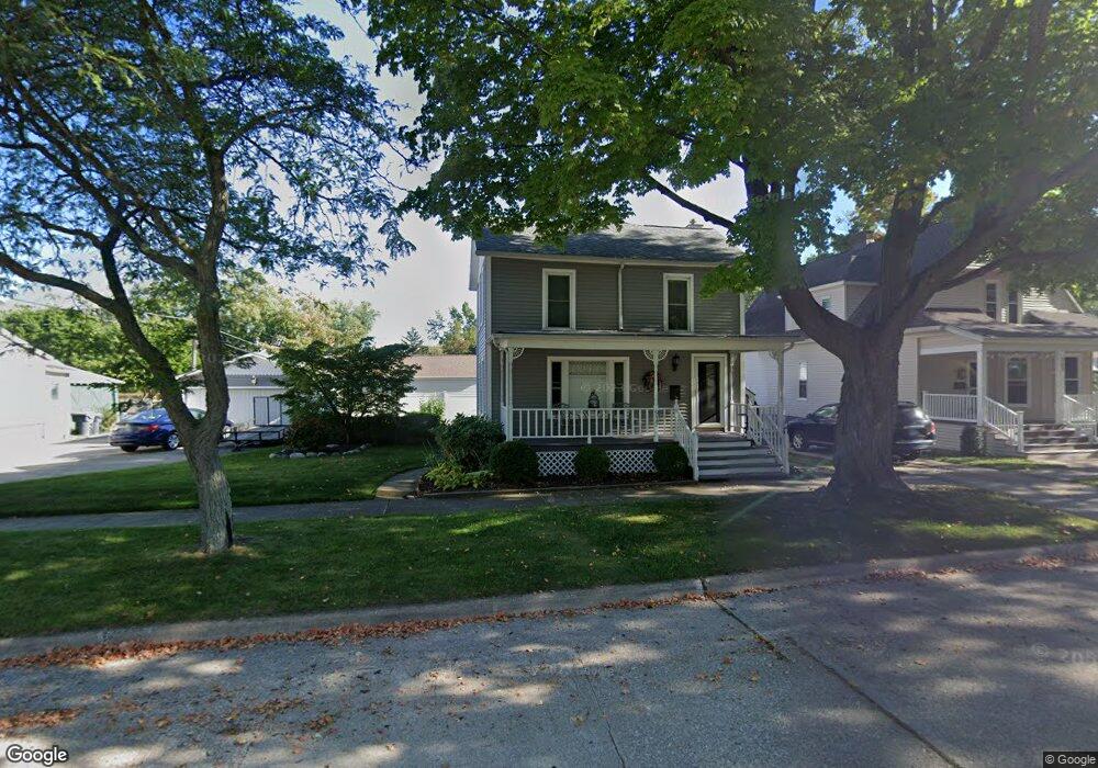
917 Price St Saint Joseph, MI 49085
Estimated Value: $257,000 - $349,000
3
Beds
2
Baths
1,560
Sq Ft
$190/Sq Ft
Est. Value
About This Home
This home is located at 917 Price St, Saint Joseph, MI 49085 and is currently estimated at $296,647, approximately $190 per square foot. 917 Price St is a home located in Berrien County with nearby schools including Upton Middle School, St. Joseph High School, and Benton Harbor Charter School Academy.
Ownership History
Date
Name
Owned For
Owner Type
Purchase Details
Closed on
Jan 29, 2024
Sold by
Gersonde Michael A
Bought by
Gersonde Michael A and Gersonde Griffin Chase
Current Estimated Value
Purchase Details
Closed on
Dec 5, 2023
Sold by
Gersonde Michael A
Bought by
Gersonde Michael A and Gersonde Griffin Chase
Purchase Details
Closed on
Jul 7, 2020
Sold by
Gersond Michael A and Magnowski Katherine M
Bought by
Gersonde Michael A
Purchase Details
Closed on
Dec 16, 2008
Sold by
Gersonde Michael A
Bought by
Gersonde Michael A and Magnowski Katherine M
Home Financials for this Owner
Home Financials are based on the most recent Mortgage that was taken out on this home.
Original Mortgage
$122,500
Interest Rate
6.3%
Mortgage Type
New Conventional
Purchase Details
Closed on
Feb 22, 2001
Create a Home Valuation Report for This Property
The Home Valuation Report is an in-depth analysis detailing your home's value as well as a comparison with similar homes in the area
Home Values in the Area
Average Home Value in this Area
Purchase History
| Date | Buyer | Sale Price | Title Company |
|---|---|---|---|
| Gersonde Michael A | -- | None Listed On Document | |
| Gersonde Michael A | -- | None Listed On Document | |
| Gersonde Michael A | -- | None Listed On Document | |
| Gersonde Michael A | -- | None Available | |
| Gersonde Michael A | -- | Metropolitan Title Company | |
| -- | -- | -- |
Source: Public Records
Mortgage History
| Date | Status | Borrower | Loan Amount |
|---|---|---|---|
| Previous Owner | Gersonde Michael A | $122,500 |
Source: Public Records
Tax History
| Year | Tax Paid | Tax Assessment Tax Assessment Total Assessment is a certain percentage of the fair market value that is determined by local assessors to be the total taxable value of land and additions on the property. | Land | Improvement |
|---|---|---|---|---|
| 2025 | $2,317 | $138,400 | $0 | $0 |
| 2024 | $2,247 | $132,000 | $0 | $0 |
| 2023 | $2,156 | $109,200 | $0 | $0 |
| 2022 | $2,058 | $89,600 | $0 | $0 |
| 2021 | $2,044 | $85,200 | $20,300 | $64,900 |
| 2020 | $2,017 | $81,500 | $0 | $0 |
| 2019 | $2,001 | $72,200 | $22,500 | $49,700 |
| 2018 | $1,967 | $72,200 | $0 | $0 |
| 2017 | $1,765 | $70,600 | $0 | $0 |
| 2016 | $1,765 | $67,600 | $0 | $0 |
| 2015 | $1,743 | $61,200 | $0 | $0 |
| 2014 | $1,661 | $57,600 | $0 | $0 |
Source: Public Records
Map
Nearby Homes
- 1210 Guernsey Ct
- 907 Market St
- 516 Church St
- 126 Mariners Cove
- 144 Mariners Cove
- 242 Cavelier Ave
- 1221 Broad St Unit 3
- 239 Cavelier Ave
- 221 Cavelier Ave
- 1002 Lake Blvd
- 1516 Forres Ave
- 1518 Forres Ave
- 403 State St Unit 3
- 327 State St Unit 2
- 398 Anchors Way Unit 87s
- 398 Anchors Way Unit 82s
- 1209 Mohawk Ln
- 1457 Main St
- 1020 Lions Park Dr
- 800 Whitwam Dr Unit 1 & 1A
Your Personal Tour Guide
Ask me questions while you tour the home.