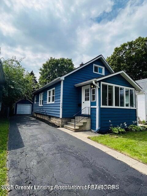
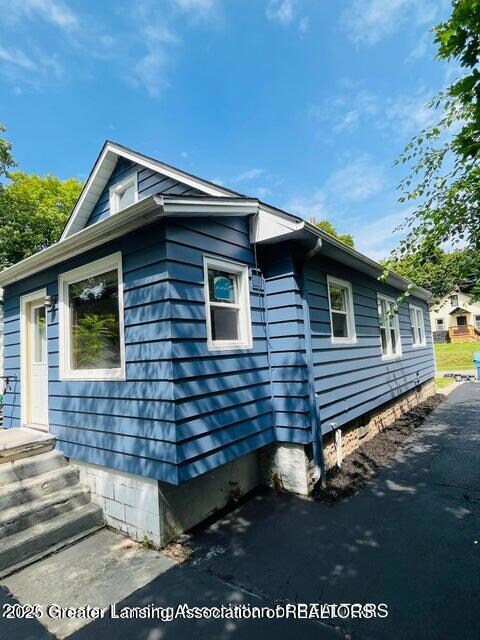
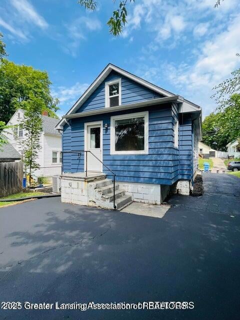
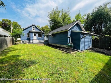
918 Mckim Ave Lansing, MI 48910
Clifford Park NeighborhoodEstimated payment $872/month
Highlights
- City View
- Wood Flooring
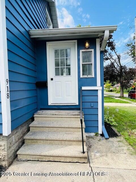
- Enclosed Glass Porch
- Traditional Architecture
- Main Floor Primary Bedroom
- Stainless Steel Appliances
About This Home
2nd floor is currently used as a 3rd bedroom but is non-conforming.
Turnkey home. Move in Ready. New roof in 2023, new furnace in 2023 and new kitchen appliances in 2023.
Home Details
Home Type
- Single Family
Year Built
- Built in 1928 | Remodeled
Lot Details
- 4,792 Sq Ft Lot
- Lot Dimensions are 39x120
- Wood Fence
- Chain Link Fence
- Back Yard Fenced
Parking
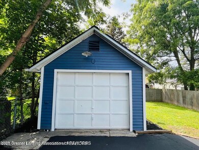
- Detached Garage
Home Design
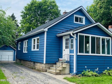
- Traditional Architecture
- Combination Foundation
- Block Foundation
- Shingle Roof
- Aluminum Siding
Interior Spaces
- 1,129 Sq Ft Home
- 1.5-Story Property
- Electric Fireplace
- Wood Frame Window
- Living Room
- Dining Room
- City Views
Kitchen
- Oven
- Gas Range
- Microwave
- Stainless Steel Appliances
Flooring
- Wood
- Linoleum
- Tile
Bedrooms and Bathrooms
- 2 Bedrooms
- Primary Bedroom on Main
- 1 Full Bathroom
Laundry
- Dryer
- Washer
Basement
- Basement Fills Entire Space Under The House
- Laundry in Basement
Utilities
- Forced Air Heating and Cooling System
- 100 Amp Service
- High Speed Internet
Additional Features
- Enclosed Glass Porch
- City Lot
Community Details
- Hollywood Subdivision
- Office
Map
Home Values in the Area
Average Home Value in this Area
Tax History
| Year | Tax Paid | Tax Assessment Tax Assessment Total Assessment is a certain percentage of the fair market value that is determined by local assessors to be the total taxable value of land and additions on the property. | Land | Improvement |
|---|---|---|---|---|
| 2025 | $4,297 | $57,800 | $5,400 | $52,400 |
| 2024 | $36 | $51,600 | $5,400 | $46,200 |
| 2023 | $3,855 | $46,800 | $5,400 | $41,400 |
| 2022 | $2,077 | $41,800 | $5,400 | $36,400 |
| 2021 | $2,034 | $38,400 | $3,400 | $35,000 |
| 2020 | $2,021 | $36,200 | $3,400 | $32,800 |
| 2019 | $3,388 | $31,300 | $3,400 | $27,900 |
| 2018 | $1,817 | $31,700 | $3,400 | $28,300 |
| 2017 | $1,739 | $31,700 | $3,400 | $28,300 |
| 2016 | $1,683 | $31,100 | $3,400 | $27,700 |
| 2015 | $1,683 | $29,600 | $6,878 | $22,722 |
| 2014 | $1,683 | $29,500 | $4,968 | $24,532 |
Property History
| Date | Event | Price | List to Sale | Price per Sq Ft |
|---|---|---|---|---|
| 09/22/2025 09/22/25 | For Sale | $139,000 | -- | $123 / Sq Ft |
Purchase History
| Date | Type | Sale Price | Title Company |
|---|---|---|---|
| Quit Claim Deed | -- | -- | |
| Quit Claim Deed | $42,500 | -- | |
| Warranty Deed | $47,500 | None Available |
Source: Greater Lansing Association of Realtors®
MLS Number: 291429
APN: 01-01-27-108-161
Disclaimer: Certain information contained herein is derived from information provided by parties other than Homes.com. All information provided is deemed reliable, but is not guaranteed to be accurate and should be independently verified.
![]() IDX information is provided exclusively for Consumers'
IDX information is provided exclusively for Consumers'
personal, non-commercial use, that it may not be used for any purpose other than to identify prospective properties Consumers may be interested in purchasing. Data is deemed reliable but is not guaranteed accurate by the MLS.
Copyright © 2025 Greater Lansing Association of REALTORS®
- 2201 S Pennsylvania Ave
- 904 Pacific Ave
- 704 Mckim Ave
- 2215 Alpha St
- 2309 S Pennsylvania Ave
- 2208 Lyons Ave
- 2340 S Pennsylvania Ave
- 580 E Mount Hope Ave
- 2345 Lyons Ave
- 707 Isbell St
- 701 Tisdale Ave
- 1221 Pershing Dr
- 2011 Clifton Ave
- 1529 S Pennsylvania Ave
- 2338 Harding Ave
- 626 Tisdale Ave
- 601 Tisdale Ave
- 1708 Sunnyside Ave
- 2300 Sunnyside Ave
- 1818 Ray St
- 2205 S Pennsylvania Ave
- 2305 S Pennsylvania Ave
- 527 Florence St
- 1610 S Cedar St
- 1610 S Cedar St
- 2420 Maplewood Ave
- 124 E Barnes Ave
- 124 E Barnes Ave
- 1039 S Pennsylvania Ave
- 1039 S Pennsylvania Ave
- 1206 Leslie St
- 917 S Pennsylvania Ave
- 917 S Pennsylvania Ave
- 1225 Regent St
- 224 Crest St
- 224 Crest St
- 224 Crest St
- 1224 E Malcolm x St
- 1224 E Malcolm x St
- 1224 E Malcolm x St
