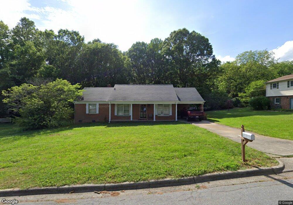
918 Tait St Lincolnton, NC 28092
Estimated Value: $241,000 - $281,000
3
Beds
2
Baths
1,475
Sq Ft
$172/Sq Ft
Est. Value
About This Home
This home is located at 918 Tait St, Lincolnton, NC 28092 and is currently estimated at $253,456, approximately $171 per square foot. 918 Tait St is a home located in Lincoln County with nearby schools including S. Ray Lowder Elementary School, Lincolnton Middle School, and Lincolnton High School.
Ownership History
Date
Name
Owned For
Owner Type
Purchase Details
Closed on
Dec 30, 2008
Sold by
Wright Gary L and Wright Kimberly Dawn
Bought by
Dawson Thomas L
Current Estimated Value
Purchase Details
Closed on
Dec 8, 2005
Sold by
Church Patricia B and Boggs Robin L
Bought by
Wright Gary L
Home Financials for this Owner
Home Financials are based on the most recent Mortgage that was taken out on this home.
Original Mortgage
$18,400
Interest Rate
6.1%
Mortgage Type
Purchase Money Mortgage
Create a Home Valuation Report for This Property
The Home Valuation Report is an in-depth analysis detailing your home's value as well as a comparison with similar homes in the area
Home Values in the Area
Average Home Value in this Area
Purchase History
| Date | Buyer | Sale Price | Title Company |
|---|---|---|---|
| Dawson Thomas L | $78,750 | None Available | |
| Wright Gary L | $92,000 | None Available |
Source: Public Records
Mortgage History
| Date | Status | Borrower | Loan Amount |
|---|---|---|---|
| Previous Owner | Wright Gary L | $18,400 |
Source: Public Records
Tax History Compared to Growth
Tax History
| Year | Tax Paid | Tax Assessment Tax Assessment Total Assessment is a certain percentage of the fair market value that is determined by local assessors to be the total taxable value of land and additions on the property. | Land | Improvement |
|---|---|---|---|---|
| 2025 | $2,154 | $201,556 | $24,700 | $176,856 |
| 2024 | $2,134 | $201,556 | $24,700 | $176,856 |
| 2023 | $2,129 | $201,556 | $24,700 | $176,856 |
| 2022 | $1,474 | $115,244 | $21,000 | $94,244 |
| 2021 | $1,474 | $115,244 | $21,000 | $94,244 |
| 2020 | $1,336 | $115,244 | $21,000 | $94,244 |
| 2019 | $1,336 | $115,244 | $21,000 | $94,244 |
| 2018 | $1,046 | $80,383 | $20,000 | $60,383 |
| 2017 | $941 | $80,383 | $20,000 | $60,383 |
| 2016 | $941 | $80,383 | $20,000 | $60,383 |
| 2015 | $1,008 | $80,383 | $20,000 | $60,383 |
| 2014 | $1,314 | $106,313 | $22,000 | $84,313 |
Source: Public Records
Map
Nearby Homes
- 217 Rock Creek Dr
- 916 E Park Dr
- 709 Catawba St
- 68 Mockingbird Ln
- 810 & 812 Lincoln St E Unit 810
- 515 S Academy St
- 329 E Congress St
- 140 Robin Rd
- 1024 Catawba St
- 109 Saddletree Rd
- 675 Heather Dr
- 818 Grier St
- 622 E Pine St
- 101 Saddletree Rd
- 317 S High St
- 106 Saddletree Rd
- 110 W Pine St
- 00 Lake Sylvia Rd
- 665 S Grove St
- 681 S Grove St
- 914 Tait St
- 919 Tait St
- 305 Rock Creek Dr
- 909 Tait St
- 303 Rock Creek Dr
- 300 Rock Creek Dr
- 907 Tait St Unit 13F
- 907 Tait St
- 301 Rock Creek Dr
- 906 Tait St
- 116 Wendover Dr
- 220 Rock Creek Dr
- 114 Wendover Dr
- 233 Rock Creek Dr
- 901 Tait St
- 219 Fairfield Ct
- 217 Fairfield Ct
- 117 Wendover Dr
- 902 Tait St
- 112 Wendover Dr