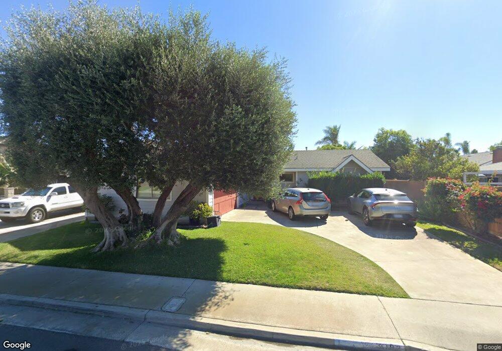
9192 Spencer Cir Huntington Beach, CA 92646
Southeast NeighborhoodEstimated Value: $1,254,296 - $1,506,000
3
Beds
2
Baths
1,431
Sq Ft
$980/Sq Ft
Est. Value
About This Home
This home is located at 9192 Spencer Cir, Huntington Beach, CA 92646 and is currently estimated at $1,402,074, approximately $979 per square foot. 9192 Spencer Cir is a home located in Orange County with nearby schools including S.A. Moffett Elementary School, Isaac L. Sowers Middle School, and Edison High School.
Ownership History
Date
Name
Owned For
Owner Type
Purchase Details
Closed on
Nov 6, 2024
Sold by
Melanson Mark S and Melanson Gwen M
Bought by
Melanson Family Trust and Melanson
Current Estimated Value
Purchase Details
Closed on
Feb 4, 2010
Sold by
Melanson Mark S and Gwen Melanson M
Bought by
Melanson Mark S and Gwen Melanson M
Home Financials for this Owner
Home Financials are based on the most recent Mortgage that was taken out on this home.
Original Mortgage
$305,000
Interest Rate
5.11%
Mortgage Type
New Conventional
Purchase Details
Closed on
May 28, 2003
Sold by
Melanson Mark Steven and Melanson Merri Gwen
Bought by
Melanson Mark S and Gwen Melanson M
Purchase Details
Closed on
Oct 16, 2001
Sold by
Melanson Mark Steven and Melanson Merri Gwen
Bought by
Melanson Mark Steven and Melanson Merri Gwen
Home Financials for this Owner
Home Financials are based on the most recent Mortgage that was taken out on this home.
Original Mortgage
$190,000
Interest Rate
6.63%
Purchase Details
Closed on
Mar 25, 1998
Sold by
William Wallace and William Joan M
Bought by
Melanson Mark Steven and Melanson Merri Gwen
Home Financials for this Owner
Home Financials are based on the most recent Mortgage that was taken out on this home.
Original Mortgage
$168,000
Interest Rate
7.13%
Purchase Details
Closed on
Feb 3, 1998
Sold by
William Wallace and William Joan M
Bought by
Wallace William A and Joan Wallace M
Home Financials for this Owner
Home Financials are based on the most recent Mortgage that was taken out on this home.
Original Mortgage
$168,000
Interest Rate
7.13%
Purchase Details
Closed on
Aug 8, 1995
Sold by
Wallace Marguerite Joan
Bought by
Wallace William A and Joan Wallace M
Purchase Details
Closed on
Jun 20, 1995
Sold by
Wallace Marguerite Joan and Robinson Merri Gwen
Bought by
Wallace Marguerite Joan
Purchase Details
Closed on
Mar 1, 1994
Sold by
Wallace M Joan
Bought by
Wallace Marguerite Joan and Robinson Merri Gwen
Create a Home Valuation Report for This Property
The Home Valuation Report is an in-depth analysis detailing your home's value as well as a comparison with similar homes in the area
Home Values in the Area
Average Home Value in this Area
Purchase History
| Date | Buyer | Sale Price | Title Company |
|---|---|---|---|
| Melanson Family Trust | -- | None Listed On Document | |
| Melanson Family Trust | -- | None Listed On Document | |
| Melanson Mark S | -- | Commerce Title Company | |
| Melanson Mark S | -- | -- | |
| Melanson Mark Steven | -- | Lawyers Title Company | |
| Melanson Mark Steven | -- | First American Title Ins Co | |
| Wallace William A | -- | Fidelity National Title Ins | |
| Wallace William A | -- | -- | |
| Wallace Marguerite Joan | -- | -- | |
| Wallace Marguerite Joan | -- | First American Title Ins Co | |
| Wallace Marguerite Joan | -- | First American Title Ins Co |
Source: Public Records
Mortgage History
| Date | Status | Borrower | Loan Amount |
|---|---|---|---|
| Previous Owner | Melanson Mark S | $305,000 | |
| Previous Owner | Melanson Mark Steven | $190,000 | |
| Previous Owner | Melanson Mark Steven | $168,000 |
Source: Public Records
Tax History Compared to Growth
Tax History
| Year | Tax Paid | Tax Assessment Tax Assessment Total Assessment is a certain percentage of the fair market value that is determined by local assessors to be the total taxable value of land and additions on the property. | Land | Improvement |
|---|---|---|---|---|
| 2025 | $1,496 | $109,320 | $55,259 | $54,061 |
| 2024 | $1,496 | $107,177 | $54,176 | $53,001 |
| 2023 | $1,458 | $105,076 | $53,114 | $51,962 |
| 2022 | $1,417 | $103,016 | $52,072 | $50,944 |
| 2021 | $1,391 | $100,997 | $51,051 | $49,946 |
| 2020 | $1,380 | $99,962 | $50,528 | $49,434 |
| 2019 | $1,366 | $98,002 | $49,537 | $48,465 |
| 2018 | $1,344 | $96,081 | $48,566 | $47,515 |
| 2017 | $1,325 | $94,198 | $47,614 | $46,584 |
| 2016 | $1,274 | $92,351 | $46,680 | $45,671 |
| 2015 | $1,259 | $90,964 | $45,979 | $44,985 |
| 2014 | $1,231 | $89,183 | $45,079 | $44,104 |
Source: Public Records
Map
Nearby Homes
- 9001 Oceanwood Dr
- 20862 Lancelot Ln
- 8932 Amador Cir Unit 1309B
- 8856 Sutter Cir Unit 522A
- 8777 Tulare Dr Unit 409D
- 8856 526C Sutter
- 21221 Hillsdale Ln
- 8788 Coral Springs Ct Unit 203
- 8886 Plumas Cir Unit 1124-A
- 8646 Butte Cir Unit 607E
- 21211 Poston Ln
- 20258 Lantana Dr
- 9522 Yellowstone Dr
- 9581 Chevy Chase Dr
- 8565 Trinity Cir Unit 824D
- 8566 Larkhall Cir Unit 808A
- 8566 Larkhall Cir Unit 809D
- 9812 La Cresta Cir
- 8633 Portola Ct Unit 18G
- 8565 Larkhall Cir Unit 804A
- 9202 Spencer Cir
- 20722 Hopetown Ln
- 20742 Hopetown Ln
- 9222 Spencer Cir
- 9201 Carrolltown Dr
- 9191 Carrolltown Dr
- 20752 Hopetown Ln
- 20702 Hopetown Ln
- 9191 Spencer Cir
- 9201 Spencer Cir
- 20762 Hopetown Ln
- 9221 Spencer Cir
- 20692 Hopetown Ln
- 20731 Hopetown Ln
- 20741 Hopetown Ln
- 20711 Hopetown Ln
- 20751 Hopetown Ln
- 20682 Hopetown Ln
- 20701 Hopetown Ln
- 20761 Hopetown Ln