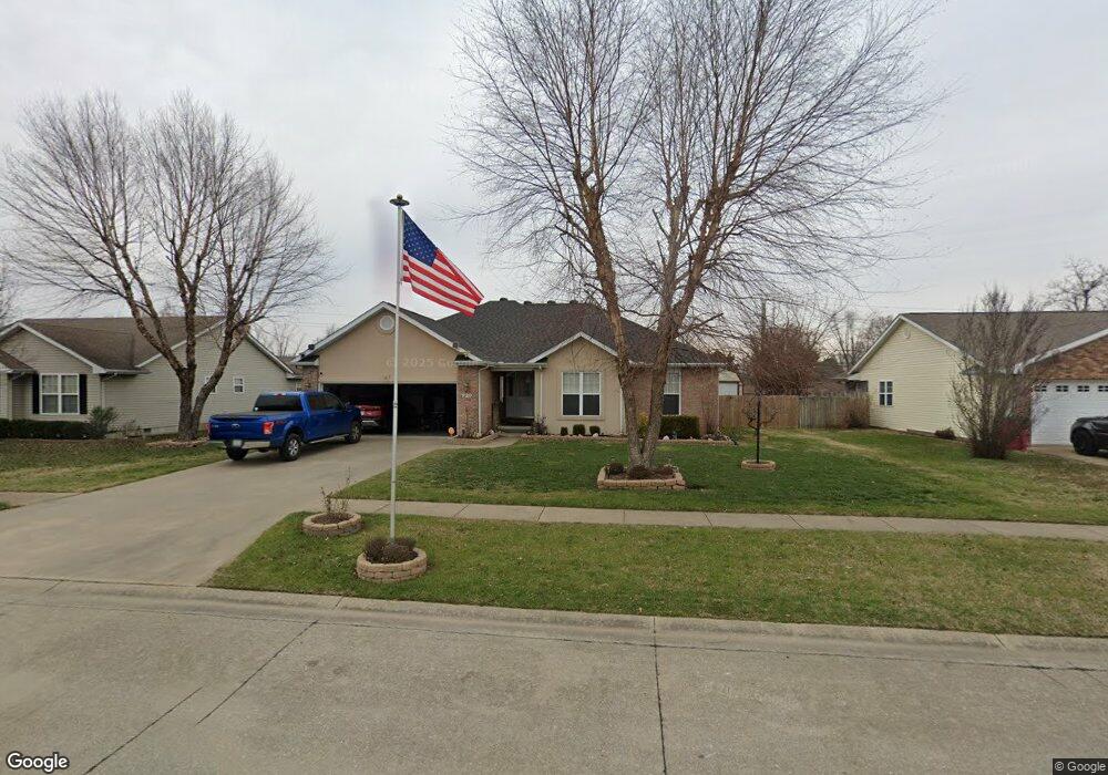
920 Bucklin Cir Sikeston, MO 63801
Estimated Value: $239,000 - $289,000
3
Beds
1
Bath
1,684
Sq Ft
$156/Sq Ft
Est. Value
About This Home
This home is located at 920 Bucklin Cir, Sikeston, MO 63801 and is currently estimated at $262,069, approximately $155 per square foot. 920 Bucklin Cir is a home with nearby schools including Sikeston Senior High School, Southeast Missouri Christian Academy, and The Christian Academy.
Ownership History
Date
Name
Owned For
Owner Type
Purchase Details
Closed on
Oct 25, 2019
Sold by
Tidwell Rick and Tidwell Susan
Bought by
Tidwell Rick and Tidwell Nancy S
Current Estimated Value
Home Financials for this Owner
Home Financials are based on the most recent Mortgage that was taken out on this home.
Original Mortgage
$135,000
Outstanding Balance
$90,929
Interest Rate
3.6%
Mortgage Type
New Conventional
Estimated Equity
$171,140
Purchase Details
Closed on
Jul 29, 2005
Sold by
Merchak Assaad and Merchak Susan
Bought by
Habs John C and Habs Wilma L
Create a Home Valuation Report for This Property
The Home Valuation Report is an in-depth analysis detailing your home's value as well as a comparison with similar homes in the area
Home Values in the Area
Average Home Value in this Area
Purchase History
| Date | Buyer | Sale Price | Title Company |
|---|---|---|---|
| Tidwell Rick | -- | Semo Title | |
| Habs John C | -- | -- |
Source: Public Records
Mortgage History
| Date | Status | Borrower | Loan Amount |
|---|---|---|---|
| Open | Tidwell Rick | $135,000 |
Source: Public Records
Tax History
| Year | Tax Paid | Tax Assessment Tax Assessment Total Assessment is a certain percentage of the fair market value that is determined by local assessors to be the total taxable value of land and additions on the property. | Land | Improvement |
|---|---|---|---|---|
| 2024 | $1,754 | $35,340 | $3,040 | $32,300 |
| 2023 | $1,744 | $35,000 | $0 | $0 |
| 2022 | $1,567 | $31,700 | $3,000 | $28,700 |
| 2021 | $1,565 | $31,700 | $0 | $0 |
| 2020 | $1,370 | $31,700 | $0 | $0 |
| 2019 | $1,369 | $30,100 | $3,000 | $27,100 |
| 2018 | $1,311 | $28,840 | $0 | $0 |
| 2017 | $1,299 | $28,840 | $0 | $0 |
| 2016 | -- | $28,840 | $0 | $0 |
| 2015 | -- | $28,750 | $0 | $0 |
| 2014 | -- | $28,750 | $0 | $0 |
| 2011 | -- | $0 | $0 | $0 |
Source: Public Records
Map
Nearby Homes
- 912 Plantation Blvd
- 926 Crescent Dr
- 707 Bayberry Dr
- 1003 Red Arrow
- 604 Maple St
- 1130 Persimmon Place
- 806 Innsbruck Ln
- 838 E Gladys St
- 819 E Kathleen St
- 322 Helen St
- 733 Matthews Ave
- 312 Hardin St
- 321 Benton St
- 319 Benton St
- 309 Benton St
- 338 E Gladys St
- 414 Secretariat
- 403 Secretariat
- 334 E Kathleen St
- 414 Matthews Ave
- 918 Bucklin Cir
- 922 Bucklin Cir
- 924 Bucklin Cir
- 915 Cambridge Dr
- 921 Bucklin Cir
- 916 Bucklin Cir
- 923 Bucklin Cir
- 911 Cambridge Dr
- 919 Bucklin Cir
- 917 Cambridge Dr
- 909 Cambridge Dr
- 925 Bucklin Cir
- 908 Bucklin Cir
- 912 Cambridge Dr
- 926 Bucklin Cir
- 914 Cambridge Dr
- 916 Cambridge Dr
- 919 Cambridge Dr
- 940 Bucklin Cir
- 914 Bucklin Cir
Your Personal Tour Guide
Ask me questions while you tour the home.