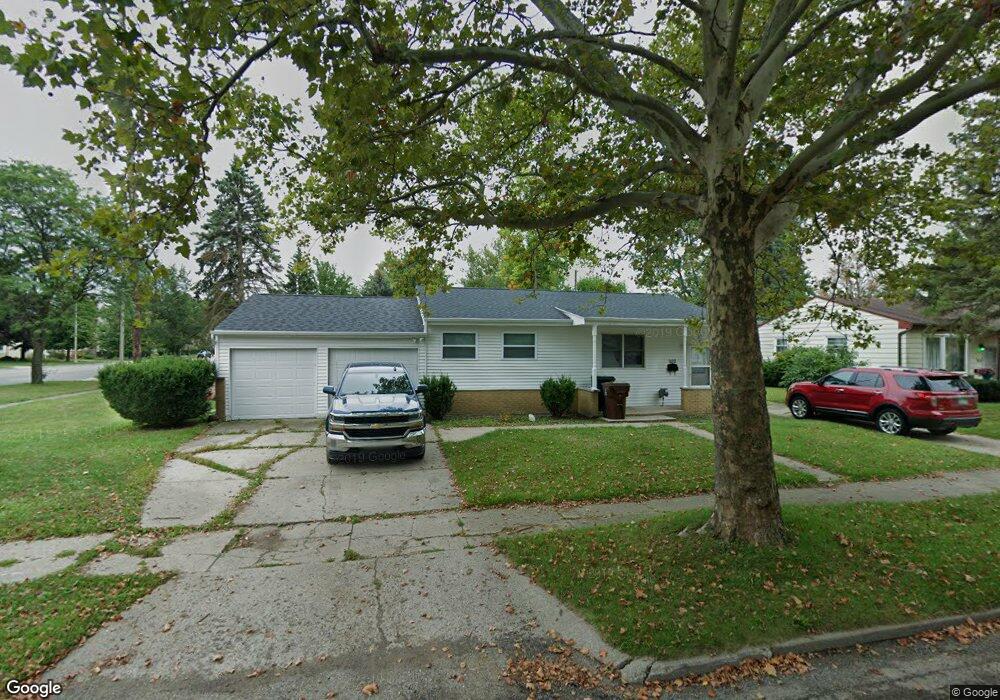
920 Kendon Dr Lansing, MI 48910
Old Everett NeighborhoodEstimated Value: $131,000 - $176,000
--
Bed
--
Bath
1,020
Sq Ft
$146/Sq Ft
Est. Value
About This Home
This home is located at 920 Kendon Dr, Lansing, MI 48910 and is currently estimated at $149,423, approximately $146 per square foot. 920 Kendon Dr is a home located in Ingham County with nearby schools including Kendon School, Attwood School, and Everett High School.
Ownership History
Date
Name
Owned For
Owner Type
Purchase Details
Closed on
Oct 15, 2002
Sold by
Garlitz Bernard J and Garlitz Rosella L
Bought by
Young Kenneth and Young Denise
Current Estimated Value
Home Financials for this Owner
Home Financials are based on the most recent Mortgage that was taken out on this home.
Original Mortgage
$54,400
Outstanding Balance
$22,840
Interest Rate
6.18%
Mortgage Type
Purchase Money Mortgage
Estimated Equity
$126,583
Create a Home Valuation Report for This Property
The Home Valuation Report is an in-depth analysis detailing your home's value as well as a comparison with similar homes in the area
Home Values in the Area
Average Home Value in this Area
Purchase History
| Date | Buyer | Sale Price | Title Company |
|---|---|---|---|
| Young Kenneth | $28,963 | -- |
Source: Public Records
Mortgage History
| Date | Status | Borrower | Loan Amount |
|---|---|---|---|
| Open | Young Kenneth | $54,400 |
Source: Public Records
Tax History Compared to Growth
Tax History
| Year | Tax Paid | Tax Assessment Tax Assessment Total Assessment is a certain percentage of the fair market value that is determined by local assessors to be the total taxable value of land and additions on the property. | Land | Improvement |
|---|---|---|---|---|
| 2025 | $2,601 | $65,700 | $12,800 | $52,900 |
| 2024 | $20 | $61,800 | $12,800 | $49,000 |
| 2023 | $2,439 | $57,000 | $12,800 | $44,200 |
| 2022 | $2,200 | $51,100 | $12,200 | $38,900 |
| 2021 | $2,155 | $47,200 | $8,200 | $39,000 |
| 2020 | $2,141 | $45,000 | $8,200 | $36,800 |
| 2019 | $2,052 | $41,000 | $8,200 | $32,800 |
| 2018 | $1,924 | $38,000 | $8,200 | $29,800 |
| 2017 | $1,842 | $38,000 | $8,200 | $29,800 |
| 2016 | $1,724 | $33,500 | $8,200 | $25,300 |
| 2015 | $1,724 | $32,100 | $16,382 | $15,718 |
| 2014 | $1,724 | $30,500 | $11,954 | $18,546 |
Source: Public Records
Map
Nearby Homes
- 4719 S Pennsylvania Ave
- 4412 Devonshire Ave
- 4922 Southgate Ave
- 713 E Cavanaugh Rd
- 629 Emily Ave
- 1101 Barr Ave
- 736 Fenton St
- 600 E Cavanaugh Rd
- 522 E Cavanaugh Rd
- 4317 S Cedar St
- 639 Maplehill Ave
- 3725 Parkway Dr
- 3716 S Pennsylvania Ave
- 3611 Homewood Ave
- 3603 Parkway Dr
- 201 E Syringa Dr
- 4118 Donald St
- 105 Cox Blvd
- 111 E Potter Ave
- 5011 Stafford Ave
- 914 Kendon Dr
- 4800 S Pennsylvania Ave
- 908 Kendon Dr
- 4804 S Pennsylvania Ave
- 921 Kendon Dr
- 915 Kendon Dr
- 4711 Lyncott Dr
- 900 Kendon Dr
- 4810 S Pennsylvania Ave
- 4733 S Pennsylvania Ave
- 909 Kendon Dr
- 4725 S Pennsylvania Ave
- 4717 Lyncott Dr
- 4733 S Pennsylvania Ave
- 4801 S Pennsylvania Ave
- 4624 S Pennsylvania Ave
- 901 Kendon Dr Unit Bldg-Unit
- 901 Kendon Dr
- 4801 Lyncott Dr
- 4816 S Pennsylvania Ave