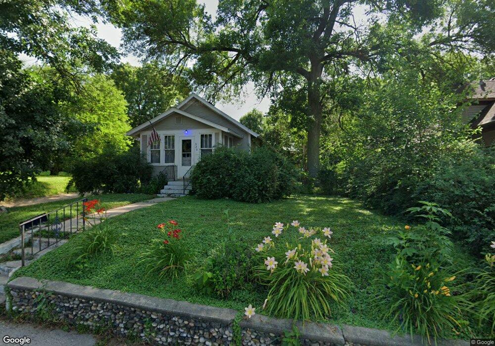
920 Saint Jacob Ave Albert Lea, MN 56007
Estimated Value: $109,000 - $135,000
2
Beds
2
Baths
752
Sq Ft
$160/Sq Ft
Est. Value
About This Home
This home is located at 920 Saint Jacob Ave, Albert Lea, MN 56007 and is currently estimated at $120,651, approximately $160 per square foot. 920 Saint Jacob Ave is a home located in Freeborn County with nearby schools including Hawthorne Elementary School, Southwest Middle School, and Albert Lea Senior High School.
Ownership History
Date
Name
Owned For
Owner Type
Purchase Details
Closed on
Jun 26, 2015
Sold by
Back Barry Barry
Bought by
Mehus Tamie Tamie
Current Estimated Value
Home Financials for this Owner
Home Financials are based on the most recent Mortgage that was taken out on this home.
Original Mortgage
$60,000
Outstanding Balance
$47,045
Interest Rate
4.02%
Estimated Equity
$73,606
Create a Home Valuation Report for This Property
The Home Valuation Report is an in-depth analysis detailing your home's value as well as a comparison with similar homes in the area
Home Values in the Area
Average Home Value in this Area
Purchase History
| Date | Buyer | Sale Price | Title Company |
|---|---|---|---|
| Mehus Tamie Tamie | $75,000 | -- |
Source: Public Records
Mortgage History
| Date | Status | Borrower | Loan Amount |
|---|---|---|---|
| Open | Mehus Tamie Tamie | $60,000 |
Source: Public Records
Tax History Compared to Growth
Tax History
| Year | Tax Paid | Tax Assessment Tax Assessment Total Assessment is a certain percentage of the fair market value that is determined by local assessors to be the total taxable value of land and additions on the property. | Land | Improvement |
|---|---|---|---|---|
| 2025 | $772 | $109,900 | $45,300 | $64,600 |
| 2024 | $768 | $69,900 | $18,100 | $51,800 |
| 2023 | $738 | $70,800 | $18,100 | $52,700 |
| 2022 | $706 | $68,800 | $18,100 | $50,700 |
| 2021 | $674 | $56,900 | $18,100 | $38,800 |
| 2020 | $672 | $53,600 | $18,100 | $35,500 |
| 2019 | $590 | $48,000 | $16,000 | $32,000 |
| 2018 | $574 | $0 | $0 | $0 |
| 2016 | $480 | $0 | $0 | $0 |
| 2015 | $432 | $0 | $0 | $0 |
| 2014 | $456 | $0 | $0 | $0 |
| 2012 | $610 | $0 | $0 | $0 |
Source: Public Records
Map
Nearby Homes
- 1020 Saint Jacob Ave
- 819 Pillsbury Ave
- 713 Minnesota Ave
- 605 E Hawthorne St
- 602 Minnesota Ave
- 614 Garfield Ave
- 1321 Garfield Ave
- 505 Pillsbury Ave
- 1200 Crestview Rd
- 613 & 615 Giles Place
- 618 & 620 Giles Place
- 902 Clausen Ave
- 314 Burr Oak Dr
- 611 Ulstad Ave
- 711 Clausen Ave
- 313 Glenn Rd
- 209 Burr Oak Dr
- 1626 Keystone Dr
- 505 Wayside Ave
- 1715 SE Marshall St
- 1010 Saint Jacob Ave
- 916 Saint Jacob Ave
- 1005 1005 St Jacob
- 1012 Saint Jacob Ave
- 910 Saint Jacob Ave
- 921 Saint Jacob Ave
- 921 921 St Jacob Ave
- 917 Saint Jacob Ave
- 913 Saint Jacob Ave
- 908 Saint Jacob Ave
- 1009 Saint Jacob Ave
- 907 Saint Jacob Ave
- 1016 Saint Jacob Ave
- 1016 1016 St Jacob
- 905 Saint Jacob Ave
- 1011 Saint Jacob Ave
- 902 Saint Jacob Ave
- 1002 E Hawthorne St
- 901 Saint Jacob Ave
- 1020 1020 St Jacob Ave