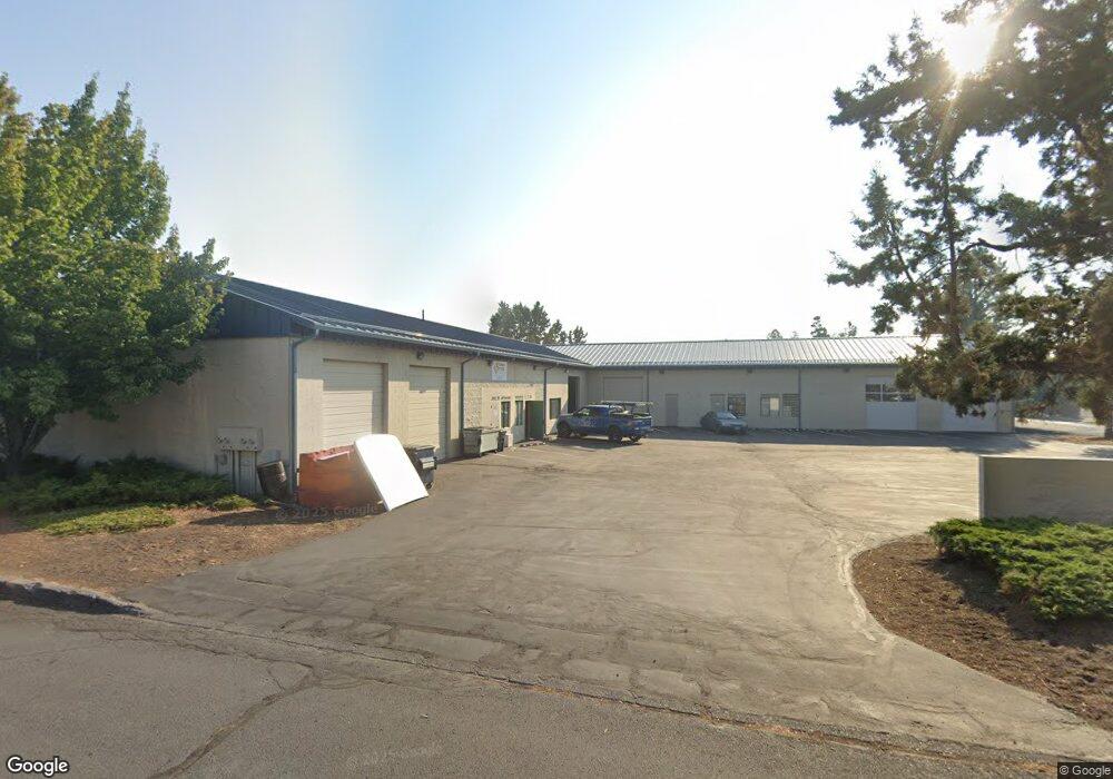
920 SE Textron Dr Bend, OR 97702
Larkspur Neighborhood
--
Bed
--
Bath
9,160
Sq Ft
6,970
Sq Ft Lot
About This Home
This home is located at 920 SE Textron Dr, Bend, OR 97702. 920 SE Textron Dr is a home located in Deschutes County with nearby schools including Bear Creek Elementary School, Bend Senior High School, and Deschutes River Montessori School.
Ownership History
Date
Name
Owned For
Owner Type
Purchase Details
Closed on
Jun 25, 2024
Sold by
Holeman Family Trust and Holeman Minter J
Bought by
M Deborah Holeman Revocable Trust and Holeman
Purchase Details
Closed on
Sep 10, 2012
Sold by
Holeman Minter James
Bought by
Holeman Minter L and Holeman Christine B
Purchase Details
Closed on
Aug 8, 2008
Sold by
Holeman Mary Deborah
Bought by
Revocab Holeman M Deborah and M Deborah Holeman 2008 Revocable Trust
Purchase Details
Closed on
May 18, 2006
Sold by
Holeman Minter James and Holeman Mary Deborah
Bought by
Holeman Minter James and Holeman Mary Deborah
Create a Home Valuation Report for This Property
The Home Valuation Report is an in-depth analysis detailing your home's value as well as a comparison with similar homes in the area
Home Values in the Area
Average Home Value in this Area
Purchase History
| Date | Buyer | Sale Price | Title Company |
|---|---|---|---|
| M Deborah Holeman Revocable Trust | -- | Western Title | |
| Holeman Minter L | -- | None Available | |
| Revocab Holeman M Deborah | -- | None Available | |
| Holeman Minter James | -- | None Available |
Source: Public Records
Tax History Compared to Growth
Tax History
| Year | Tax Paid | Tax Assessment Tax Assessment Total Assessment is a certain percentage of the fair market value that is determined by local assessors to be the total taxable value of land and additions on the property. | Land | Improvement |
|---|---|---|---|---|
| 2025 | $6,278 | $529,400 | -- | -- |
| 2024 | $6,040 | $513,990 | -- | -- |
| 2023 | $5,599 | $499,030 | $0 | $0 |
| 2022 | $5,224 | $470,400 | $0 | $0 |
| 2021 | $5,232 | $456,710 | $0 | $0 |
| 2020 | $4,964 | $456,710 | $0 | $0 |
| 2019 | $4,826 | $311,210 | $0 | $0 |
| 2018 | $4,689 | $302,150 | $0 | $0 |
| 2017 | $4,194 | $270,300 | $0 | $0 |
| 2016 | $4,000 | $262,430 | $0 | $0 |
| 2015 | $3,889 | $254,790 | $0 | $0 |
| 2014 | $3,774 | $247,370 | $0 | $0 |
Source: Public Records
Map
Nearby Homes
- 438 NE 9th St
- 322 SE 5th St
- 688 SE Centennial St
- 608 NE 10th St
- 501 SE Wilson Ave
- 623 SE Roosevelt Ave
- 477 SE Roosevelt Ave
- 530 SE 3rd St
- 845 NE 8th St
- 1001 SE 15th St Unit 56
- 1001 SE 15th St Unit 77
- 1001 SE 15th St Unit 110
- 1001 SE 15th St Unit 92
- 1001 SE 15th St Unit 109
- 1001 SE 15th St Unit 126
- 1001 SE 15th St Unit 137
- 1100 SW Mt Bachelor Dr Unit A203
- 1100 SW Mt Bachelor Dr Unit A302
- 633 SE Glengarry Place
- 98 NE Telima Ln
- 35 SE Bridgeford Blvd
- 37 SE Bridgeford Blvd
- 930 SE Textron Dr
- 45 SE Bridgeford Blvd
- 110 SE 9th St
- 36 SE 9th St
- 105 SE Bridgeford Blvd
- 124 SE 9th St Unit 3
- 124 SE 9th St
- 34 SE Bridgeford Blvd Unit 1
- 34 SE Bridgeford Blvd
- 40 SE Bridgeford Blvd
- 22 SE Bridgeford
- 131 SE 9th St
- 52 SE Bridgeford Blvd
- 52 SE Bridgeford Blvd Unit 52
- 170 SE 9th St
- 44 SE Bridgeford Blvd Unit 3
- 44 SE Bridgeford Blvd Unit 2
- 44 SE Bridgeford Blvd Unit 1