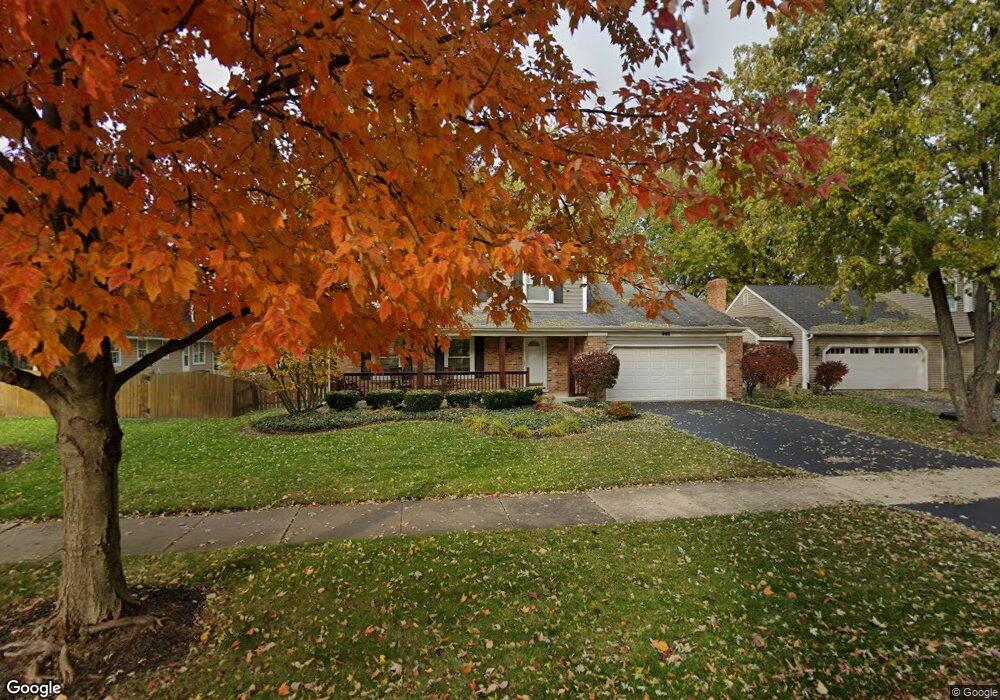
921 Darius Ln Naperville, IL 60565
Signal Point NeighborhoodEstimated Value: $576,000 - $616,118
4
Beds
3
Baths
2,284
Sq Ft
$263/Sq Ft
Est. Value
About This Home
This home is located at 921 Darius Ln, Naperville, IL 60565 and is currently estimated at $600,280, approximately $262 per square foot. 921 Darius Ln is a home located in DuPage County with nearby schools including Scott Elementary School, Madison Jr High School, and Naperville Central High School.
Ownership History
Date
Name
Owned For
Owner Type
Purchase Details
Closed on
Mar 19, 2007
Sold by
Savage Murray R
Bought by
Deegan Jason E and Deegan Melissa A
Current Estimated Value
Home Financials for this Owner
Home Financials are based on the most recent Mortgage that was taken out on this home.
Original Mortgage
$300,000
Outstanding Balance
$181,486
Interest Rate
6.25%
Mortgage Type
Purchase Money Mortgage
Estimated Equity
$418,794
Purchase Details
Closed on
Nov 15, 2002
Sold by
Todd Margaret D and The Margaret D Todd Trust
Bought by
Savage Murray R
Home Financials for this Owner
Home Financials are based on the most recent Mortgage that was taken out on this home.
Original Mortgage
$224,000
Interest Rate
6.22%
Mortgage Type
Balloon
Purchase Details
Closed on
Sep 30, 1996
Sold by
Todd William F and Todd Margaret D
Bought by
Margaret D Todd Trust
Create a Home Valuation Report for This Property
The Home Valuation Report is an in-depth analysis detailing your home's value as well as a comparison with similar homes in the area
Home Values in the Area
Average Home Value in this Area
Purchase History
| Date | Buyer | Sale Price | Title Company |
|---|---|---|---|
| Deegan Jason E | $380,000 | Stewart Title Company | |
| Savage Murray R | $280,000 | Burnet Title Llc | |
| Margaret D Todd Trust | -- | -- |
Source: Public Records
Mortgage History
| Date | Status | Borrower | Loan Amount |
|---|---|---|---|
| Open | Deegan Jason E | $300,000 | |
| Previous Owner | Savage Murray R | $224,000 | |
| Closed | Savage Murray R | $28,000 |
Source: Public Records
Tax History Compared to Growth
Tax History
| Year | Tax Paid | Tax Assessment Tax Assessment Total Assessment is a certain percentage of the fair market value that is determined by local assessors to be the total taxable value of land and additions on the property. | Land | Improvement |
|---|---|---|---|---|
| 2024 | $9,580 | $164,388 | $69,566 | $94,822 |
| 2023 | $9,229 | $150,030 | $63,490 | $86,540 |
| 2022 | $8,824 | $142,350 | $60,240 | $82,110 |
| 2021 | $8,501 | $136,960 | $57,960 | $79,000 |
| 2020 | $8,319 | $134,500 | $56,920 | $77,580 |
| 2019 | $8,075 | $128,680 | $54,460 | $74,220 |
| 2018 | $8,077 | $128,680 | $54,460 | $74,220 |
| 2017 | $7,914 | $124,340 | $52,620 | $71,720 |
| 2016 | $7,755 | $119,850 | $50,720 | $69,130 |
| 2015 | $7,703 | $112,860 | $47,760 | $65,100 |
| 2014 | $7,752 | $110,150 | $45,700 | $64,450 |
| 2013 | $7,635 | $110,410 | $45,810 | $64,600 |
Source: Public Records
Map
Nearby Homes
- 1717 Drake Ct
- 1340 Auburn Ave
- 621 Bourbon Ct
- 456 Timber Trail Ct
- 1323 Auburn Ave
- 431 Orleans Ave
- 517 Sheffield Rd
- 816 Spindletree Ave
- 158 E Bailey Rd Unit F
- 144 E Bailey Rd Unit L
- 1704 Kenyon Dr
- 1449 Whitespire Ct Unit 5104
- 138 E Bailey Rd Unit M
- 128 E Bailey Rd Unit G
- 805 Potomac Ave
- 336 Brooklea Ct
- 2230 Keim Rd Unit 3B
- 1751 S Washington St Unit 1
- 1721 S Washington St Unit 1721
- 302 Carriage Hill Rd
- 917 Darius Ln
- 925 Darius Ln
- 1766 Fairoak Rd
- 1762 Fairoak Rd
- 911 River Oak Dr
- 930 Darius Ln
- 919 River Oak Dr
- 925 River Oak Dr
- 940 Darius Ln
- 1767 Fairoak Rd
- 939 Darius Ln
- 1763 Fairoak Rd
- 907 River Oak Dr
- 929 River Oak Dr
- 946 Darius Ln
- 943 Darius Ln
- 1803 Fairoak Rd
- 1755 Fairoak Rd
- 949 Darius Ln
- 933 River Oak Dr