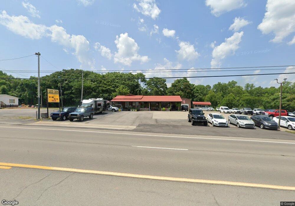
921 Highway 70 E Dickson, TN 37055
Estimated Value: $485,000 - $857,354
--
Bed
3
Baths
2,625
Sq Ft
$256/Sq Ft
Est. Value
About This Home
This home is located at 921 Highway 70 E, Dickson, TN 37055 and is currently estimated at $671,177, approximately $255 per square foot. 921 Highway 70 E is a home located in Humphreys County with nearby schools including The Discovery School, Dickson Middle School, and Dickson County High School.
Ownership History
Date
Name
Owned For
Owner Type
Purchase Details
Closed on
Jun 12, 2023
Sold by
Sliman Brady B and Sliman Robin
Bought by
Lee And Doris Umsted Family Trust
Current Estimated Value
Purchase Details
Closed on
Oct 29, 1996
Bought by
Umsted Lee and Shawna Umsted Doris A
Purchase Details
Closed on
Jul 2, 1996
Bought by
Umsted Lee and Shawna Umsted Doris A
Purchase Details
Closed on
Dec 21, 1994
Bought by
Umsted Lee and Shawna Umsted Doris A
Purchase Details
Closed on
Jul 1, 1994
Bought by
Umsted Lee and Shawna Umsted Doris A
Purchase Details
Closed on
Jul 27, 1977
Bought by
Riggins Donovan and Riggins Lillian
Purchase Details
Closed on
Jun 15, 1977
Purchase Details
Closed on
Mar 8, 1977
Purchase Details
Closed on
Jan 17, 1973
Create a Home Valuation Report for This Property
The Home Valuation Report is an in-depth analysis detailing your home's value as well as a comparison with similar homes in the area
Home Values in the Area
Average Home Value in this Area
Purchase History
| Date | Buyer | Sale Price | Title Company |
|---|---|---|---|
| Lee And Doris Umsted Family Trust | -- | None Listed On Document | |
| Clark Joshua S | -- | None Listed On Document | |
| Umsted Lee | -- | -- | |
| Umsted Lee | -- | -- | |
| Umsted Lee | -- | -- | |
| Umsted Lee | $40,400 | -- | |
| Riggins Donovan | -- | -- | |
| -- | -- | -- | |
| -- | -- | -- | |
| -- | -- | -- |
Source: Public Records
Tax History Compared to Growth
Tax History
| Year | Tax Paid | Tax Assessment Tax Assessment Total Assessment is a certain percentage of the fair market value that is determined by local assessors to be the total taxable value of land and additions on the property. | Land | Improvement |
|---|---|---|---|---|
| 2024 | $4,032 | $219,150 | $62,550 | $156,600 |
| 2023 | $4,034 | $219,150 | $62,550 | $156,600 |
| 2022 | $3,387 | $155,375 | $39,275 | $116,100 |
| 2021 | $3,387 | $155,375 | $39,275 | $116,100 |
| 2020 | $2,968 | $155,375 | $39,275 | $116,100 |
| 2019 | $2,260 | $111,175 | $33,350 | $77,825 |
| 2018 | $2,260 | $111,175 | $33,350 | $77,825 |
| 2017 | $2,264 | $111,175 | $33,350 | $77,825 |
| 2016 | $2,109 | $95,875 | $27,225 | $68,650 |
| 2015 | $2,109 | $95,875 | $27,225 | $68,650 |
| 2014 | $2,109 | $95,869 | $0 | $0 |
Source: Public Records
Map
Nearby Homes
- 307 Village Ln W
- 0 Forrest Hills Cir
- 315 Village Ln W
- 109 Village Cir
- 823 Highway 70 E
- 412 Village Cir
- 110 Eastdale Ln
- 209 E Quail Hollow Way
- 126 Eastdale Ln
- 815 Highway 70 E
- 103 Forrest Hills Dr
- 123 Eastdale Ln
- 304 E Overhill Dr
- 108 Lake Circle Dr
- 104 Lake Circle Dr
- 108 Lake Valley Rd
- 109 S Hummingbird Ln
- 112 Hillwood Dr
- 103 W Lake Cir
- 102 Warren Place
- 915 Highway 70 E
- 108 Village Cir
- 107 Valley Rd
- 225 Village Cir W
- 223 Village Cir W
- 222 Village Cir W
- 227 Village Cir W
- 205 Valley Dr W
- 224 Village Cir W
- 205 Valley Rd
- 101 Village Cir
- 221 Village Cir W
- 202 Village Cir W
- 201 Village Cir W
- 220 Village Cir W
- 102 Village Cir
- 102 Bellwood Cir
- 103 Village Cir
- 218 Village Cir W
- 207 Valley Rd
