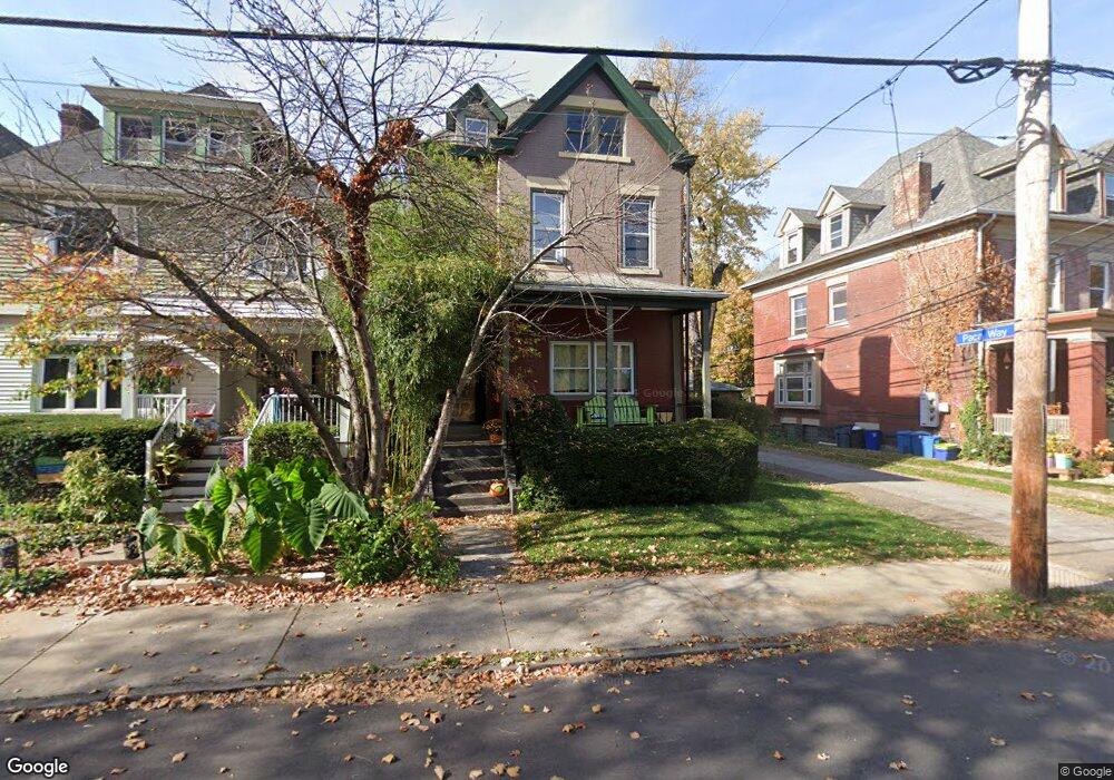
921 N Euclid Ave Pittsburgh, PA 15206
Highland Park NeighborhoodEstimated Value: $420,000 - $635,000
3
Beds
4
Baths
2,505
Sq Ft
$193/Sq Ft
Est. Value
About This Home
This home is located at 921 N Euclid Ave, Pittsburgh, PA 15206 and is currently estimated at $483,351, approximately $192 per square foot. 921 N Euclid Ave is a home located in Allegheny County with nearby schools including Pittsburgh Fulton PreK-5, Westinghouse High School, and Environmental Charter School.
Ownership History
Date
Name
Owned For
Owner Type
Purchase Details
Closed on
Oct 30, 2006
Sold by
Danko John R
Bought by
Silver Paul D and Defoe,Jennifer J
Current Estimated Value
Home Financials for this Owner
Home Financials are based on the most recent Mortgage that was taken out on this home.
Original Mortgage
$72,900
Outstanding Balance
$43,748
Interest Rate
6.47%
Mortgage Type
New Conventional
Estimated Equity
$439,603
Purchase Details
Closed on
Jan 12, 1998
Sold by
Goldhammer Hilda and Goldhamer Hilda
Bought by
Danko John Robert
Create a Home Valuation Report for This Property
The Home Valuation Report is an in-depth analysis detailing your home's value as well as a comparison with similar homes in the area
Home Values in the Area
Average Home Value in this Area
Purchase History
| Date | Buyer | Sale Price | Title Company |
|---|---|---|---|
| Silver Paul D | $92,900 | -- | |
| Danko John Robert | $67,000 | -- |
Source: Public Records
Mortgage History
| Date | Status | Borrower | Loan Amount |
|---|---|---|---|
| Open | Silver Paul D | $72,900 |
Source: Public Records
Tax History Compared to Growth
Tax History
| Year | Tax Paid | Tax Assessment Tax Assessment Total Assessment is a certain percentage of the fair market value that is determined by local assessors to be the total taxable value of land and additions on the property. | Land | Improvement |
|---|---|---|---|---|
| 2025 | $2,537 | $110,100 | $38,600 | $71,500 |
| 2024 | $2,537 | $110,100 | $38,600 | $71,500 |
| 2023 | $2,537 | $110,100 | $38,600 | $71,500 |
| 2022 | $2,504 | $110,100 | $38,600 | $71,500 |
| 2021 | $2,434 | $110,100 | $38,600 | $71,500 |
| 2020 | $2,492 | $110,100 | $38,600 | $71,500 |
| 2019 | $2,492 | $110,100 | $38,600 | $71,500 |
| 2018 | $1,906 | $110,100 | $38,600 | $71,500 |
| 2017 | $2,492 | $110,100 | $38,600 | $71,500 |
| 2016 | $521 | $110,100 | $38,600 | $71,500 |
| 2015 | $521 | $110,100 | $38,600 | $71,500 |
| 2014 | $2,437 | $110,100 | $38,600 | $71,500 |
Source: Public Records
Map
Nearby Homes
- 822 N Euclid Ave
- 835 N Saint Clair St
- 5625 Wellesley Ave
- 828 Mellon St
- 916 N Highland Ave
- 5622 Wellesley Ave
- 1105 Portland St
- 817 Farragut St
- 834 Farragut St
- 811 Farragut St
- 5620 Stanton Ave
- 00 Mellon Mellon St
- 6060 Jackson St
- 5646 Bryant St
- 6026 Stanton Ave
- 731 Mellon St
- 5923 Bryant St
- 715 N Beatty St
- 845 Collins Ave
- 5624 Bryant St
- 919 N Euclid Ave
- 917 N Euclid Ave
- 925 N Euclid Ave
- 915 N Euclid Ave
- 922 N Saint Clair St
- 924 N Saint Clair St
- 913 N Euclid Ave
- 920 N Saint Clair St
- 5801 Wayne Rd
- 928 N Saint Clair St
- 5814 Wellesley Ave
- 5818 Wellesley Ave
- 930 N Saint Clair St
- 916 N Saint Clair St
- 909 N Euclid Ave
- 914 N Saint Clair St
- 5810 Wellesley Ave
- 5804 Wellesley Ave
- 5807 Wayne Rd
- 910 N St Clair