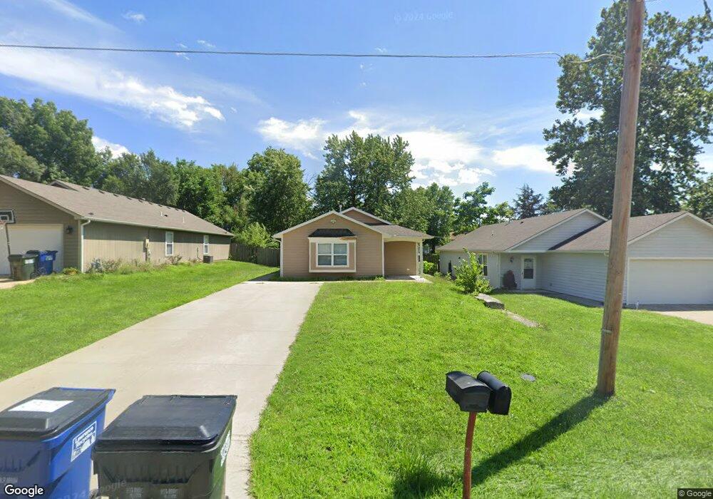
921 Ward Ave Lawrence, KS 66044
Brook Creek NeighborhoodEstimated Value: $237,000 - $252,945
4
Beds
2
Baths
1,184
Sq Ft
$205/Sq Ft
Est. Value
About This Home
This home is located at 921 Ward Ave, Lawrence, KS 66044 and is currently estimated at $242,648, approximately $204 per square foot. 921 Ward Ave is a home located in Douglas County with nearby schools including New York Elementary School, Liberty Memorial Central Middle School, and Lawrence High School.
Ownership History
Date
Name
Owned For
Owner Type
Purchase Details
Closed on
Nov 4, 2010
Sold by
Lawrence Habitat For Humanity Inc
Bought by
Abdelbanat Karim Khatir and Abduljabbar Magda
Current Estimated Value
Home Financials for this Owner
Home Financials are based on the most recent Mortgage that was taken out on this home.
Original Mortgage
$46,000
Interest Rate
4.36%
Mortgage Type
Seller Take Back
Purchase Details
Closed on
Mar 25, 2008
Sold by
Brauer Kevin and Brauer Diana
Bought by
Lawrence Habitat For Humanity Inc
Create a Home Valuation Report for This Property
The Home Valuation Report is an in-depth analysis detailing your home's value as well as a comparison with similar homes in the area
Home Values in the Area
Average Home Value in this Area
Purchase History
| Date | Buyer | Sale Price | Title Company |
|---|---|---|---|
| Abdelbanat Karim Khatir | -- | Kansas Secured Title | |
| Lawrence Habitat For Humanity Inc | -- | Capital Title Ins Co Lc |
Source: Public Records
Mortgage History
| Date | Status | Borrower | Loan Amount |
|---|---|---|---|
| Closed | Abdelbanat Karim Khatir | $46,000 |
Source: Public Records
Tax History Compared to Growth
Tax History
| Year | Tax Paid | Tax Assessment Tax Assessment Total Assessment is a certain percentage of the fair market value that is determined by local assessors to be the total taxable value of land and additions on the property. | Land | Improvement |
|---|---|---|---|---|
| 2025 | $3,031 | $25,128 | $5,750 | $19,378 |
| 2024 | $3,031 | $24,967 | $5,405 | $19,562 |
| 2023 | $3,066 | $24,116 | $6,900 | $17,216 |
| 2022 | $2,917 | $22,793 | $6,325 | $16,468 |
| 2021 | $2,506 | $18,898 | $5,175 | $13,723 |
| 2020 | $2,372 | $17,998 | $5,175 | $12,823 |
| 2019 | $2,317 | $17,606 | $4,947 | $12,659 |
| 2018 | $2,307 | $17,400 | $4,720 | $12,680 |
| 2017 | $2,267 | $16,917 | $4,720 | $12,197 |
| 2016 | $2,005 | $15,663 | $4,884 | $10,779 |
| 2015 | -- | $14,375 | $3,436 | $10,939 |
| 2014 | -- | $14,375 | $3,436 | $10,939 |
Source: Public Records
Map
Nearby Homes
- 923 Ward Ave
- 715 Forrest Ave
- 0 Delaware St
- 1736 Brook St
- 317 E 17th St
- 1320 Pennsylvania St
- 1320 Pennsylvania St Unit apartment above gara
- 1243 Delaware St Unit B
- 1218 Delaware St Unit 2a
- 1218 Delaware St Unit 2a
- 1824 New Hampshire St
- 1620 E 18th St
- 1950 Barker Ave
- 1603 Harper St
- 2014 Maple Ln
- 1323 E 21st St
- 1141 Connecticut St
- 1111 New Jersey St
- 2045 Massachusetts St
- 918 Pennsylvania St