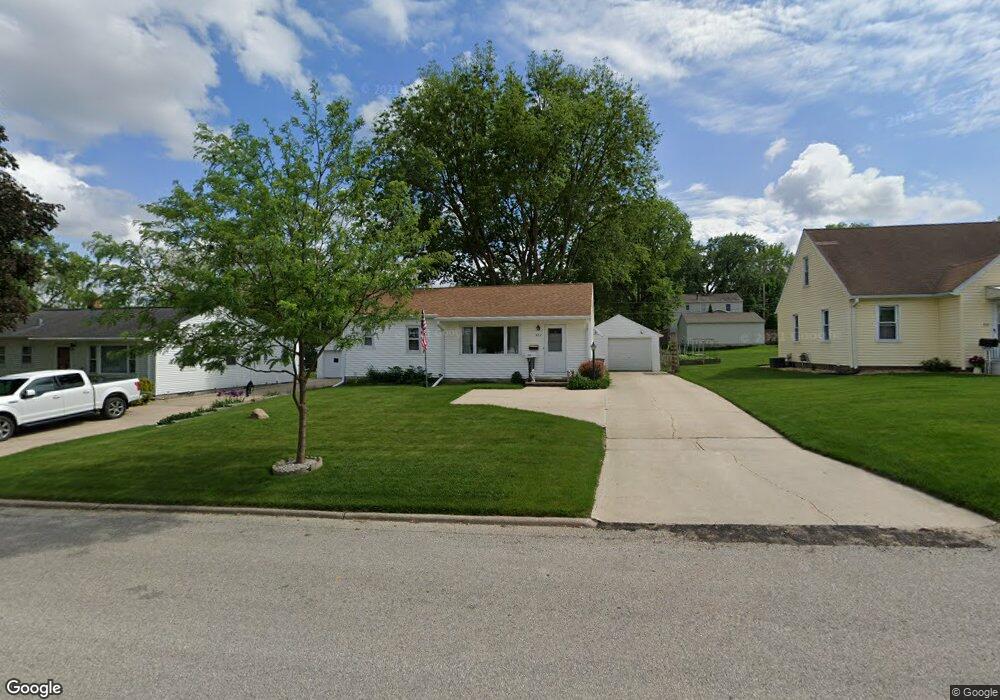
922 Cornwall Ave Waterloo, IA 50702
Liberty Park NeighborhoodEstimated Value: $146,820 - $155,000
3
Beds
1
Bath
1,108
Sq Ft
$137/Sq Ft
Est. Value
About This Home
This home is located at 922 Cornwall Ave, Waterloo, IA 50702 and is currently estimated at $151,455, approximately $136 per square foot. 922 Cornwall Ave is a home located in Black Hawk County with nearby schools including Kittrell Elementary School, Hoover Middle School, and West High School.
Ownership History
Date
Name
Owned For
Owner Type
Purchase Details
Closed on
Jul 10, 2020
Sold by
Teske Delphine E
Bought by
Elliott Kerry
Current Estimated Value
Home Financials for this Owner
Home Financials are based on the most recent Mortgage that was taken out on this home.
Original Mortgage
$76,018
Interest Rate
3.1%
Mortgage Type
Future Advance Clause Open End Mortgage
Create a Home Valuation Report for This Property
The Home Valuation Report is an in-depth analysis detailing your home's value as well as a comparison with similar homes in the area
Home Values in the Area
Average Home Value in this Area
Purchase History
| Date | Buyer | Sale Price | Title Company |
|---|---|---|---|
| Elliott Kerry | $95,000 | None Available |
Source: Public Records
Mortgage History
| Date | Status | Borrower | Loan Amount |
|---|---|---|---|
| Closed | Elliott Kerry | $76,018 |
Source: Public Records
Tax History
| Year | Tax Paid | Tax Assessment Tax Assessment Total Assessment is a certain percentage of the fair market value that is determined by local assessors to be the total taxable value of land and additions on the property. | Land | Improvement |
|---|---|---|---|---|
| 2025 | $3,198 | $162,140 | $21,170 | $140,970 |
| 2024 | $2,946 | $147,430 | $21,170 | $126,260 |
| 2023 | $2,676 | $147,430 | $21,170 | $126,260 |
| 2022 | $2,606 | $121,870 | $21,170 | $100,700 |
| 2021 | $2,348 | $121,870 | $21,170 | $100,700 |
| 2020 | $2,304 | $112,190 | $16,630 | $95,560 |
| 2019 | $2,304 | $112,190 | $16,630 | $95,560 |
| 2018 | $2,306 | $112,190 | $16,630 | $95,560 |
| 2017 | $2,380 | $112,190 | $16,630 | $95,560 |
| 2016 | $2,348 | $112,190 | $16,630 | $95,560 |
| 2015 | $2,348 | $112,190 | $16,630 | $95,560 |
| 2014 | $2,276 | $107,160 | $16,630 | $90,530 |
Source: Public Records
Map
Nearby Homes
- 819 Easton Ave
- 922 E Mitchell Ave
- 814 E Mitchell Ave
- 1103 Easton Ave
- 1809 Baltimore St
- 1107 E Mitchell Ave
- 1141 E Mitchell Ave
- 1150 Easton Ave
- 2547 W 9th St
- 2425 Randolph St
- 2527 Randolph St
- 1171 Liberty Ave
- 1002 E Ridgeway Ave
- 1219 Hammond Ave
- 812 Hawthorne Ave
- 2506 Laurel St
- 216 Bourland Ave
- 610 Burbank Ave
- 1115 Hawthorne Ave
- 1017 Forest Ave
- 916 Cornwall Ave
- 928 Cornwall Ave
- 936 Cornwall Ave
- 923 Lorraine Ave
- 927 Lorraine Ave
- 917 Lorraine Ave
- 2207 W 7th St
- 2215 W 7th St
- 933 Lorraine Ave
- 925 Cornwall Ave
- 919 Cornwall Ave
- 933 Cornwall Ave
- 917 Cornwall Ave
- 2219 W 7th St
- 2203 W 7th St
- 937 Cornwall Ave
- 2121 W 7th St
- 2201 W 8th St
- 2225 W 7th St
- 2209 W 8th St
Your Personal Tour Guide
Ask me questions while you tour the home.