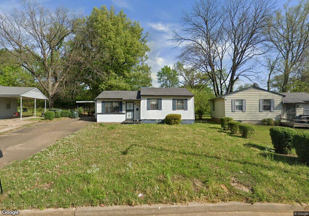
922 Leacrest Ave Memphis, TN 38109
Westwood NeighborhoodEstimated Value: $77,758 - $94,000
3
Beds
2
Baths
1,230
Sq Ft
$72/Sq Ft
Est. Value
About This Home
This home is located at 922 Leacrest Ave, Memphis, TN 38109 and is currently estimated at $88,940, approximately $72 per square foot. 922 Leacrest Ave is a home located in Shelby County with nearby schools including Levi Elementary School, Chickasaw Middle School, and Westwood High School.
Ownership History
Date
Name
Owned For
Owner Type
Purchase Details
Closed on
Jun 29, 2015
Sold by
Harris Terry
Bought by
Brookins Patricia
Current Estimated Value
Purchase Details
Closed on
May 6, 2015
Sold by
Brooins Patricia
Bought by
Harris Terry
Purchase Details
Closed on
Jan 30, 2004
Sold by
Petty Catherine
Bought by
Brookins Patricia
Home Financials for this Owner
Home Financials are based on the most recent Mortgage that was taken out on this home.
Original Mortgage
$54,900
Interest Rate
8.5%
Mortgage Type
Purchase Money Mortgage
Create a Home Valuation Report for This Property
The Home Valuation Report is an in-depth analysis detailing your home's value as well as a comparison with similar homes in the area
Home Values in the Area
Average Home Value in this Area
Purchase History
| Date | Buyer | Sale Price | Title Company |
|---|---|---|---|
| Brookins Patricia | -- | Attorney | |
| Harris Terry | $13,500 | None Available | |
| Brookins Patricia | $61,000 | Assured Escrow & Title |
Source: Public Records
Mortgage History
| Date | Status | Borrower | Loan Amount |
|---|---|---|---|
| Previous Owner | Brookins Patricia | $54,900 |
Source: Public Records
Tax History Compared to Growth
Tax History
| Year | Tax Paid | Tax Assessment Tax Assessment Total Assessment is a certain percentage of the fair market value that is determined by local assessors to be the total taxable value of land and additions on the property. | Land | Improvement |
|---|---|---|---|---|
| 2025 | $464 | $20,625 | $2,650 | $17,975 |
| 2024 | $464 | $13,700 | $2,175 | $11,525 |
| 2023 | $835 | $13,700 | $2,175 | $11,525 |
| 2022 | $835 | $13,700 | $2,175 | $11,525 |
| 2021 | $844 | $13,700 | $2,175 | $11,525 |
| 2020 | $904 | $12,475 | $2,175 | $10,300 |
| 2019 | $904 | $12,475 | $2,175 | $10,300 |
| 2018 | $904 | $12,475 | $2,175 | $10,300 |
| 2017 | $513 | $12,475 | $2,175 | $10,300 |
| 2016 | $505 | $11,550 | $0 | $0 |
| 2014 | $505 | $11,550 | $0 | $0 |
Source: Public Records
Map
Nearby Homes
- 949 W Raines Rd
- 1307 W Raines Rd
- 4233 Glenbrook Dr
- 1010 Leacrest Ave
- 830 W Raines Rd
- 906 Western Park Dr
- 4018 Swanbrook St
- 4269 Tomahawk St
- 436 Western Park Dr
- 4365 Bluebell St
- 4087 Weaver Rd
- 4108 Double Tree St
- 1185 Connemara Ave
- 4264 Double Tree Rd
- 648 Pawnee Ave
- 791 W Levi Rd
- 1221 Tahoe Rd
- 646 Western Park Dr
- 1208 Chickamauga Ave
- 693 Bonwood Ave
- 928 Leacrest Ave
- 916 Leacrest Ave
- 913 W Raines Rd
- 4182 Leacrest Cove
- 919 W Raines Rd
- 909 W Raines Rd
- 4190 Leacrest Cove
- 4178 Leacrest Cove
- 925 W Raines Rd
- 919 Leacrest Ave
- 903 W Raines Rd
- 908 Leacrest Ave
- 929 Leacrest Ave
- 931 W Raines Rd
- 899 W Raines Rd
- 4148 Archer Cove
- 4152 Archer Cove
- 933 Leacrest Ave
- 907 Leacrest Ave
- 0 W Raines St Unit 9962700