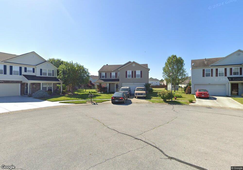
9221 Huntleigh Cir Plainfield, IN 46168
Estimated Value: $290,000 - $316,000
3
Beds
3
Baths
2,198
Sq Ft
$135/Sq Ft
Est. Value
About This Home
This home is located at 9221 Huntleigh Cir, Plainfield, IN 46168 and is currently estimated at $297,644, approximately $135 per square foot. 9221 Huntleigh Cir is a home located in Hendricks County with nearby schools including White Oak Elementary School, Cedar Elementary School, and Avon Intermediate School West.
Ownership History
Date
Name
Owned For
Owner Type
Purchase Details
Closed on
Jul 29, 2020
Sold by
Alhaidah Kim A
Bought by
Skinner Family Land Trust
Current Estimated Value
Home Financials for this Owner
Home Financials are based on the most recent Mortgage that was taken out on this home.
Original Mortgage
$193,431
Outstanding Balance
$171,587
Interest Rate
3%
Mortgage Type
FHA
Estimated Equity
$126,057
Create a Home Valuation Report for This Property
The Home Valuation Report is an in-depth analysis detailing your home's value as well as a comparison with similar homes in the area
Home Values in the Area
Average Home Value in this Area
Purchase History
| Date | Buyer | Sale Price | Title Company |
|---|---|---|---|
| Skinner Family Land Trust | $197,000 | Monument Title Ins Co |
Source: Public Records
Mortgage History
| Date | Status | Borrower | Loan Amount |
|---|---|---|---|
| Open | Skinner Family Land Trust | $193,431 |
Source: Public Records
Tax History
| Year | Tax Paid | Tax Assessment Tax Assessment Total Assessment is a certain percentage of the fair market value that is determined by local assessors to be the total taxable value of land and additions on the property. | Land | Improvement |
|---|---|---|---|---|
| 2024 | $2,548 | $227,800 | $43,000 | $184,800 |
| 2023 | $2,517 | $226,100 | $39,100 | $187,000 |
| 2022 | $2,439 | $217,100 | $37,200 | $179,900 |
| 2021 | $2,122 | $188,800 | $34,800 | $154,000 |
| 2020 | $1,751 | $156,400 | $34,800 | $121,600 |
| 2019 | $1,662 | $147,200 | $31,600 | $115,600 |
| 2018 | $1,608 | $140,600 | $31,600 | $109,000 |
| 2017 | $1,374 | $137,400 | $30,700 | $106,700 |
| 2016 | $1,365 | $136,500 | $30,700 | $105,800 |
| 2014 | $1,266 | $126,600 | $28,100 | $98,500 |
Source: Public Records
Map
Nearby Homes
- 2271 Hampton Ct
- 2643 Marjorie Ln
- 9127 Haverhill Ln
- 2571 Penn Ave
- 2579 Pearson Pkwy
- 2657 Penn Ave
- 2625 Prism Way
- Tungsten Plan at Hidden Lanes at Hobbs Station
- Monel Plan at Hidden Lanes at Hobbs Station
- Gallium Plan at Hidden Lanes at Hobbs Station
- Cobalt Plan at Hidden Lanes at Hobbs Station
- Babbitt Plan at Hidden Lanes at Hobbs Station
- Palladium Plan at Hidden Lanes at Hobbs Station
- Titanium Plan at Hidden Lanes at Hobbs Station
- 9299 Loyola Way
- 8765 Bo St
- 2669 Penn Ave
- 1893 Devonshire Ave
- 2712 Glade Ave
- 2685 W Bo St W
- 9209 Huntleigh Cir
- 2182 Westmere Dr
- 2192 Westmere Dr
- 9222 Huntleigh Cir
- 2172 Westmere Dr
- 2225 Bristol Ct
- 2202 Westmere Dr
- 2162 Westmere Dr
- 2221 Bristol Ct
- 9197 Huntleigh Cir
- 2233 Bristol Ct
- 2216 Westmere Dr
- 2152 Westmere Dr
- 9218 Huntleigh Cir
- 2230 Westmere Dr
- 9185 Huntleigh Cir
- 2224 Bristol Ct
- 2187 Westmere Dr
- 2142 Westmere Dr
- 2244 Westmere Dr