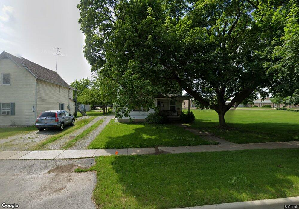
924 Broad Ave Findlay, OH 45840
Estimated Value: $134,703 - $165,000
2
Beds
2
Baths
1,204
Sq Ft
$123/Sq Ft
Est. Value
About This Home
This home is located at 924 Broad Ave, Findlay, OH 45840 and is currently estimated at $147,926, approximately $122 per square foot. 924 Broad Ave is a home located in Hancock County with nearby schools including Whittier Primary School, Bigelow Hill Elementary School, and Glenwood Middle School.
Ownership History
Date
Name
Owned For
Owner Type
Purchase Details
Closed on
Aug 22, 2003
Sold by
Fenimore John C and Fenimore Kimberly A
Bought by
Decker Robert G
Current Estimated Value
Home Financials for this Owner
Home Financials are based on the most recent Mortgage that was taken out on this home.
Original Mortgage
$67,250
Outstanding Balance
$29,614
Interest Rate
5.62%
Mortgage Type
Purchase Money Mortgage
Estimated Equity
$118,312
Purchase Details
Closed on
May 23, 1994
Bought by
Fenimore John C and Fenimore Kimberly
Purchase Details
Closed on
Nov 13, 1989
Bought by
Fenimore Donald D and Fenimore Flo A
Purchase Details
Closed on
Jun 5, 1987
Bought by
Fenimore Neva I
Purchase Details
Closed on
Dec 23, 1982
Bought by
Fenimore Charles M and Fenimore Neva
Create a Home Valuation Report for This Property
The Home Valuation Report is an in-depth analysis detailing your home's value as well as a comparison with similar homes in the area
Home Values in the Area
Average Home Value in this Area
Purchase History
| Date | Buyer | Sale Price | Title Company |
|---|---|---|---|
| Decker Robert G | $70,800 | Heartland Title | |
| Fenimore John C | $46,000 | -- | |
| Fenimore Donald D | $28,000 | -- | |
| Fenimore Neva I | -- | -- | |
| Fenimore Charles M | $20,000 | -- |
Source: Public Records
Mortgage History
| Date | Status | Borrower | Loan Amount |
|---|---|---|---|
| Open | Decker Robert G | $67,250 |
Source: Public Records
Tax History
| Year | Tax Paid | Tax Assessment Tax Assessment Total Assessment is a certain percentage of the fair market value that is determined by local assessors to be the total taxable value of land and additions on the property. | Land | Improvement |
|---|---|---|---|---|
| 2024 | $1,255 | $35,330 | $3,870 | $31,460 |
| 2023 | $1,257 | $35,330 | $3,870 | $31,460 |
| 2022 | $1,253 | $35,330 | $3,870 | $31,460 |
| 2021 | $1,230 | $30,220 | $3,860 | $26,360 |
| 2020 | $1,230 | $30,220 | $3,860 | $26,360 |
| 2019 | $1,205 | $30,220 | $3,860 | $26,360 |
| 2018 | $1,151 | $26,490 | $3,360 | $23,130 |
| 2017 | $576 | $26,490 | $3,360 | $23,130 |
| 2016 | $1,144 | $26,490 | $3,360 | $23,130 |
| 2015 | $798 | $18,240 | $4,030 | $14,210 |
| 2014 | $798 | $18,240 | $4,030 | $14,210 |
| 2012 | $804 | $18,240 | $4,030 | $14,210 |
Source: Public Records
Map
Nearby Homes
- 719 Davis St
- 705 Swing Ave
- 605 Davis St
- 341 Defiance Ave
- 421 Clifton Ave
- 243 Monroe Ave
- 405 Clifton Ave
- 528 Rector Ave
- 0 County Road 223
- 608 W Front St
- 140 Monroe Ave
- 807 W Main Cross St
- 1032 Adams St
- 724 Edith Ave
- 407 Washington St
- 146 Clifton Ave
- 207 Ash Ave
- 925 W Melrose Ave
- 701 W Melrose Ave
- 206 Midland Ave
Your Personal Tour Guide
Ask me questions while you tour the home.