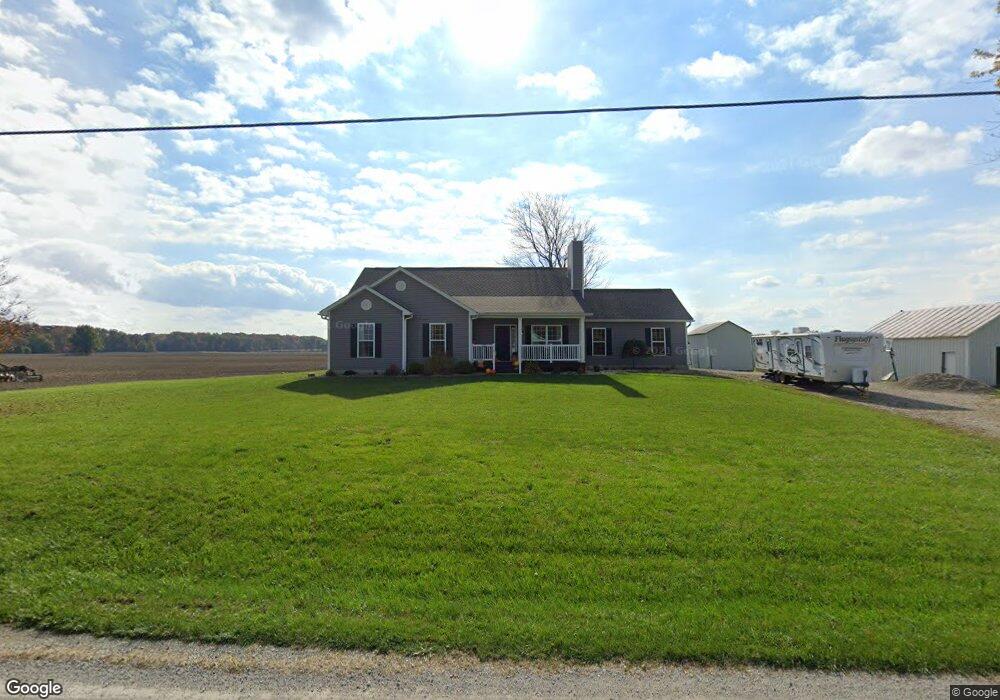
9249 County Highway 44 Upper Sandusky, OH 43351
Estimated Value: $330,000 - $393,000
4
Beds
2
Baths
1,970
Sq Ft
$187/Sq Ft
Est. Value
About This Home
This home is located at 9249 County Highway 44, Upper Sandusky, OH 43351 and is currently estimated at $367,816, approximately $186 per square foot. 9249 County Highway 44 is a home with nearby schools including Upper Sandusky High School and St. Peter Elementary School.
Ownership History
Date
Name
Owned For
Owner Type
Purchase Details
Closed on
Aug 21, 2015
Sold by
Book Drew C
Bought by
Anderson Joshua P and Anderson Katie M
Current Estimated Value
Purchase Details
Closed on
Aug 2, 2013
Sold by
Walton Lisa M
Bought by
Book Drew C
Home Financials for this Owner
Home Financials are based on the most recent Mortgage that was taken out on this home.
Original Mortgage
$24,000
Interest Rate
4.25%
Mortgage Type
Future Advance Clause Open End Mortgage
Create a Home Valuation Report for This Property
The Home Valuation Report is an in-depth analysis detailing your home's value as well as a comparison with similar homes in the area
Purchase History
| Date | Buyer | Sale Price | Title Company |
|---|---|---|---|
| Anderson Joshua P | $35,000 | None Available | |
| Book Drew C | $30,000 | None Available |
Source: Public Records
Mortgage History
| Date | Status | Borrower | Loan Amount |
|---|---|---|---|
| Previous Owner | Book Drew C | $24,000 |
Source: Public Records
Tax History
| Year | Tax Paid | Tax Assessment Tax Assessment Total Assessment is a certain percentage of the fair market value that is determined by local assessors to be the total taxable value of land and additions on the property. | Land | Improvement |
|---|---|---|---|---|
| 2025 | $3,414 | $117,610 | $7,690 | $109,920 |
| 2024 | $3,081 | $100,260 | $6,130 | $94,130 |
| 2023 | $3,081 | $100,260 | $6,130 | $94,130 |
| 2022 | $3,083 | $81,810 | $4,980 | $76,830 |
| 2021 | $2,633 | $81,810 | $4,980 | $76,830 |
| 2020 | $2,634 | $81,810 | $4,980 | $76,830 |
| 2019 | $2,633 | $81,810 | $4,980 | $76,830 |
| 2018 | $2,337 | $74,190 | $4,380 | $69,810 |
| 2017 | $2,375 | $39,820 | $4,380 | $35,440 |
| 2016 | $1,221 | $39,820 | $4,380 | $35,440 |
| 2015 | -- | $2,700 | $1,630 | $1,070 |
| 2014 | -- | $2,700 | $1,630 | $1,070 |
| 2013 | -- | $8,430 | $4,380 | $4,050 |
Source: Public Records
Map
Nearby Homes
- 0 State Route 53 & 67 Unit 11165687
- 1030 Halbedel St
- 987 Greenbrier Rd
- 6166 County Highway 107
- 0 Highway 30
- 955 Greenbrier Rd
- 7160 County Highway 47
- 479 N 5th St
- 445 N Sandusky Ave
- 479 Front St
- 432 E Bigelow St
- 334 N 4th St
- 386 W Finley St
- 314 N 4th St
- 109 Rivers Edge Ln
- 116 E Walker St
- 137 N 8th St
- 212 Duck Pond Rd
- 9768 County Highway 111
- 101 Rivers Edge Ln
- 9157 County Highway 44
- 9344 County Highway 44
- 7848 County Highway 112
- 7739 County Highway 112
- 8956 County Highway 44
- 9246 County Highway 44
- 8895 County Highway 44
- 8836 County Highway 44
- 9673 County Highway 44
- 7437 County Highway 112
- 9889 County Highway 44
- 8210 State Highway 53 N
- 8240 State Highway 53 N
- 9901 County Highway 44
- 8077 County Highway 107
- 8381 State Highway 53 N
- 7635 County Highway 107
- 0 Township Highway 44
- 8363 County Highway 107
- 7685 State Highway 53 N
Your Personal Tour Guide
Ask me questions while you tour the home.