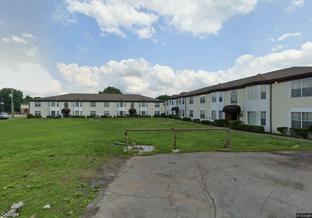
925 Interstate Dr Manchester, TN 37355
--
Bed
148
Baths
84,758
Sq Ft
7.63
Acres
About This Home
This home is located at 925 Interstate Dr, Manchester, TN 37355. 925 Interstate Dr is a home located in Coffee County with nearby schools including Westwood Middle School and Temple Baptist Christian School.
Ownership History
Date
Name
Owned For
Owner Type
Purchase Details
Closed on
Jun 30, 2020
Sold by
Ambassador Motel Inc
Bought by
Oceans Llc
Home Financials for this Owner
Home Financials are based on the most recent Mortgage that was taken out on this home.
Original Mortgage
$1,880,000
Outstanding Balance
$1,670,153
Interest Rate
3.2%
Mortgage Type
Purchase Money Mortgage
Purchase Details
Closed on
Dec 8, 1995
Sold by
Rubin Ruskin Sylvia and Rubin Ruskin
Bought by
Ambassador Motel
Create a Home Valuation Report for This Property
The Home Valuation Report is an in-depth analysis detailing your home's value as well as a comparison with similar homes in the area
Home Values in the Area
Average Home Value in this Area
Purchase History
| Date | Buyer | Sale Price | Title Company |
|---|---|---|---|
| Oceans Llc | $2,350,000 | None Available | |
| Ambassador Motel | $500,000 | -- |
Source: Public Records
Mortgage History
| Date | Status | Borrower | Loan Amount |
|---|---|---|---|
| Open | Oceans Llc | $1,880,000 |
Source: Public Records
Tax History Compared to Growth
Tax History
| Year | Tax Paid | Tax Assessment Tax Assessment Total Assessment is a certain percentage of the fair market value that is determined by local assessors to be the total taxable value of land and additions on the property. | Land | Improvement |
|---|---|---|---|---|
| 2024 | $31,596 | $749,480 | $169,400 | $580,080 |
| 2023 | $31,596 | $749,480 | $0 | $0 |
| 2022 | $27,206 | $749,480 | $169,400 | $580,080 |
| 2021 | $32,603 | $711,920 | $120,640 | $591,280 |
| 2020 | $25,646 | $711,920 | $120,640 | $591,280 |
| 2019 | $25,646 | $560,000 | $130,080 | $429,920 |
| 2018 | $33,079 | $722,280 | $130,080 | $592,200 |
| 2017 | $33,299 | $634,800 | $130,080 | $504,720 |
| 2016 | $33,299 | $634,800 | $130,080 | $504,720 |
| 2015 | $33,298 | $634,800 | $130,080 | $504,720 |
| 2014 | $46,904 | $894,181 | $0 | $0 |
Source: Public Records
Map
Nearby Homes
- 163 Stonehenge Ln
- 54 Country Cir
- 110 Phillips Dr
- 100 Phillips Dr
- 37 Laurel View St
- 57 Laurel View St
- 47 Laurel View St
- 27 Laurel View St
- 97 Stonehenge Ln
- 143 Stonehenge Cir
- 67 Stonehenge Ln
- 19 Stonehenge
- 69 Laurel View St
- 31 Stonehenge Ln
- 49 Stonehenge
- 1989 Elevation JKL Plan at Stonehenge
- 1726 Elevation JKL Plan at Stonehenge
- 1824 Elevation JKL Plan at Stonehenge
- 1258 Stonehenge Plan at Stonehenge
- 2073 Elevation JKL Plan at Stonehenge
- 940 Interstate Dr
- 892 Interstate Dr
- 852 Interstate Dr
- 1002 Interstate Dr
- 0 Woodbury Hwy Unit 1971989
- 0 Woodbury Hwy Unit 1970190
- 0 Woodbury Hwy Unit 1862386
- 0 Woodbury Hwy
- 0 Woodbury Hwy Unit RTC1789326
- 0 Woodbury Hwy Unit RTC1726639
- 0 Woodbury Hwy Unit RTC1897412
- 0 Woodbury Hwy Unit RTC1763285
- 0 Woodbury Hwy Unit RTC1292732
- 0 Woodbury Hwy Unit RTC1183095
- 0 Woodbury Hwy Unit RTC1183100
- 0 Woodbury Hwy Unit RTC2374198
- 0 Woodbury Hwy Unit RTC2369248
- 0 Woodbury Hwy Unit 2243873
- 0 Woodbury Hwy Unit 2215460
- 0 Woodbury Hwy Unit 2184119