Estimated Value: $701,134 - $755,000
4
Beds
3
Baths
2,176
Sq Ft
$339/Sq Ft
Est. Value
About This Home
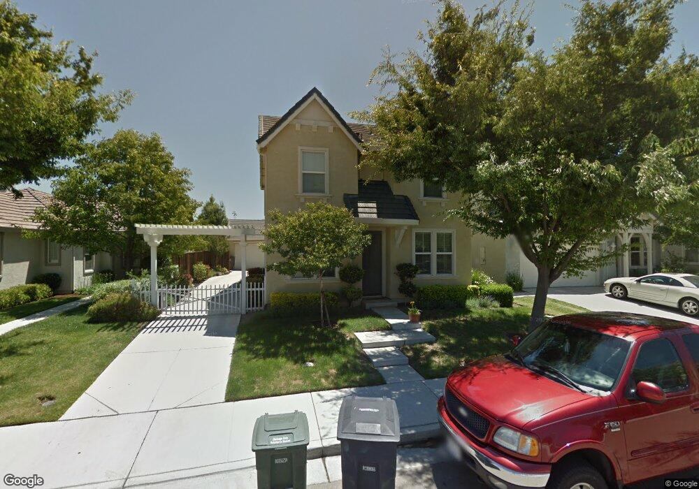
This home is located at 928 Mason Ct Unit 1B, Tracy, CA 95377 and is currently estimated at $737,784, approximately $339 per square foot. 928 Mason Ct Unit 1B is a home located in San Joaquin County with nearby schools including George Kelly Elementary School, John C. Kimball High School, and Tracy Independent Study Charter School.
Ownership History
Date
Name
Owned For
Owner Type
Purchase Details
Closed on
May 12, 2023
Sold by
Fisher Derek C and Fisher Heather A
Bought by
Fisher Living Trust
Current Estimated Value
Purchase Details
Closed on
Aug 6, 2004
Sold by
Fisher Nancy K and Fisher Derek C
Bought by
Fisher Derek C and Fisher Heather A
Home Financials for this Owner
Home Financials are based on the most recent Mortgage that was taken out on this home.
Original Mortgage
$314,000
Interest Rate
5.97%
Mortgage Type
New Conventional
Purchase Details
Closed on
Apr 24, 2002
Sold by
Standard Pacific Corp
Bought by
Fisher Nancy K and Fisher Derek C
Home Financials for this Owner
Home Financials are based on the most recent Mortgage that was taken out on this home.
Original Mortgage
$271,700
Interest Rate
5.12%
Create a Home Valuation Report for This Property
The Home Valuation Report is an in-depth analysis detailing your home's value as well as a comparison with similar homes in the area
Home Values in the Area
Average Home Value in this Area
Purchase History
| Date | Buyer | Sale Price | Title Company |
|---|---|---|---|
| Fisher Living Trust | -- | None Listed On Document | |
| Fisher Derek C | -- | First Amer Title Co | |
| Fisher Nancy K | $340,000 | First Amer Title Co |
Source: Public Records
Mortgage History
| Date | Status | Borrower | Loan Amount |
|---|---|---|---|
| Previous Owner | Fisher Derek C | $314,000 | |
| Previous Owner | Fisher Nancy K | $271,700 |
Source: Public Records
Tax History Compared to Growth
Tax History
| Year | Tax Paid | Tax Assessment Tax Assessment Total Assessment is a certain percentage of the fair market value that is determined by local assessors to be the total taxable value of land and additions on the property. | Land | Improvement |
|---|---|---|---|---|
| 2025 | $8,126 | $491,916 | $146,270 | $345,646 |
| 2024 | $7,641 | $482,271 | $143,402 | $338,869 |
| 2023 | $7,569 | $472,816 | $140,591 | $332,225 |
| 2022 | $7,411 | $463,546 | $137,835 | $325,711 |
| 2021 | $7,303 | $454,458 | $135,133 | $319,325 |
| 2020 | $7,220 | $449,799 | $133,748 | $316,051 |
| 2019 | $7,084 | $440,980 | $131,126 | $309,854 |
| 2018 | $6,929 | $432,334 | $128,555 | $303,779 |
| 2017 | $6,662 | $423,858 | $126,035 | $297,823 |
| 2016 | $6,493 | $405,000 | $120,000 | $285,000 |
| 2014 | $5,813 | $356,000 | $106,000 | $250,000 |
Source: Public Records
Map
Nearby Homes
- 2753 Merchant Ct
- 2750 Shofield Ln Unit 1B
- 2944 Lyon Ct Unit 2B
- 1214 Dover Ln
- 2942 Safford Ave
- 484 Presidio Place
- 1338 Michael Dr
- 423 Riley Ct
- 2688 W Byron Rd
- 1516 Gentry Ln
- 1654 Gloria Cir
- 2335 Cypress Dr
- 1150 Palomar Ct
- 1680 Southbrook St
- 1677 Green Springs Ct
- 1740 Hampshire Ln
- 2518 Peppercorn Ln
- 2963 Rugby Ct
- 485 Cape Breton Ln
- 2172 Golden Gate Dr