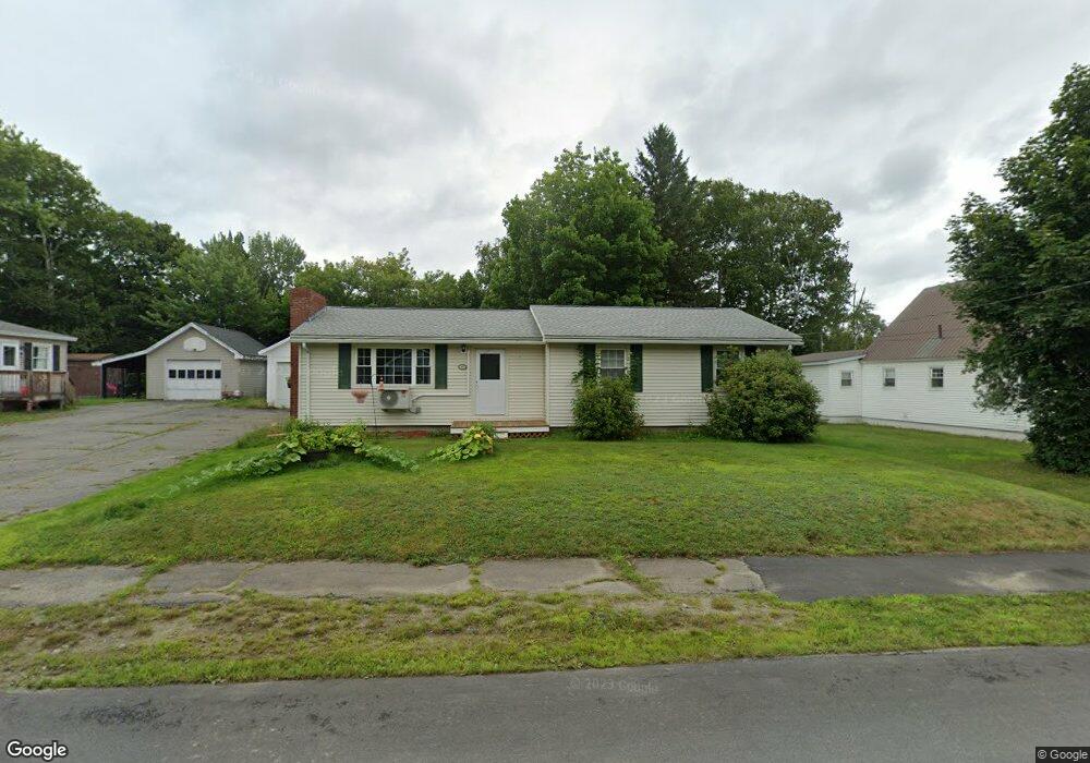
93 New York St Millinocket, ME 04462
Estimated Value: $177,740 - $199,000
3
Beds
1
Bath
--
Sq Ft
10,019
Sq Ft Lot
About This Home
This home is located at 93 New York St, Millinocket, ME 04462 and is currently estimated at $189,185. 93 New York St is a home located in Penobscot County with nearby schools including Granite Street School and Stearns Junior/Senior High School.
Ownership History
Date
Name
Owned For
Owner Type
Purchase Details
Closed on
Jun 4, 2021
Sold by
Flanagan Cathleen Est
Bought by
Lovejoy Elbridge G and Lovejoy Janet M
Current Estimated Value
Home Financials for this Owner
Home Financials are based on the most recent Mortgage that was taken out on this home.
Original Mortgage
$72,000
Outstanding Balance
$64,902
Interest Rate
2.9%
Mortgage Type
Purchase Money Mortgage
Estimated Equity
$124,283
Purchase Details
Closed on
Jan 18, 2018
Sold by
Robbins Paul A and Robbins Ivory-Anna
Bought by
Flanagan Cathleen L
Create a Home Valuation Report for This Property
The Home Valuation Report is an in-depth analysis detailing your home's value as well as a comparison with similar homes in the area
Home Values in the Area
Average Home Value in this Area
Purchase History
| Date | Buyer | Sale Price | Title Company |
|---|---|---|---|
| Lovejoy Elbridge G | -- | None Available | |
| Flanagan Cathleen L | -- | -- |
Source: Public Records
Mortgage History
| Date | Status | Borrower | Loan Amount |
|---|---|---|---|
| Open | Lovejoy Elbridge G | $72,000 |
Source: Public Records
Tax History Compared to Growth
Tax History
| Year | Tax Paid | Tax Assessment Tax Assessment Total Assessment is a certain percentage of the fair market value that is determined by local assessors to be the total taxable value of land and additions on the property. | Land | Improvement |
|---|---|---|---|---|
| 2025 | $3,107 | $135,100 | $12,000 | $123,100 |
| 2024 | $3,094 | $112,100 | $6,000 | $106,100 |
| 2023 | $2,563 | $90,900 | $6,000 | $84,900 |
| 2022 | $2,392 | $81,100 | $6,000 | $75,100 |
| 2021 | $2,230 | $68,600 | $6,000 | $62,600 |
| 2020 | $2,213 | $65,100 | $6,000 | $59,100 |
| 2019 | $2,148 | $65,100 | $6,000 | $59,100 |
| 2018 | $2,116 | $65,100 | $6,000 | $59,100 |
| 2017 | $2,103 | $65,100 | $6,000 | $59,100 |
| 2016 | $2,038 | $65,100 | $6,000 | $59,100 |
| 2015 | $1,931 | $65,100 | $6,000 | $59,100 |
| 2014 | $1,927 | $65,100 | $6,000 | $59,100 |
Source: Public Records
Map
Nearby Homes
- 78 Massachusetts Ave
- 45 Vermont St
- 102 Connecticut Ave
- 54 Rhode Island Ave
- 125 Connecticut Ave
- 30 New Hampshire St
- 47 New Jersey St
- 92 Ohio St
- 86 Ohio St
- Lot # Fern St
- 5 Grove St
- 73 Forest Ave
- 26 Pleasant St
- 13 Colony Place
- 6 Colony Place
- 899 Central St
- 22 Colony Place
- 23 Hillcrest Ave
- 6 & 6A Forest Ave
- 79 Pamola Park
- 99 New York St
- 53 Connecticut Ave
- 67 Connecticut Ave
- 92 New York St
- 105 New York St
- 100 New York St
- 178 Ohio St
- 172 Ohio St
- 184 Ohio St
- 52 Conn Ave
- 106 New York St
- 52 Connecticut Ave
- 190 Ohio St
- 46 Connecticut Ave
- 68 Connecticut Ave
- 111 New York St
- 68 Conn Ave
- 67 New York St
- 196 Ohio St
- 81 Michigan St