Estimated Value: $6,731,000 - $9,355,000
4
Beds
5
Baths
3,643
Sq Ft
$2,285/Sq Ft
Est. Value
About This Home
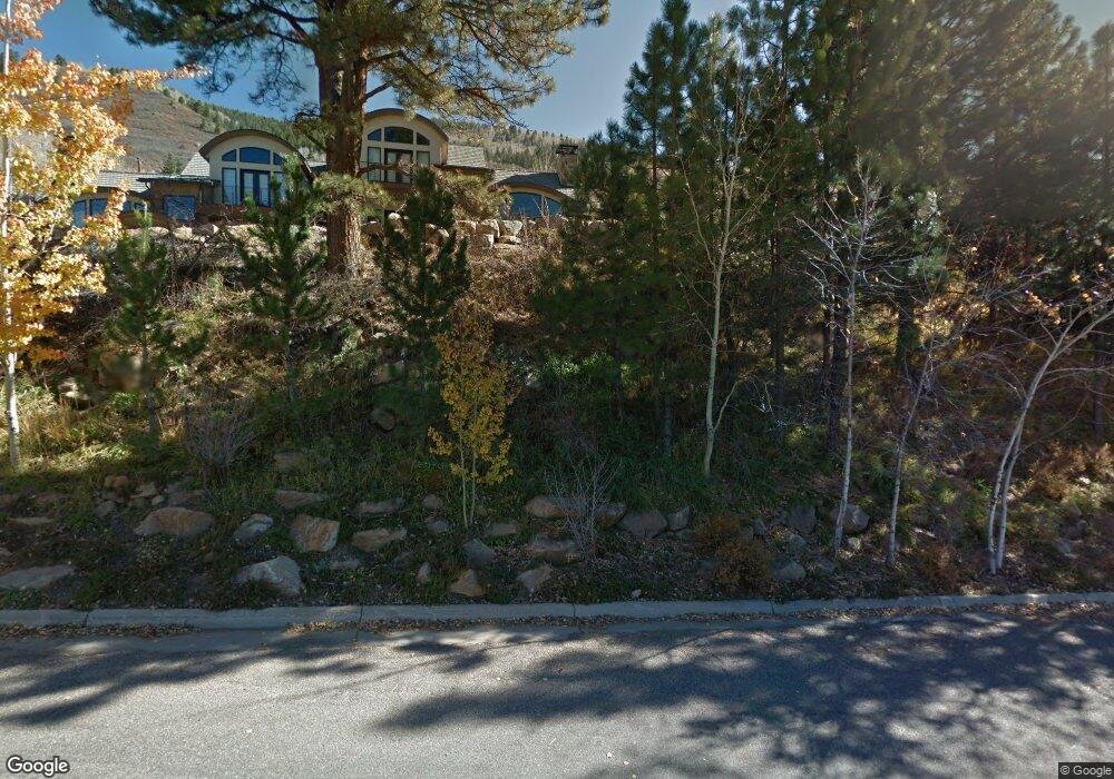
This home is located at 93 W Lupine Dr, Aspen, CO 81611 and is currently estimated at $8,323,779, approximately $2,284 per square foot. 93 W Lupine Dr is a home located in Pitkin County with nearby schools including Aspen Elementary School, Aspen Middle School, and Aspen High School.
Ownership History
Date
Name
Owned For
Owner Type
Purchase Details
Closed on
Apr 9, 2008
Sold by
Midlarsky Steven and Midlarsky Lisa
Bought by
Jonathan Levine & Stacey Levine Joint Re
Current Estimated Value
Purchase Details
Closed on
Jan 17, 2008
Sold by
Levine Jonathan and Levine Stacey
Bought by
Midlarsky Steven and Midlarsky Lisa
Purchase Details
Closed on
Dec 19, 2007
Sold by
Midlarsky Steven and Midlarsky Lisa
Bought by
Levine Jonathan and Levine Stacey
Create a Home Valuation Report for This Property
The Home Valuation Report is an in-depth analysis detailing your home's value as well as a comparison with similar homes in the area
Home Values in the Area
Average Home Value in this Area
Purchase History
| Date | Buyer | Sale Price | Title Company |
|---|---|---|---|
| Jonathan Levine & Stacey Levine Joint Re | -- | None Available | |
| Midlarsky Steven | -- | None Available | |
| Levine Jonathan | -- | None Available |
Source: Public Records
Tax History Compared to Growth
Tax History
| Year | Tax Paid | Tax Assessment Tax Assessment Total Assessment is a certain percentage of the fair market value that is determined by local assessors to be the total taxable value of land and additions on the property. | Land | Improvement |
|---|---|---|---|---|
| 2024 | $23,048 | $793,620 | $0 | $793,620 |
| 2023 | $23,048 | $859,620 | $0 | $859,620 |
| 2022 | $11,181 | $349,180 | $0 | $349,180 |
| 2021 | $11,152 | $359,230 | $0 | $359,230 |
| 2020 | $10,246 | $329,030 | $0 | $329,030 |
| 2019 | $10,246 | $329,030 | $0 | $329,030 |
| 2018 | $9,033 | $331,330 | $0 | $331,330 |
| 2017 | $7,854 | $289,800 | $0 | $289,800 |
| 2016 | $7,919 | $286,560 | $0 | $286,560 |
| 2015 | $7,871 | $286,560 | $0 | $286,560 |
| 2014 | $7,105 | $252,520 | $0 | $252,520 |
Source: Public Records
Map
Nearby Homes
- 184 Mountain Laurel Dr
- 602 Mountain Laurel Dr
- 552 Mountain Laurel Dr
- 161 Stillwater Ln
- 1271 S Ute Ave
- 100 Park Ave
- 71 & 73 Smuggler Grove Rd
- 1212 E Hopkins Ave
- 326 Midland Ave Unit 306
- 326 Midland Ave Unit 302
- 322 Park Ave Unit 2
- 10 Ute Place
- 1034 E Cooper Ave Unit 19A
- 1006 E Cooper Ave
- 940 Waters Ave Unit 201
- 939 E Cooper Ave Unit B
- 1024 E Hopkins Ave Unit 16
- 610 S West End St Unit D304
- 610 S West End St Unit D 206
- 610 S West End St Unit A304
- 93 W Lupine Dr Unit B
- 93 W Lupine Dr Unit A
- 93 W Lupine Dr Unit B
- 95 W Lupine Dr Unit A
- 95 W Lupine Dr Unit A
- 95 W Lupine Dr
- 39 W Lupine Dr
- 107 W Lupine Dr
- 257 Mountain Laurel Dr
- 64 E Lupine Dr
- 281 Mountain Laurel Dr
- 32 E Lupine Dr
- 19 E Lupine Dr
- 82 W Lupine Dr
- 135 W Lupine Dr
- 201 Mountain Laurel Dr
- 18 E Lupine Dr
- 309 Mountain Laurel Dr
- 250 Mountain Laurel Dr Unit B
- 250 Mountain Laurel Dr Unit A