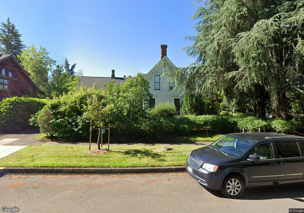
930 E 21st Ave Eugene, OR 97405
South University NeighborhoodEstimated Value: $746,964 - $1,032,000
5
Beds
3
Baths
2,735
Sq Ft
$332/Sq Ft
Est. Value
About This Home
This home is located at 930 E 21st Ave, Eugene, OR 97405 and is currently estimated at $906,991, approximately $331 per square foot. 930 E 21st Ave is a home located in Lane County with nearby schools including Edison Elementary School, Roosevelt Middle School, and South Eugene High School.
Ownership History
Date
Name
Owned For
Owner Type
Purchase Details
Closed on
Jun 26, 2015
Sold by
Dole Dorothy M
Bought by
Slayton Nathaniel Lincoln and Slayton Michelle Andrea
Current Estimated Value
Home Financials for this Owner
Home Financials are based on the most recent Mortgage that was taken out on this home.
Original Mortgage
$375,000
Outstanding Balance
$290,243
Interest Rate
3.81%
Mortgage Type
New Conventional
Estimated Equity
$616,748
Create a Home Valuation Report for This Property
The Home Valuation Report is an in-depth analysis detailing your home's value as well as a comparison with similar homes in the area
Home Values in the Area
Average Home Value in this Area
Purchase History
| Date | Buyer | Sale Price | Title Company |
|---|---|---|---|
| Slayton Nathaniel Lincoln | $500,000 | First American |
Source: Public Records
Mortgage History
| Date | Status | Borrower | Loan Amount |
|---|---|---|---|
| Open | Slayton Nathaniel Lincoln | $375,000 |
Source: Public Records
Tax History
| Year | Tax Paid | Tax Assessment Tax Assessment Total Assessment is a certain percentage of the fair market value that is determined by local assessors to be the total taxable value of land and additions on the property. | Land | Improvement |
|---|---|---|---|---|
| 2025 | $6,573 | $337,346 | -- | -- |
| 2024 | $6,491 | $327,521 | -- | -- |
| 2023 | $6,491 | $317,982 | $0 | $0 |
| 2022 | $6,081 | $308,721 | $0 | $0 |
| 2021 | $5,712 | $299,730 | $0 | $0 |
| 2020 | $5,732 | $291,000 | $0 | $0 |
| 2019 | $5,536 | $282,525 | $0 | $0 |
| 2018 | $5,211 | $266,308 | $0 | $0 |
| 2017 | $4,977 | $266,308 | $0 | $0 |
| 2016 | $4,854 | $258,551 | $0 | $0 |
| 2015 | $4,714 | $251,020 | $0 | $0 |
| 2014 | -- | $243,709 | $0 | $0 |
Source: Public Records
Map
Nearby Homes
- 2121 Hilyard St
- 940 E 23rd Ave
- 1828 Hilyard St
- 2571 Alder St
- 1826 Mill St
- 1350 E 25th Ave
- 1733 Mill Aly
- 2683 Alder St
- 2630 Onyx St
- 193 E 20th Ave
- 1857 Pearl St
- 181 Civic Dr
- 177 E 20th Ave
- 508 E 14th Ave
- 2580 Chula Vista Blvd
- 0 Agate St
- 1600 Pearl St Unit 608
- 2815 Hilyard St
- 344 E 14th Ave
- 1492 Pearl St
- 2133 Kincaid St
- 948 E 21st Ave
- 2145 Kincaid St
- 2091 Kincaid St
- 894 E 21st Ave
- 958 E 21st Ave
- 2167 Kincaid St
- 939 E 21st Ave
- 2075 Kincaid St
- 2140 Kincaid St
- 882 E 21st Ave
- 961 E 21st Ave
- 2159 Harris Aly Unit 3
- 2159 Harris Aly
- 2159 Harris Aly
- 2159 Harris Aly Unit 1
- 2140 Harris St
- 931 E 22nd Ave
- 2090 Kincaid St
- 990 E 21st Ave
Your Personal Tour Guide
Ask me questions while you tour the home.