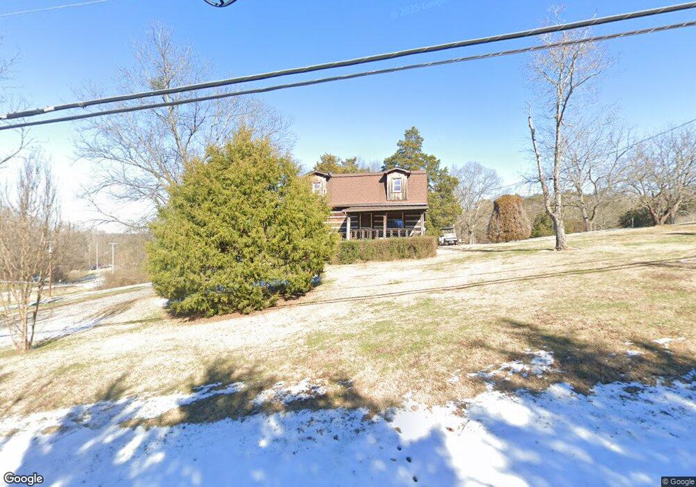
9309 Johnson Rd Strawberry Plains, TN 37871
Eastwood NeighborhoodEstimated Value: $190,000 - $342,000
2
Beds
3
Baths
1,120
Sq Ft
$245/Sq Ft
Est. Value
About This Home
This home is located at 9309 Johnson Rd, Strawberry Plains, TN 37871 and is currently estimated at $274,739, approximately $245 per square foot. 9309 Johnson Rd is a home located in Knox County with nearby schools including Carter Elementary School, Carter Middle School, and Carter High School.
Ownership History
Date
Name
Owned For
Owner Type
Purchase Details
Closed on
Feb 6, 2014
Sold by
Mellon William V
Bought by
Smelcer Joseph W and Smelcer Michelle Y
Current Estimated Value
Home Financials for this Owner
Home Financials are based on the most recent Mortgage that was taken out on this home.
Original Mortgage
$25,000
Outstanding Balance
$19,016
Interest Rate
4.51%
Mortgage Type
Purchase Money Mortgage
Estimated Equity
$255,723
Purchase Details
Closed on
Jul 21, 2010
Sold by
Mellon William V
Bought by
Mellon William V and Mellon Mona
Create a Home Valuation Report for This Property
The Home Valuation Report is an in-depth analysis detailing your home's value as well as a comparison with similar homes in the area
Home Values in the Area
Average Home Value in this Area
Purchase History
| Date | Buyer | Sale Price | Title Company |
|---|---|---|---|
| Smelcer Joseph W | $60,000 | None Available | |
| Mellon William V | -- | None Available | |
| Mellon William Virgil | $34,320 | None Available |
Source: Public Records
Mortgage History
| Date | Status | Borrower | Loan Amount |
|---|---|---|---|
| Open | Smelcer Joseph W | $25,000 |
Source: Public Records
Tax History Compared to Growth
Tax History
| Year | Tax Paid | Tax Assessment Tax Assessment Total Assessment is a certain percentage of the fair market value that is determined by local assessors to be the total taxable value of land and additions on the property. | Land | Improvement |
|---|---|---|---|---|
| 2024 | $225 | $27,350 | $0 | $0 |
| 2023 | $425 | $27,350 | $0 | $0 |
| 2022 | $425 | $27,350 | $0 | $0 |
| 2021 | $346 | $16,300 | $0 | $0 |
| 2020 | $346 | $16,300 | $0 | $0 |
| 2019 | $346 | $16,300 | $0 | $0 |
| 2018 | $346 | $16,300 | $0 | $0 |
| 2017 | $346 | $16,300 | $0 | $0 |
| 2016 | $371 | $0 | $0 | $0 |
| 2015 | $371 | $0 | $0 | $0 |
| 2014 | -- | $0 | $0 | $0 |
Source: Public Records
Map
Nearby Homes
- 824 Commonwealth Ave
- 601 Running Brook Dr
- 9332 Gabrielle Rd
- 0 Clift Rd
- 9832 Clift Rd
- 8816 N Ruggles Ferry Pike
- 8812 N Ruggles Ferry Pike
- 8705 N Ruggles Ferry Pike
- 303 Andrew Johnson Hwy
- 9615 Smoky Row Rd
- 8719 Pleasant Hill Rd
- 213 Arms Rd
- 1146 Madison Oaks Rd
- 9320 River Cane Rd
- 9324 Number Four Dr
- 8634 Shackleford Ln
- 9316 Number Four Dr
- 9633 Stringtown Rd
- 9316 Tipple Ln
- 8514 Pleasant Hill Rd
- 9311 Johnson Rd
- 837 Commonwealth Ave
- 833 Commonwealth Ave
- Lot217 Running Brook Dr
- 520 Running Brook Dr
- 524 Running Brook Dr
- 836 Commonwealth Ave
- 829 Commonwealth Ave
- 832 Commonwealth Ave
- 528 Running Brook Dr
- 825 Commonwealth Ave
- 516 Running Brook Dr
- 828 Commonwealth Ave
- 532 Running Brook Dr
- 512 Running Brook Dr
- 9317 Johnson Rd
- 821 Commonwealth Ave
- 821 Commonwealth Ave Unit 1
- 521 Running Brook Dr
- 521 Running Brook Dr Unit 2