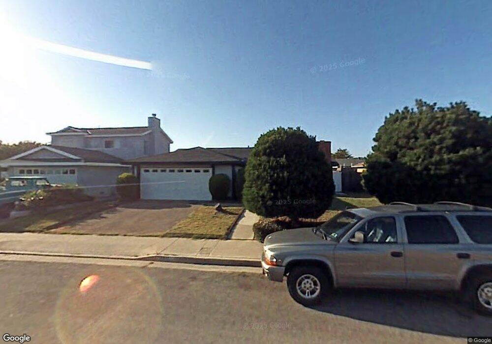
9311 Comstock Dr Huntington Beach, CA 92646
Southeast NeighborhoodEstimated Value: $1,207,636 - $1,438,000
4
Beds
2
Baths
1,332
Sq Ft
$980/Sq Ft
Est. Value
About This Home
This home is located at 9311 Comstock Dr, Huntington Beach, CA 92646 and is currently estimated at $1,305,159, approximately $979 per square foot. 9311 Comstock Dr is a home located in Orange County with nearby schools including Ralph E. Hawes Elementary School, Isaac L. Sowers Middle School, and Edison High School.
Ownership History
Date
Name
Owned For
Owner Type
Purchase Details
Closed on
Sep 20, 2017
Sold by
Pelter James R and Pelter Rita R
Bought by
Pelter James R and Pelter Rita R
Current Estimated Value
Purchase Details
Closed on
Sep 3, 2014
Sold by
Pelter Mary Rita Rose
Bought by
Pelter Rita R and Pelter James R
Purchase Details
Closed on
May 20, 2014
Sold by
Pelter Mary Rita Rose
Bought by
Pelter Mary Rita Rose
Create a Home Valuation Report for This Property
The Home Valuation Report is an in-depth analysis detailing your home's value as well as a comparison with similar homes in the area
Home Values in the Area
Average Home Value in this Area
Purchase History
| Date | Buyer | Sale Price | Title Company |
|---|---|---|---|
| Pelter James R | -- | None Available | |
| Pelter Rita R | -- | None Available | |
| Pelter Mary Rita Rose | -- | None Available |
Source: Public Records
Tax History Compared to Growth
Tax History
| Year | Tax Paid | Tax Assessment Tax Assessment Total Assessment is a certain percentage of the fair market value that is determined by local assessors to be the total taxable value of land and additions on the property. | Land | Improvement |
|---|---|---|---|---|
| 2025 | $8,872 | $784,547 | $698,401 | $86,146 |
| 2024 | $8,872 | $769,164 | $684,707 | $84,457 |
| 2023 | $8,674 | $754,083 | $671,282 | $82,801 |
| 2022 | $8,448 | $739,298 | $658,120 | $81,178 |
| 2021 | $8,291 | $724,802 | $645,215 | $79,587 |
| 2020 | $8,238 | $717,371 | $638,600 | $78,771 |
| 2019 | $8,140 | $703,305 | $626,078 | $77,227 |
| 2018 | $8,015 | $689,515 | $613,802 | $75,713 |
| 2017 | $7,909 | $675,996 | $601,767 | $74,229 |
| 2016 | $7,557 | $662,742 | $589,968 | $72,774 |
| 2015 | $7,486 | $652,787 | $581,106 | $71,681 |
| 2014 | $7,330 | $640,000 | $569,723 | $70,277 |
Source: Public Records
Map
Nearby Homes
- 20862 Lancelot Ln
- 9221 Belcaro Dr
- 9001 Oceanwood Dr
- 21221 Hillsdale Ln
- 8932 Amador Cir Unit 1309B
- 9581 Chevy Chase Dr
- 8856 Sutter Cir Unit 522A
- 8856 526C Sutter
- 8788 Coral Springs Ct Unit 203
- 21211 Poston Ln
- 8886 Plumas Cir Unit 1124-A
- 9812 La Cresta Cir
- 9802 Effingham Dr
- 9522 Yellowstone Dr
- 21361 Lemontree Ln
- 20258 Lantana Dr
- 8646 Butte Cir Unit 607E
- 21382 Lemontree Ln
- 9171 Regatta Dr
- 20392 Redwood Ln
- 9301 Comstock Dr
- 9321 Comstock Dr
- 9292 Winterwood Cir
- 9312 Winterwood Cir
- 9282 Winterwood Cir
- 9291 Comstock Dr
- 9331 Comstock Dr
- 9312 Comstock Dr
- 9322 Winterwood Cir
- 9272 Winterwood Cir
- 9322 Comstock Dr
- 9302 Comstock Dr
- 9341 Comstock Dr
- 9281 Comstock Dr
- 9332 Comstock Dr
- 9292 Comstock Dr
- 9252 Winterwood Cir
- 9332 Winterwood Cir
- 9342 Comstock Dr
- 9282 Comstock Dr