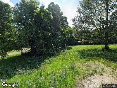
936 State Route 61 N Monroeville, OH 44847
Estimated Value: $159,845 - $261,000
5
Beds
2
Baths
2,316
Sq Ft
$99/Sq Ft
Est. Value
About This Home
This home is located at 936 State Route 61 N, Monroeville, OH 44847 and is currently estimated at $228,211, approximately $98 per square foot. 936 State Route 61 N is a home located in Huron County with nearby schools including Monroeville Elementary School and Monroeville High School.
Ownership History
Date
Name
Owned For
Owner Type
Purchase Details
Closed on
Nov 9, 2023
Bought by
Lonnie D Cherry
Current Estimated Value
Home Financials for this Owner
Home Financials are based on the most recent Mortgage that was taken out on this home.
Interest Rate
7.5%
Purchase Details
Closed on
Apr 16, 2018
Sold by
Cherry Lonnie D and Cherry Eleanor C
Bought by
Garwood David C and Cherry Joann
Purchase Details
Closed on
Feb 11, 2002
Bought by
Cherry Lonnie D and Cherry Eleanor C
Purchase Details
Closed on
Apr 13, 1978
Bought by
Cherry Lonnie Dean
Create a Home Valuation Report for This Property
The Home Valuation Report is an in-depth analysis detailing your home's value as well as a comparison with similar homes in the area
Home Values in the Area
Average Home Value in this Area
Purchase History
| Date | Buyer | Sale Price | Title Company |
|---|---|---|---|
| Garwood David C | -- | None Available | |
| Cherry Lonnie D | -- | -- | |
| Cherry Lonnie Dean | -- | -- |
Source: Public Records
Tax History Compared to Growth
Tax History
| Year | Tax Paid | Tax Assessment Tax Assessment Total Assessment is a certain percentage of the fair market value that is determined by local assessors to be the total taxable value of land and additions on the property. | Land | Improvement |
|---|---|---|---|---|
| 2024 | $1,562 | $49,350 | $8,110 | $41,240 |
| 2023 | $1,562 | $42,060 | $6,790 | $35,270 |
| 2022 | $1,535 | $45,000 | $6,790 | $38,210 |
| 2021 | $1,500 | $45,000 | $6,790 | $38,210 |
| 2020 | $1,493 | $43,280 | $6,790 | $36,490 |
| 2019 | $1,483 | $43,280 | $6,790 | $36,490 |
| 2018 | $1,423 | $43,280 | $6,790 | $36,490 |
| 2017 | $1,218 | $38,970 | $6,790 | $32,180 |
| 2016 | $1,194 | $38,970 | $6,790 | $32,180 |
| 2015 | $1,221 | $38,980 | $6,790 | $32,190 |
| 2014 | $940 | $34,590 | $5,780 | $28,810 |
| 2013 | $1,035 | $35,360 | $6,550 | $28,810 |
Source: Public Records
Map
Nearby Homes
- 424 N Ridge Rd
- 1797 Old State Rd N
- 37 Briarcrest Dr
- 40 Briarcrest Village
- 189 Briarcrest Dr
- 644 State Route 99
- 138 S Norwalk Rd W
- 0 Ohio 162
- 0 Valley Park Dr Unit 5098529
- 0 Valley Park Dr Unit 20250398
- 863 Peru Olena Rd E
- 0 Valley Park Lot #4
- 0 Valley Park Lot #6
- 10 Par Ct
- 191 W Main St
- 6 Breezewood Dr
- 2 Executive Village Ct Unit A
- 2A Executive Village Ct
- 144 Sycamore Dr
- 3 Executive Village Ct Unit A
- 936 State Route 61 N
- 1601 Snyder Rd
- 991 State Route 61 N
- 1619 Snyder Rd
- 922 Ohio 61
- 994 State Route 61 N
- 1002 State Route 61 S
- 871 State Route 61 N
- 1586 Snyder Rd
- 1630 Snyder Rd
- 1551 Peru Olena Rd W
- 1561 Peru Olena Rd W
- 1517 Peru Olena Rd W
- 1567 Peru Olena Rd W
- 1567 Peru Olena Rd W
- 1567 Peru Olena Rd W
- 1567 Peru Olena Rd W
- 968 Peru Olena Rd W
- 1556 Peru Olena Rd W
- 1556 Peru Olena Rd W
