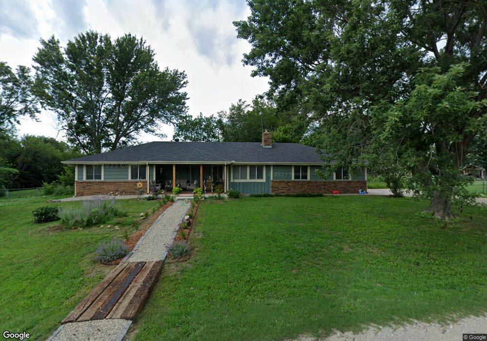
9373 SW Lois Rd Andover, KS 67002
Estimated Value: $302,652 - $355,000
3
Beds
2
Baths
1,536
Sq Ft
$217/Sq Ft
Est. Value
About This Home
This home is located at 9373 SW Lois Rd, Andover, KS 67002 and is currently estimated at $333,413, approximately $217 per square foot. 9373 SW Lois Rd is a home located in Butler County with nearby schools including Sunflower Elementary School, Andover Central Middle School, and Andover Central High School.
Ownership History
Date
Name
Owned For
Owner Type
Purchase Details
Closed on
Jul 2, 2019
Sold by
Algrim Family Trust
Bought by
Keenan Dan Poore and Poore Brenda Elaine
Current Estimated Value
Home Financials for this Owner
Home Financials are based on the most recent Mortgage that was taken out on this home.
Original Mortgage
$186,558
Outstanding Balance
$150,383
Interest Rate
0.37%
Mortgage Type
New Conventional
Estimated Equity
$183,030
Create a Home Valuation Report for This Property
The Home Valuation Report is an in-depth analysis detailing your home's value as well as a comparison with similar homes in the area
Home Values in the Area
Average Home Value in this Area
Purchase History
| Date | Buyer | Sale Price | Title Company |
|---|---|---|---|
| Keenan Dan Poore | $188,424 | Other |
Source: Public Records
Mortgage History
| Date | Status | Borrower | Loan Amount |
|---|---|---|---|
| Open | Poore Keenan Dan | $50,000 | |
| Open | Keenan Dan Poore | $186,558 |
Source: Public Records
Tax History Compared to Growth
Tax History
| Year | Tax Paid | Tax Assessment Tax Assessment Total Assessment is a certain percentage of the fair market value that is determined by local assessors to be the total taxable value of land and additions on the property. | Land | Improvement |
|---|---|---|---|---|
| 2025 | $39 | $29,613 | $5,842 | $23,771 |
| 2024 | $39 | $29,211 | $3,761 | $25,450 |
| 2023 | $3,676 | $28,049 | $3,289 | $24,760 |
| 2022 | $3,658 | $24,093 | $3,289 | $20,804 |
| 2021 | $2,981 | $21,305 | $2,915 | $18,390 |
| 2020 | $3,031 | $20,758 | $2,795 | $17,963 |
| 2019 | $2,981 | $20,219 | $2,795 | $17,424 |
| 2018 | $2,962 | $20,229 | $2,795 | $17,434 |
| 2017 | $2,736 | $18,781 | $1,530 | $17,251 |
| 2014 | -- | $152,310 | $10,300 | $142,010 |
Source: Public Records
Map
Nearby Homes
- 9463 SW Lois Rd
- 000 SW Hwy 54
- 12222 SW 104th Terrace
- 8139 SW Tawakoni Rd
- 1413 U S 54
- 515 U S 54
- 8548 SW Parish Place Rd
- 730 S Pleasantview Dr
- 12707 SW Chisholm Trail Rd
- 12722 SW Chisholm Trail Rd
- 1403 N Chinaberry St
- 2025 E Clover Ct
- 2018 E Clover Ct
- 10498 SW 90th St
- 705 N Deerfield Ct
- 7067 SW Meadowlark Rd
- 1542 N Quince Ct
- 1548 N Quince Ct
- 1535 N Quince Ct
- 1013 E Rosemont Ct
- 12788 SW 94th St
- 12855 SW 93rd Terrace
- 9445 SW Lois Rd
- 12792 SW 94th Terrace
- 9372 SW Pine Rd
- 12798 SW 93rd Terrace
- 9342 SW Pine Rd
- 9470 SW Lois Rd
- 9408 SW Pine Rd
- 9444 SW Pine Rd
- 9299 SW Lois Rd
- 9424 SW Pine Rd
- 12799 SW 92nd Terrace
- 12930 SW 93rd Terrace
- 9466 SW Pine Rd
- 9377 SW Pine Rd
- 9422 SW Indianola Rd
- 12955 SW 93rd Terrace
- 12717 SW 94th Terrace
- 12843 SW 95th St