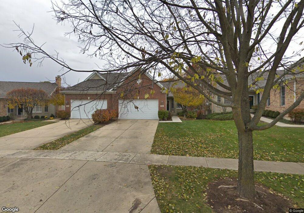
938 Ginger Ln Unit B Geneva, IL 60134
Southwest Geneva NeighborhoodEstimated Value: $467,000 - $526,000
4
Beds
3
Baths
2,000
Sq Ft
$250/Sq Ft
Est. Value
About This Home
This home is located at 938 Ginger Ln Unit B, Geneva, IL 60134 and is currently estimated at $500,489, approximately $250 per square foot. 938 Ginger Ln Unit B is a home located in Kane County with nearby schools including Williamsburg Elementary School, Geneva Community High School, and St. Peter School.
Ownership History
Date
Name
Owned For
Owner Type
Purchase Details
Closed on
Oct 31, 2017
Sold by
Penick V Scott
Bought by
Hatcher Harold F and Hatcher Juliana R
Current Estimated Value
Home Financials for this Owner
Home Financials are based on the most recent Mortgage that was taken out on this home.
Original Mortgage
$53,250
Outstanding Balance
$29,242
Interest Rate
3.83%
Mortgage Type
New Conventional
Estimated Equity
$471,247
Purchase Details
Closed on
Jun 6, 2017
Sold by
Carlson Sharon A
Bought by
Penick V Scott
Purchase Details
Closed on
Mar 9, 2001
Sold by
Lautz Builders Inc
Bought by
Carlson Marvin E and Trust #101
Create a Home Valuation Report for This Property
The Home Valuation Report is an in-depth analysis detailing your home's value as well as a comparison with similar homes in the area
Home Values in the Area
Average Home Value in this Area
Purchase History
| Date | Buyer | Sale Price | Title Company |
|---|---|---|---|
| Hatcher Harold F | $355,000 | Chicago Title Insurance Co | |
| Penick V Scott | $337,000 | Chicago Title Ins Co | |
| Carlson Marvin E | $306,500 | Ticor Title Insurance |
Source: Public Records
Mortgage History
| Date | Status | Borrower | Loan Amount |
|---|---|---|---|
| Open | Hatcher Harold F | $53,250 |
Source: Public Records
Tax History
| Year | Tax Paid | Tax Assessment Tax Assessment Total Assessment is a certain percentage of the fair market value that is determined by local assessors to be the total taxable value of land and additions on the property. | Land | Improvement |
|---|---|---|---|---|
| 2024 | $10,141 | $149,279 | $39,949 | $109,330 |
| 2023 | $9,821 | $135,708 | $36,317 | $99,391 |
| 2022 | $9,610 | $126,100 | $33,746 | $92,354 |
| 2021 | $9,312 | $121,414 | $32,492 | $88,922 |
| 2020 | $9,199 | $119,561 | $31,996 | $87,565 |
| 2019 | $9,166 | $117,297 | $31,390 | $85,907 |
| 2018 | $8,265 | $106,989 | $31,390 | $75,599 |
| 2017 | $7,524 | $96,898 | $30,553 | $66,345 |
| 2016 | $7,554 | $95,588 | $30,140 | $65,448 |
| 2015 | -- | $90,881 | $28,656 | $62,225 |
| 2014 | -- | $94,253 | $28,656 | $65,597 |
| 2013 | -- | $108,691 | $28,656 | $80,035 |
Source: Public Records
Map
Nearby Homes
- Unit 6A Prairie Grove Dr
- Unit 5B Prairie Grove Dr
- Unit 4A Prairie Grove Dr
- Unit 5A Prairie Grove Dr
- Unit 7A Prairie Grove Dr
- Unit 6C Prairie Grove Dr
- Unit 5C Prairie Grove Dr
- Unit 6B Prairie Grove Dr
- Unit 4C Prairie Grove Dr
- Unit 7C Prairie Grove Dr
- 2685 Cedar Ave
- 839 S Randall Rd
- 2250 South St
- 2300 Kaneville Rd
- 1949 Gary Ln
- 2782 Miller Rd
- 948 Bluestem Dr
- 1145 Keim Ct
- 2707 Stone Cir
- 2767 Stone Cir
- 942 Ginger Ln Unit A
- 932 Ginger Ln Unit A
- 946 Ginger Ln Unit B
- 952 Ginger Ln Unit A
- 926 Ginger Ln Unit B
- 925 Lewis Rd
- 919 Lewis Rd
- 960 Ginger Ln Unit B
- 931 Lewis Rd Unit 1
- 913 Lewis Rd
- 949 Ginger Ln Unit A
- 964 Ginger Ln
- 957 Ginger Ln Unit B
- 935 Ginger Ln Unit B
- 907 Lewis Rd
- 968 Ginger Ln Unit B
- 929 Ginger Ln
- 923 Ginger Ln Unit B
- 905 Ginger Ln Unit A
- 977 Ginger Ln Unit A
Your Personal Tour Guide
Ask me questions while you tour the home.