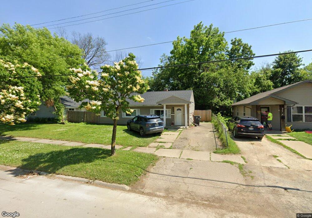
939 Ingleside Ave Flint, MI 48507
South Side NeighborhoodEstimated Value: $56,645 - $72,000
3
Beds
1
Bath
1,120
Sq Ft
$56/Sq Ft
Est. Value
About This Home
This home is located at 939 Ingleside Ave, Flint, MI 48507 and is currently estimated at $63,161, approximately $56 per square foot. 939 Ingleside Ave is a home located in Genesee County with nearby schools including Neithercut Elementary School, Flint Southwestern Classical Academy, and International Academy of Flint (K-12).
Ownership History
Date
Name
Owned For
Owner Type
Purchase Details
Closed on
Oct 7, 2025
Sold by
Stockwell Marian and Stockwell Roger
Bought by
Stockwell Landlords Llc
Current Estimated Value
Purchase Details
Closed on
Aug 16, 2024
Sold by
Byrne Land Corporation
Bought by
Stockwell Marian and Stockwell Roger
Purchase Details
Closed on
Oct 1, 2014
Sold by
Smith William L
Bought by
Byrne Land Corporation
Purchase Details
Closed on
Nov 18, 2005
Sold by
Doerr Kim M
Bought by
Smith William L
Create a Home Valuation Report for This Property
The Home Valuation Report is an in-depth analysis detailing your home's value as well as a comparison with similar homes in the area
Home Values in the Area
Average Home Value in this Area
Purchase History
| Date | Buyer | Sale Price | Title Company |
|---|---|---|---|
| Stockwell Landlords Llc | -- | None Listed On Document | |
| Stockwell Marian | $64,000 | None Listed On Document | |
| Byrne Land Corporation | $36,000 | First American Title Ins Co | |
| Smith William L | -- | Title Michigan Agency Ltd |
Source: Public Records
Tax History
| Year | Tax Paid | Tax Assessment Tax Assessment Total Assessment is a certain percentage of the fair market value that is determined by local assessors to be the total taxable value of land and additions on the property. | Land | Improvement |
|---|---|---|---|---|
| 2025 | $1,081 | $17,700 | $0 | $0 |
| 2024 | $1,002 | $18,200 | $0 | $0 |
| 2023 | $981 | $14,700 | $0 | $0 |
| 2022 | $0 | $12,400 | $0 | $0 |
| 2021 | $994 | $11,200 | $0 | $0 |
| 2020 | $916 | $11,200 | $0 | $0 |
| 2019 | $896 | $11,500 | $0 | $0 |
| 2018 | $883 | $9,700 | $0 | $0 |
| 2017 | $860 | $0 | $0 | $0 |
| 2016 | $855 | $0 | $0 | $0 |
| 2015 | -- | $0 | $0 | $0 |
| 2014 | -- | $0 | $0 | $0 |
| 2012 | -- | $11,600 | $0 | $0 |
Source: Public Records
Map
Nearby Homes
- 912 Huron St
- 1015 Alvord Ave
- 846 W Hemphill Rd
- 1122 Markham St
- 829 Clinton St
- 845 Alvord Ave
- 1210 Pinehurst Ave
- 805 Alvord Ave
- 806 Alvord Ave
- 1234 Huron St
- 1310 Huron St
- 1318 Ingleside Ave
- 3902 Brunswick Ave
- 1028 Campbell St
- 822 Campbell St
- 1216 E Hemphill Rd
- 652 Crawford St
- 1130 W Atherton Rd
- 612 Clinton St
- 1219 Norton St
- 935 Ingleside Ave
- 947 Ingleside Ave
- 936 Major St
- 944 Major St
- 929 Ingleside Ave
- 948 Major St
- 928 Major St
- 940 Ingleside Ave
- 919 Ingleside Ave
- 924 Major St
- 932 Ingleside Ave
- 952 Ingleside Ave
- 928 Ingleside Ave
- 943 Huron St
- 952 Major St
- 916 Major St
- 4417 Fenton Rd
- 939 Major St
- 4409 Fenton Rd
- 4413 Fenton Rd
Your Personal Tour Guide
Ask me questions while you tour the home.