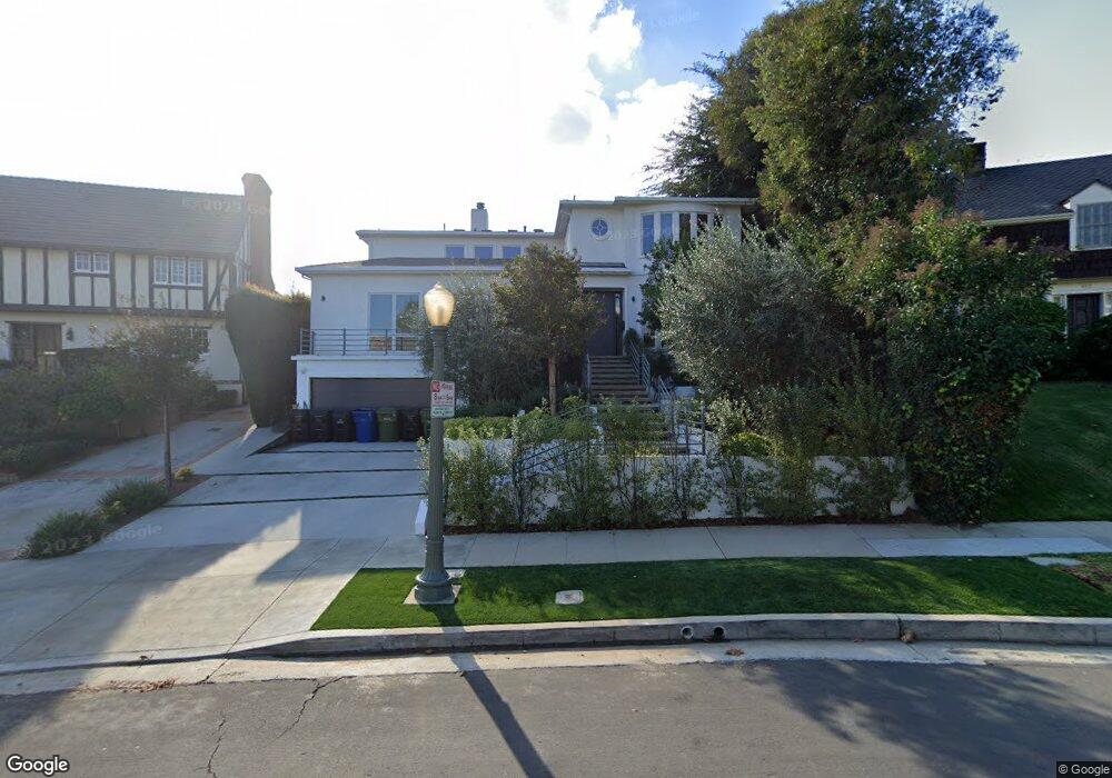
939 Manning Ave Los Angeles, CA 90024
Westwood NeighborhoodEstimated Value: $2,602,000 - $5,029,000
6
Beds
7
Baths
4,787
Sq Ft
$875/Sq Ft
Est. Value
About This Home
This home is located at 939 Manning Ave, Los Angeles, CA 90024 and is currently estimated at $4,189,374, approximately $875 per square foot. 939 Manning Ave is a home located in Los Angeles County with nearby schools including Warner Avenue Elementary, Ralph Waldo Emerson Community Charter Middle School, and University High School Charter.
Ownership History
Date
Name
Owned For
Owner Type
Purchase Details
Closed on
Feb 22, 2005
Sold by
Zimbler Edward and Zimbler Lola
Bought by
Zimbler Edward L and Zimbler Lola S
Current Estimated Value
Purchase Details
Closed on
Jan 8, 1999
Sold by
Sara W Goldberg Trust and Alice
Bought by
Zimbler Edward and Zimberl Lola
Home Financials for this Owner
Home Financials are based on the most recent Mortgage that was taken out on this home.
Original Mortgage
$650,000
Outstanding Balance
$150,892
Interest Rate
6.77%
Estimated Equity
$4,038,482
Create a Home Valuation Report for This Property
The Home Valuation Report is an in-depth analysis detailing your home's value as well as a comparison with similar homes in the area
Home Values in the Area
Average Home Value in this Area
Purchase History
| Date | Buyer | Sale Price | Title Company |
|---|---|---|---|
| Zimbler Edward L | -- | -- | |
| Zimbler Edward | -- | First American Title Co |
Source: Public Records
Mortgage History
| Date | Status | Borrower | Loan Amount |
|---|---|---|---|
| Open | Zimbler Edward | $650,000 | |
| Closed | Zimbler Edward | $95,200 |
Source: Public Records
Tax History Compared to Growth
Tax History
| Year | Tax Paid | Tax Assessment Tax Assessment Total Assessment is a certain percentage of the fair market value that is determined by local assessors to be the total taxable value of land and additions on the property. | Land | Improvement |
|---|---|---|---|---|
| 2025 | $20,377 | $1,677,479 | $984,524 | $692,955 |
| 2024 | $20,377 | $1,644,588 | $965,220 | $679,368 |
| 2023 | $19,989 | $1,612,343 | $946,295 | $666,048 |
| 2022 | $19,070 | $1,580,730 | $927,741 | $652,989 |
| 2021 | $18,820 | $1,549,736 | $909,550 | $640,186 |
| 2019 | $18,260 | $1,503,772 | $882,573 | $621,199 |
| 2018 | $18,117 | $1,474,287 | $865,268 | $609,019 |
| 2016 | $17,301 | $1,417,040 | $831,669 | $585,371 |
| 2015 | $17,050 | $1,395,756 | $819,177 | $576,579 |
| 2014 | $17,104 | $1,368,416 | $803,131 | $565,285 |
Source: Public Records
Map
Nearby Homes
- 10736 Le Conte Ave
- 10778 Weyburn Ave
- 901 Malcolm Ave
- 821 Malcolm Ave
- 10727 Wilshire Blvd Unit 301
- 10727 Wilshire Blvd Unit 1802
- 10727 Wilshire Blvd Unit 501
- 10727 Wilshire Blvd Unit 806
- 10727 Wilshire Blvd Unit 1805
- 10727 Wilshire Blvd Unit 2002
- 10798 Weyburn Ave
- 10747 Wilshire Blvd Unit 1102
- 10701 Wilshire Blvd Unit 503
- 10701 Wilshire Blvd Unit 1601
- 10701 Wilshire Blvd Unit 306
- 10751 Wilshire Blvd Unit 1009
- 10751 Wilshire Blvd Unit 1204
- 10777 Wilshire Blvd Unit 209
- 820 Glenmont Ave
- 10787 Wilshire Blvd Unit 1003
- 933 Manning Ave
- 945 Manning Ave
- 1010 Selby Ave
- 925 Manning Ave
- 951 Manning Ave
- 1016 Selby Ave
- 1004 Selby Ave
- 10730 Le Conte Ave
- 10748 Weyburn Ave
- 10742 Weyburn Ave
- 1022 Selby Ave
- 10724 Le Conte Ave
- 957 Manning Ave
- 917 Manning Ave
- 942 Manning Ave
- 930 Manning Ave
- 1028 Selby Ave
- 10720 Le Conte Ave
- 1001 Manning Ave
- 922 Manning Ave