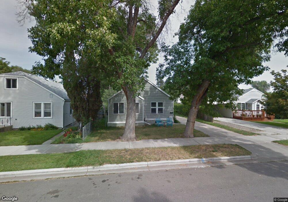
939 Miles Ave Billings, MT 59101
East Central Billings NeighborhoodEstimated Value: $257,000 - $308,000
3
Beds
2
Baths
2,120
Sq Ft
$133/Sq Ft
Est. Value
About This Home
This home is located at 939 Miles Ave, Billings, MT 59101 and is currently estimated at $282,243, approximately $133 per square foot. 939 Miles Ave is a home located in Yellowstone County with nearby schools including Washington School, Lewis & Clark Junior High School, and Billings Senior High School.
Ownership History
Date
Name
Owned For
Owner Type
Purchase Details
Closed on
Jul 7, 2014
Sold by
Glantz Gary K and Glantz Nicole D
Bought by
Keen Investments Llc
Current Estimated Value
Purchase Details
Closed on
May 1, 2014
Sold by
Glennon Daniel J and Glennon Nicole
Bought by
Glantz Gary K and Glantz Nicole
Home Financials for this Owner
Home Financials are based on the most recent Mortgage that was taken out on this home.
Original Mortgage
$127,500
Interest Rate
4.38%
Mortgage Type
New Conventional
Purchase Details
Closed on
Mar 27, 2008
Sold by
Klimper David W and Klimper Nancy
Bought by
Glennon Daniel J and Glennon Janet L
Home Financials for this Owner
Home Financials are based on the most recent Mortgage that was taken out on this home.
Original Mortgage
$118,221
Interest Rate
5.72%
Mortgage Type
Purchase Money Mortgage
Create a Home Valuation Report for This Property
The Home Valuation Report is an in-depth analysis detailing your home's value as well as a comparison with similar homes in the area
Home Values in the Area
Average Home Value in this Area
Purchase History
| Date | Buyer | Sale Price | Title Company |
|---|---|---|---|
| Keen Investments Llc | -- | None Available | |
| Glantz Gary K | -- | Stewart Title | |
| Glennon Daniel J | -- | None Available |
Source: Public Records
Mortgage History
| Date | Status | Borrower | Loan Amount |
|---|---|---|---|
| Previous Owner | Glantz Gary K | $127,500 | |
| Previous Owner | Glennon Daniel J | $118,221 |
Source: Public Records
Tax History
| Year | Tax Paid | Tax Assessment Tax Assessment Total Assessment is a certain percentage of the fair market value that is determined by local assessors to be the total taxable value of land and additions on the property. | Land | Improvement |
|---|---|---|---|---|
| 2025 | $2,906 | $315,240 | $37,400 | $277,840 |
| 2024 | $2,906 | $293,260 | $37,300 | $255,960 |
| 2023 | $2,897 | $293,260 | $37,300 | $255,960 |
| 2022 | $2,118 | $224,370 | $0 | $0 |
| 2021 | $2,427 | $225,020 | $0 | $0 |
| 2020 | $2,339 | $201,770 | $0 | $0 |
| 2019 | $2,228 | $201,770 | $0 | $0 |
| 2018 | $2,001 | $175,610 | $0 | $0 |
| 2017 | $1,944 | $175,610 | $0 | $0 |
| 2016 | $1,833 | $165,980 | $0 | $0 |
| 2015 | $1,785 | $165,980 | $0 | $0 |
| 2014 | $1,594 | $77,967 | $0 | $0 |
Source: Public Records
Map
Nearby Homes
- 925 Miles Ave
- 947 Howard Ave
- 1003 Wyoming Ave
- 1009 Wyoming Ave
- 708 Terry Ave
- 1132 Saint Johns Ave
- 1029 Yellowstone Ave Unit 2
- 43 Prickett Ln
- 1205 Lynn Ave
- 811 7th St W
- 632 Saint Johns Ave Unit 8
- 1245 Cook Ave
- 626 Wyoming Ave
- 608 Broadwater Ave
- 1326 Custer Ave
- 1288 Yellowstone Ave Unit 2
- 1116 8th St W
- 1310 Yellowstone Ave Unit 16
- 1310 Yellowstone Ave Unit 6
- 1107 12th St W
Your Personal Tour Guide
Ask me questions while you tour the home.