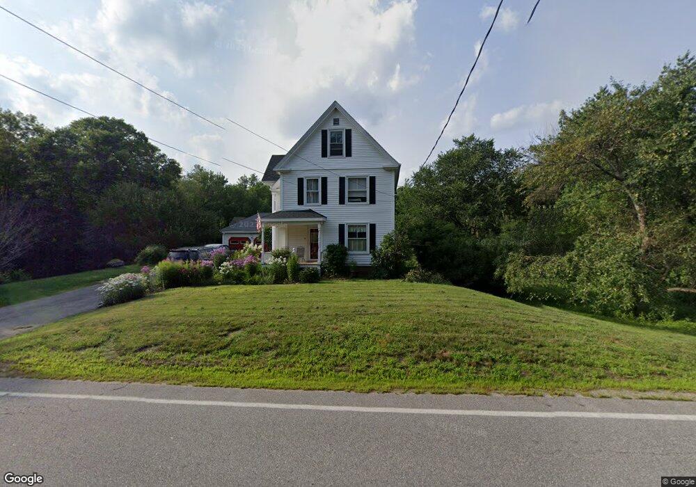
94 Emerson Ave Hampstead, NH 03841
Estimated Value: $596,000 - $721,000
3
Beds
2
Baths
2,713
Sq Ft
$235/Sq Ft
Est. Value
About This Home
This home is located at 94 Emerson Ave, Hampstead, NH 03841 and is currently estimated at $637,573, approximately $235 per square foot. 94 Emerson Ave is a home located in Rockingham County with nearby schools including Hampstead Central School, Hampstead Middle School, and Pinkerton Academy.
Ownership History
Date
Name
Owned For
Owner Type
Purchase Details
Closed on
Jun 13, 2003
Sold by
Parker Michael P and Parker Lori L
Bought by
Barlow Andrew K and Barlow Judith S
Current Estimated Value
Home Financials for this Owner
Home Financials are based on the most recent Mortgage that was taken out on this home.
Original Mortgage
$250,000
Interest Rate
5.77%
Purchase Details
Closed on
Sep 29, 2000
Sold by
Lamphier Jonathan and Lamphier Lynne
Bought by
Parker Michael P
Home Financials for this Owner
Home Financials are based on the most recent Mortgage that was taken out on this home.
Original Mortgage
$223,250
Interest Rate
7.94%
Purchase Details
Closed on
May 21, 1999
Sold by
Noyes Est Barbara L
Bought by
Lamphier Jonathan and Lamphier Lynne
Home Financials for this Owner
Home Financials are based on the most recent Mortgage that was taken out on this home.
Original Mortgage
$170,900
Interest Rate
6.88%
Create a Home Valuation Report for This Property
The Home Valuation Report is an in-depth analysis detailing your home's value as well as a comparison with similar homes in the area
Home Values in the Area
Average Home Value in this Area
Purchase History
| Date | Buyer | Sale Price | Title Company |
|---|---|---|---|
| Barlow Andrew K | $339,900 | -- | |
| Parker Michael P | $235,000 | -- | |
| Lamphier Jonathan | $179,900 | -- |
Source: Public Records
Mortgage History
| Date | Status | Borrower | Loan Amount |
|---|---|---|---|
| Open | Lamphier Jonathan | $213,550 | |
| Closed | Lamphier Jonathan | $250,000 | |
| Previous Owner | Lamphier Jonathan | $223,250 | |
| Previous Owner | Lamphier Jonathan | $170,900 |
Source: Public Records
Tax History Compared to Growth
Tax History
| Year | Tax Paid | Tax Assessment Tax Assessment Total Assessment is a certain percentage of the fair market value that is determined by local assessors to be the total taxable value of land and additions on the property. | Land | Improvement |
|---|---|---|---|---|
| 2024 | $9,570 | $516,200 | $193,200 | $323,000 |
| 2023 | $8,372 | $329,100 | $138,000 | $191,100 |
| 2022 | $7,793 | $329,100 | $138,000 | $191,100 |
| 2021 | $7,537 | $331,300 | $138,000 | $193,300 |
| 2020 | $7,140 | $331,300 | $138,000 | $193,300 |
| 2016 | $6,265 | $258,900 | $81,200 | $177,700 |
| 2015 | $5,807 | $258,900 | $81,200 | $177,700 |
| 2014 | $5,807 | $258,900 | $81,200 | $177,700 |
| 2006 | $4,959 | $273,700 | $98,000 | $175,700 |
Source: Public Records
Map
Nearby Homes
- 3 Cameron Ct Unit 3
- 12 Stage Rd
- 93 Stage Rd
- 62 Veterans Way
- 14 Meredith Dr
- 15 Cambridge Rd
- 16 Edmund Meadow Ln
- 32 Ells Rd
- 41 Tewksbury Rd
- 185 Buttrick Rd
- 35 Kelly Brook Ln
- 13 Autumn Ln
- 8 Ians Path
- 40 Coles Way
- 7 Stevens Ct Unit 7
- 7 Stevens Ct
- 127 Cowbell Crossing
- 21 Coles Way
- 9 Valcat Ln
- Lot 22-50 Valcat Ln