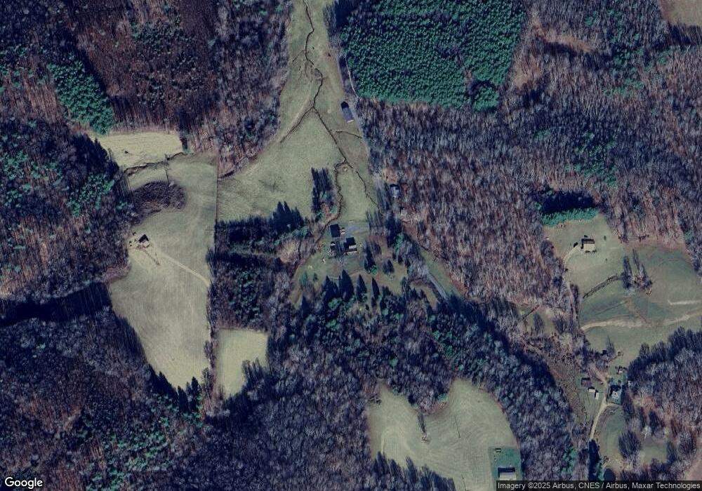
941 Dust Trail Rd Laurel Fork, VA 24352
Laurel Fork NeighborhoodEstimated Value: $156,000 - $217,000
5
Beds
1
Bath
1,744
Sq Ft
$102/Sq Ft
Est. Value
About This Home
This home is located at 941 Dust Trail Rd, Laurel Fork, VA 24352 and is currently estimated at $177,315, approximately $101 per square foot. 941 Dust Trail Rd is a home located in Carroll County with nearby schools including Gladesboro Elementary School, Carroll County Middle School, and Carroll County High School.
Ownership History
Date
Name
Owned For
Owner Type
Purchase Details
Closed on
Jan 7, 2010
Sold by
Thomas Darryel Wayne and Thomas Sherry Renee
Bought by
Plemmons Danny E and Plemmmons Vickie E
Current Estimated Value
Home Financials for this Owner
Home Financials are based on the most recent Mortgage that was taken out on this home.
Original Mortgage
$63,200
Outstanding Balance
$21,923
Interest Rate
7%
Mortgage Type
Adjustable Rate Mortgage/ARM
Estimated Equity
$155,392
Create a Home Valuation Report for This Property
The Home Valuation Report is an in-depth analysis detailing your home's value as well as a comparison with similar homes in the area
Home Values in the Area
Average Home Value in this Area
Purchase History
| Date | Buyer | Sale Price | Title Company |
|---|---|---|---|
| Plemmons Danny E | $79,000 | None Available |
Source: Public Records
Mortgage History
| Date | Status | Borrower | Loan Amount |
|---|---|---|---|
| Open | Plemmons Danny E | $63,200 |
Source: Public Records
Tax History Compared to Growth
Tax History
| Year | Tax Paid | Tax Assessment Tax Assessment Total Assessment is a certain percentage of the fair market value that is determined by local assessors to be the total taxable value of land and additions on the property. | Land | Improvement |
|---|---|---|---|---|
| 2025 | $780 | $159,200 | $67,200 | $92,000 |
| 2024 | $614 | $104,100 | $47,000 | $57,100 |
| 2023 | $614 | $104,100 | $47,000 | $57,100 |
| 2022 | $666 | $104,100 | $47,000 | $57,100 |
| 2021 | $666 | $104,100 | $47,000 | $57,100 |
| 2020 | $661 | $90,500 | $45,000 | $45,500 |
| 2019 | $629 | $90,500 | $45,000 | $45,500 |
| 2018 | $629 | $90,500 | $45,000 | $45,500 |
| 2017 | $629 | $90,500 | $45,000 | $45,500 |
| 2016 | $479 | $70,500 | $55,000 | $15,500 |
| 2015 | -- | $70,500 | $55,000 | $15,500 |
| 2014 | -- | $70,500 | $55,000 | $15,500 |
Source: Public Records
Map
Nearby Homes
- TBD Lake Bend Trail
- TBD Laurel Fork Rd
- 688 Gibson Knob Rd
- TBD Dugspur Rd
- 291 Laurel Fork Rd
- 368 Chippewa Ln
- 13256 Danville Pike
- TBD Old Danville Pike
- 1205 Stone Mountain Rd
- TBD Blue Lake Ln
- TBD Manor House Dr
- Lot 28 Manor House Dr
- TBD Fairlake Ln
- 19 Lone Oak Ct
- 416 Mountain Laurel Dr
- TBD Lone Oak Ct
- 1485 Pine Branch Rd
- 49 Hoover Rd
- 000 Fairhaven Dr
- UNIT G 20 Golf Overlook Way
- 784 Dust Trail Rd
- 105 Dust Trail Rd
- 708 Dust Trail Rd
- 1142 Laurel Fork Rd
- 1284 Dust Trail Rd
- 1208 Laurel Fork Rd
- 908 Laurel Fork Rd
- 900 Laurel Fork Rd
- 890 Laurel Fork Rd
- 2146 Laurel Fork Rd
- 2125 Laurel Fork Rd
- 812 Laurel Fork Rd
- 1044 Laurel Fork Rd
- 944 Laurel Fork Rd
- 1775 Laurel Fork Rd
- 0 Laurel Fork Rd Unit 310430
- 0 Laurel Fork Rd Unit VACA2000016
- 0 Laurel Fork Rd Unit VACA2000010
- 477 Dust Trail Rd
- 211 Briar Hill Ln
