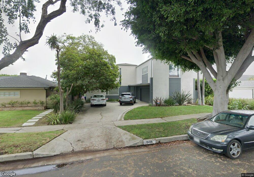
9415 Duxbury Rd Los Angeles, CA 90034
Beverlywood NeighborhoodEstimated Value: $3,583,000 - $4,502,000
5
Beds
4
Baths
4,182
Sq Ft
$984/Sq Ft
Est. Value
About This Home
This home is located at 9415 Duxbury Rd, Los Angeles, CA 90034 and is currently estimated at $4,116,202, approximately $984 per square foot. 9415 Duxbury Rd is a home located in Los Angeles County with nearby schools including Castle Heights Elementary, Palms Middle School, and Alexander Hamilton Senior High School.
Ownership History
Date
Name
Owned For
Owner Type
Purchase Details
Closed on
Jan 22, 2016
Sold by
Lerman Robert D and Lerman Sharon G
Bought by
R & S Lerman Trust
Current Estimated Value
Purchase Details
Closed on
Nov 1, 1994
Sold by
Simons Donald S and Brauner Sandra
Bought by
Lerman Robert Dean and Lerman Sharon Grobman
Home Financials for this Owner
Home Financials are based on the most recent Mortgage that was taken out on this home.
Original Mortgage
$396,000
Outstanding Balance
$156,212
Interest Rate
4.25%
Estimated Equity
$3,959,990
Create a Home Valuation Report for This Property
The Home Valuation Report is an in-depth analysis detailing your home's value as well as a comparison with similar homes in the area
Home Values in the Area
Average Home Value in this Area
Purchase History
| Date | Buyer | Sale Price | Title Company |
|---|---|---|---|
| R & S Lerman Trust | -- | None Available | |
| Lerman Robert D | -- | None Available | |
| Lerman Robert Dean | $495,000 | Equity Title Company |
Source: Public Records
Mortgage History
| Date | Status | Borrower | Loan Amount |
|---|---|---|---|
| Open | Lerman Robert Dean | $396,000 |
Source: Public Records
Tax History Compared to Growth
Tax History
| Year | Tax Paid | Tax Assessment Tax Assessment Total Assessment is a certain percentage of the fair market value that is determined by local assessors to be the total taxable value of land and additions on the property. | Land | Improvement |
|---|---|---|---|---|
| 2025 | $14,530 | $1,195,917 | $545,563 | $650,354 |
| 2024 | $14,530 | $1,172,468 | $534,866 | $637,602 |
| 2023 | $14,254 | $1,149,479 | $524,379 | $625,100 |
| 2022 | $13,601 | $1,126,942 | $514,098 | $612,844 |
| 2021 | $13,415 | $1,104,846 | $504,018 | $600,828 |
| 2019 | $13,015 | $1,072,077 | $489,069 | $583,008 |
| 2018 | $12,890 | $1,051,057 | $479,480 | $571,577 |
| 2016 | $12,297 | $1,010,245 | $460,862 | $549,383 |
| 2015 | $12,118 | $995,071 | $453,940 | $541,131 |
| 2014 | $12,158 | $975,579 | $445,048 | $530,531 |
Source: Public Records
Map
Nearby Homes
- 9313 Bolton Rd
- 9142 Monte Mar Dr
- 9125 David Ave
- 1625 Rexford Dr
- 9503 Beverlywood St
- 2700 Anchor Ave
- 2411 S Canfield Ave
- 9730 Cresta Dr
- 2671 Anchor Ave
- 1601 S Beverly Dr
- 2631 Castle Heights Place
- 1904 Preuss Rd
- 1515 S Beverly Dr Unit 201
- 1630 S Crest Dr
- 8953 W 24th St
- 2502 S Robertson Blvd
- 2011 S Shenandoah St
- 9521 Cattaraugus Ave
- 1543 S Crest Dr
- 2718 Forrester Dr
- 9401 Duxbury Rd
- 9417 Duxbury Rd
- 9406 Bolton Rd
- 9400 Bolton Rd Unit G-HUS
- 9400 Bolton Rd
- 9425 Duxbury Rd
- 9412 Bolton Rd
- 9330 Bolton Rd
- 9345 Duxbury Rd
- 9410 Duxbury Rd
- 9324 Bolton Rd
- 9422 Duxbury Rd
- 9418 Bolton Rd
- 9400 Duxbury Rd
- 9435 Duxbury Rd
- 9428 Duxbury Rd
- 9354 Duxbury Rd
- 9333 Duxbury Rd
- 9318 Bolton Rd
- 9426 Bolton Rd