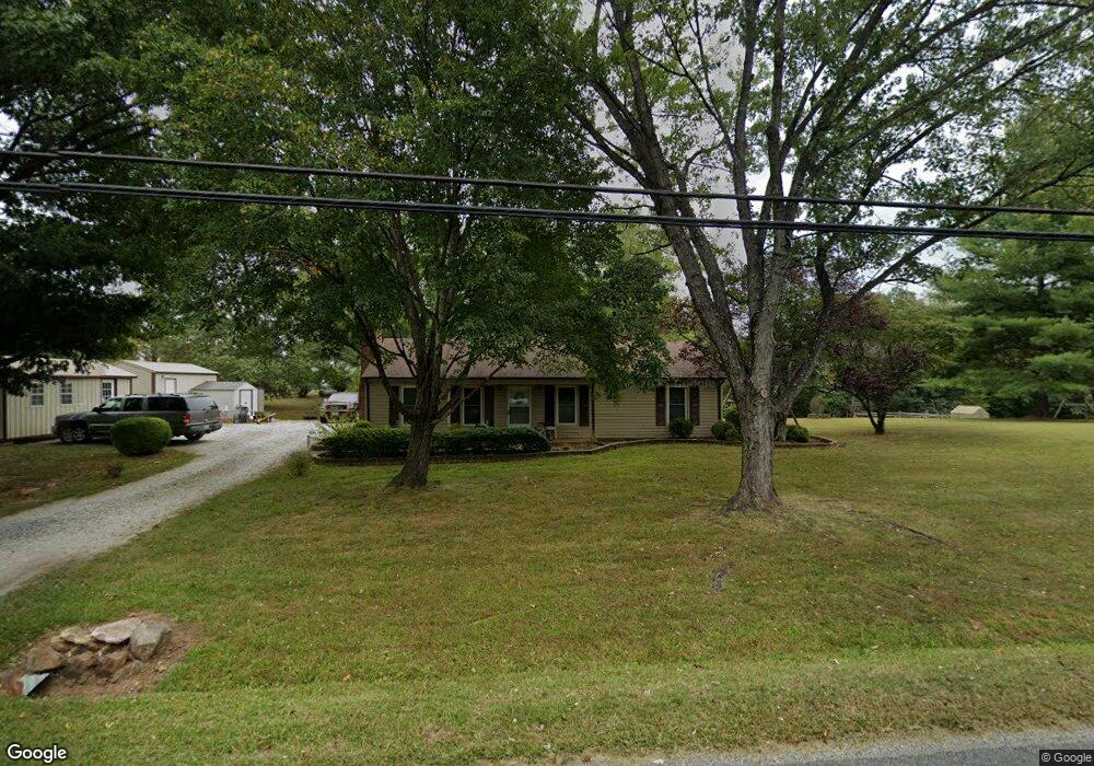
942 High Peak Rd Monroe, VA 24574
Estimated Value: $232,997 - $332,000
3
Beds
2
Baths
1,232
Sq Ft
$221/Sq Ft
Est. Value
About This Home
This home is located at 942 High Peak Rd, Monroe, VA 24574 and is currently estimated at $272,249, approximately $220 per square foot. 942 High Peak Rd is a home located in Amherst County with nearby schools including Elon Elementary School, Monelison Middle School, and Amherst County High School.
Ownership History
Date
Name
Owned For
Owner Type
Purchase Details
Closed on
Jun 3, 2010
Sold by
Pekar Rebekah Cox and Cox Rebekah M
Bought by
White David Michael and White Jeanie Jenkins
Current Estimated Value
Home Financials for this Owner
Home Financials are based on the most recent Mortgage that was taken out on this home.
Original Mortgage
$138,040
Outstanding Balance
$92,001
Interest Rate
5.25%
Mortgage Type
FHA
Estimated Equity
$180,248
Purchase Details
Closed on
Oct 25, 2007
Sold by
Schneider Steven D
Bought by
Cox Rebekah M
Home Financials for this Owner
Home Financials are based on the most recent Mortgage that was taken out on this home.
Original Mortgage
$132,000
Interest Rate
6.37%
Mortgage Type
New Conventional
Purchase Details
Closed on
Feb 1, 2007
Sold by
Middleton Troy E
Bought by
Schneider Steven D
Home Financials for this Owner
Home Financials are based on the most recent Mortgage that was taken out on this home.
Original Mortgage
$72,000
Interest Rate
7.25%
Mortgage Type
Purchase Money Mortgage
Create a Home Valuation Report for This Property
The Home Valuation Report is an in-depth analysis detailing your home's value as well as a comparison with similar homes in the area
Purchase History
| Date | Buyer | Sale Price | Title Company |
|---|---|---|---|
| White David Michael | $137,800 | None Available | |
| Cox Rebekah M | -- | Southern Title Ins Co | |
| Schneider Steven D | -- | None Available |
Source: Public Records
Mortgage History
| Date | Status | Borrower | Loan Amount |
|---|---|---|---|
| Open | White David Michael | $138,040 | |
| Previous Owner | Cox Rebekah M | $132,000 | |
| Previous Owner | Schneider Steven D | $72,000 |
Source: Public Records
Tax History
| Year | Tax Paid | Tax Assessment Tax Assessment Total Assessment is a certain percentage of the fair market value that is determined by local assessors to be the total taxable value of land and additions on the property. | Land | Improvement |
|---|---|---|---|---|
| 2026 | $1,349 | $221,200 | $30,000 | $191,200 |
| 2025 | $684 | $112,200 | $25,000 | $87,200 |
| 2024 | $684 | $112,200 | $25,000 | $87,200 |
| 2023 | $684 | $112,200 | $25,000 | $87,200 |
| 2022 | $684 | $112,200 | $25,000 | $87,200 |
| 2021 | $684 | $112,200 | $25,000 | $87,200 |
| 2020 | $684 | $112,200 | $25,000 | $87,200 |
| 2019 | $676 | $110,800 | $31,000 | $79,800 |
| 2018 | $676 | $110,800 | $31,000 | $79,800 |
| 2017 | $676 | $110,800 | $31,000 | $79,800 |
| 2016 | $676 | $110,800 | $31,000 | $79,800 |
| 2015 | $620 | $110,800 | $31,000 | $79,800 |
| 2014 | $620 | $110,800 | $31,000 | $79,800 |
Source: Public Records
Map
Nearby Homes
- 216 Burford Farm Rd
- 893 Cedar Gate Rd
- 0 Crawford's Hill Place
- 150 Terrapin Station Ln
- 447 Matohe Rd
- 111 Partridge Place
- 2229 Cedar Gate Rd
- 126 Rothwood Rd
- 157 Old Country Rd
- 135 Old Country Rd
- 123 Lynchburg Ave
- 249 Camden Dr
- 257 Camden Dr
- 124-138 Cedar Gate Rd
- 112 Graham Creek Rd
- 109 Cedar Gate Rd
- 1612 S Amherst Hwy
- 0 S Amherst Hwy Unit 336267
- 0 Rothwood Rd
- 1697 S Amherst Hwy
- 1250 High Peak Rd
- 114 Burford Farm Rd
- 928 High Peak Rd
- 961 High Peak Rd
- 114 Macon Ln
- 966 High Peak Rd
- 971 High Peak Rd
- 914 High Peak Rd
- 907 High Peak Rd
- 152 Burford Farm Rd
- 145 Burford Farm Rd
- 138 Macon Ln
- 895 High Peak Rd
- 997 High Peak Rd
- 892 High Peak Rd
- 990 High Peak Rd
- 877 High Peak Rd
- 156 Macon Ln
- 147 Macon Ln
- 872 High Peak Rd
Your Personal Tour Guide
Ask me questions while you tour the home.