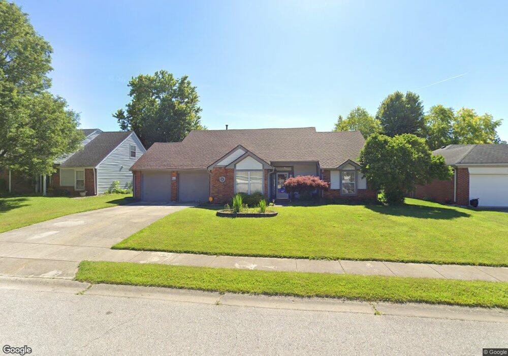
943 Brendon Dr Plainfield, IN 46168
Estimated Value: $297,000 - $337,000
3
Beds
2
Baths
2,159
Sq Ft
$147/Sq Ft
Est. Value
About This Home
This home is located at 943 Brendon Dr, Plainfield, IN 46168 and is currently estimated at $316,929, approximately $146 per square foot. 943 Brendon Dr is a home located in Hendricks County with nearby schools including Van Buren Elementary School, Plainfield Community Middle School, and Plainfield High School.
Ownership History
Date
Name
Owned For
Owner Type
Purchase Details
Closed on
Mar 28, 2005
Sold by
Ward James F
Bought by
Grubbs Ricky J and Grubbs Wendy S
Current Estimated Value
Home Financials for this Owner
Home Financials are based on the most recent Mortgage that was taken out on this home.
Original Mortgage
$150,372
Outstanding Balance
$74,690
Interest Rate
5.71%
Mortgage Type
FHA
Estimated Equity
$242,239
Purchase Details
Closed on
Oct 28, 2003
Sold by
Brizendine Jane A Payton
Bought by
Ward James F
Home Financials for this Owner
Home Financials are based on the most recent Mortgage that was taken out on this home.
Original Mortgage
$138,542
Interest Rate
6.04%
Mortgage Type
FHA
Create a Home Valuation Report for This Property
The Home Valuation Report is an in-depth analysis detailing your home's value as well as a comparison with similar homes in the area
Home Values in the Area
Average Home Value in this Area
Purchase History
| Date | Buyer | Sale Price | Title Company |
|---|---|---|---|
| Grubbs Ricky J | -- | None Available | |
| Ward James F | -- | -- |
Source: Public Records
Mortgage History
| Date | Status | Borrower | Loan Amount |
|---|---|---|---|
| Open | Grubbs Ricky J | $150,372 | |
| Previous Owner | Ward James F | $138,542 |
Source: Public Records
Tax History
| Year | Tax Paid | Tax Assessment Tax Assessment Total Assessment is a certain percentage of the fair market value that is determined by local assessors to be the total taxable value of land and additions on the property. | Land | Improvement |
|---|---|---|---|---|
| 2025 | $2,470 | $261,700 | $54,000 | $207,700 |
| 2024 | $2,470 | $266,600 | $31,200 | $235,400 |
| 2023 | $2,305 | $254,300 | $29,600 | $224,700 |
| 2022 | $2,376 | $242,100 | $28,200 | $213,900 |
| 2021 | $2,113 | $217,000 | $27,200 | $189,800 |
| 2020 | $1,939 | $202,800 | $27,200 | $175,600 |
| 2019 | $1,773 | $191,500 | $25,300 | $166,200 |
| 2018 | $1,775 | $187,500 | $25,300 | $162,200 |
| 2017 | $1,570 | $165,800 | $24,400 | $141,400 |
| 2016 | $1,479 | $159,400 | $24,400 | $135,000 |
| 2014 | $1,356 | $147,200 | $23,000 | $124,200 |
Source: Public Records
Map
Nearby Homes
- 800 Walton Dr
- 1107 Ridgewood Dr
- 2668 Marjorie Ln
- 537 Wayside Ct
- 1713 Sycamore Dr
- 430 Lawndale Dr
- 428 Southmore St
- 942 Highlander Dr
- 324 Lawndale Dr
- 1018 Pamela Dr
- 228 Shaw St
- 2198 Galleone Way
- 7683 Fairwood Blvd
- 5565 Crystal Bay West Dr
- 1849 Crystal Bay East Dr
- 1771 Quaker Blvd
- 5968 Mia Ct
- 5906 Juna Ave
- 5922 Juna Ave
- 5907 Farwell Ave
- 947 Brendon Dr
- 939 Brendon Dr
- 922 Brookside Ln
- 935 Brendon Dr
- 926 Brookside Ln
- 918 Brookside Ln
- 951 Brendon Dr
- 936 Brendon Dr
- 1335 Keller Dr
- 914 Brookside Ln
- 940 Brendon Dr
- 930 Brookside Ln
- 931 Brendon Dr
- 948 Brendon Dr
- 910 Brookside Ln
- 944 Brendon Dr
- 1334 Keller Dr
- 927 Brendon Dr
- 1426 Sabrina Cir
- 1329 Keller Dr
Your Personal Tour Guide
Ask me questions while you tour the home.