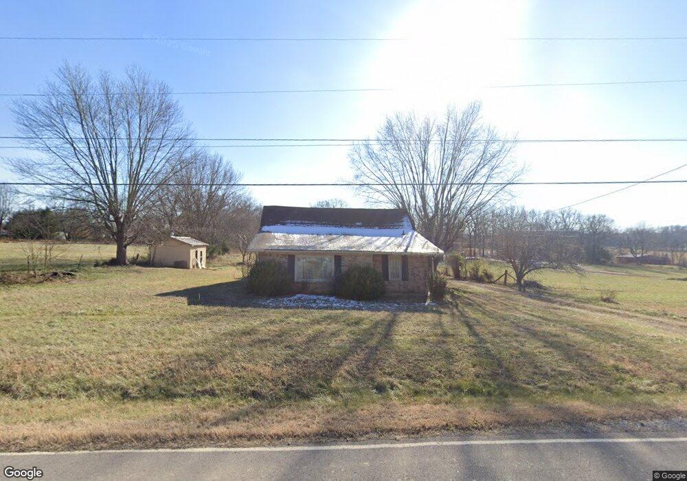
946 Clearview Rd Cottontown, TN 37048
Estimated Value: $252,000 - $417,000
3
Beds
2
Baths
1,530
Sq Ft
$212/Sq Ft
Est. Value
About This Home
This home is located at 946 Clearview Rd, Cottontown, TN 37048 and is currently estimated at $325,045, approximately $212 per square foot. 946 Clearview Rd is a home located in Sumner County with nearby schools including Portland Gateview Elementary School, Portland West Middle School, and Portland High School.
Ownership History
Date
Name
Owned For
Owner Type
Purchase Details
Closed on
Apr 16, 2025
Sold by
Cooksey Betsy Gail Agee and Mccreary Cynthia Marie
Bought by
Chapman Andrew
Current Estimated Value
Home Financials for this Owner
Home Financials are based on the most recent Mortgage that was taken out on this home.
Original Mortgage
$284,000
Outstanding Balance
$167,944
Interest Rate
6.63%
Mortgage Type
Construction
Estimated Equity
$157,101
Purchase Details
Closed on
Jul 22, 2024
Sold by
Halvorson Bob and Suiter Rick
Bought by
Allen Aaron and Allen Kimberly
Purchase Details
Closed on
May 2, 2023
Sold by
Agee Cliter Mai Bryant
Bought by
Cooksey Betsy Gail Agee and Mccreary Cynthia Marie
Purchase Details
Closed on
Nov 9, 1994
Sold by
Volunteer Restr & Const Co
Bought by
Pentecost Alvin C
Create a Home Valuation Report for This Property
The Home Valuation Report is an in-depth analysis detailing your home's value as well as a comparison with similar homes in the area
Home Values in the Area
Average Home Value in this Area
Purchase History
| Date | Buyer | Sale Price | Title Company |
|---|---|---|---|
| Chapman Andrew | $250,000 | None Listed On Document | |
| Chapman Andrew | $250,000 | None Listed On Document | |
| Allen Aaron | $120,000 | Title Escrow Of Robertson Coun | |
| Cooksey Betsy Gail Agee | -- | None Listed On Document | |
| Pentecost Alvin C | $106,400 | -- |
Source: Public Records
Mortgage History
| Date | Status | Borrower | Loan Amount |
|---|---|---|---|
| Open | Chapman Andrew | $284,000 | |
| Closed | Chapman Andrew | $284,000 |
Source: Public Records
Tax History Compared to Growth
Tax History
| Year | Tax Paid | Tax Assessment Tax Assessment Total Assessment is a certain percentage of the fair market value that is determined by local assessors to be the total taxable value of land and additions on the property. | Land | Improvement |
|---|---|---|---|---|
| 2024 | $939 | $66,075 | $27,675 | $38,400 |
| 2023 | $909 | $40,350 | $14,650 | $25,700 |
| 2022 | $913 | $40,350 | $14,650 | $25,700 |
| 2021 | $913 | $40,350 | $14,650 | $25,700 |
| 2020 | $913 | $40,350 | $14,650 | $25,700 |
| 2019 | $913 | $0 | $0 | $0 |
| 2018 | $595 | $0 | $0 | $0 |
| 2017 | $595 | $0 | $0 | $0 |
| 2016 | $595 | $0 | $0 | $0 |
| 2015 | -- | $0 | $0 | $0 |
| 2014 | -- | $0 | $0 | $0 |
Source: Public Records
Map
Nearby Homes
- 782 New Deal Potts Rd
- 167 Denning Ln
- 0 New Deal Pots Rd
- 721 New Deal Potts Rd
- 686 Clearview Rd
- 0 Jake Link Rd
- 1 Clearview Rd
- 101 Riggs Rd
- 541 Clearview Rd
- 105 Riggs Rd
- 458 Jake Link Rd
- 572 Buntin Mill Rd
- 512 N Happy Hollow Rd
- 300 N Happy Hollow Rd
- 1502 New Deal Potts Rd
- 1003 Roland Ct
- 267 Aplin Branch Rd
- 482 Austin Branch Rd
- 3172 Highway 76
- 3011 Highway 76
- 945 Clearview Rd
- 939 New Deal Potts Rd
- 961 Clearview Rd
- 920 Clearview Rd
- 1011 New Deal Potts Rd
- 1011 New Deal Potts Rd
- 919 New Deal Potts Rd
- 1002 New Deal Potts Rd
- 940 New Deal Potts Rd
- 1019 New Deal Potts Rd
- 1010 New Deal Potts Rd
- 1027 New Deal Potts Rd
- 920 New Deal Potts Rd
- 1018 New Deal Potts Rd
- 1031 New Deal Potts Rd
- 115 Denning Ln
- 1049 New Deal Potts Rd
- 905 New Deal Potts Rd
- 791 New Deal Potts Rd
- 1028 New Deal Potts Rd