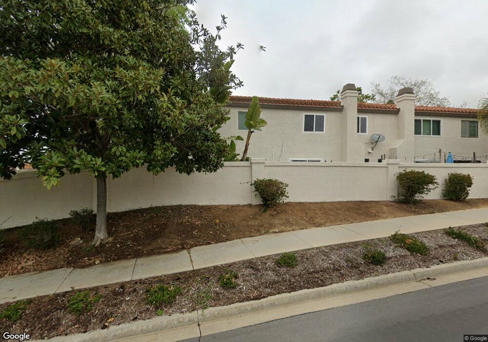
948 Laurelwood St Carlsbad, CA 92011
Poinsettia NeighborhoodEstimated Value: $917,000 - $1,083,000
2
Beds
3
Baths
1,292
Sq Ft
$780/Sq Ft
Est. Value
About This Home
This home is located at 948 Laurelwood St, Carlsbad, CA 92011 and is currently estimated at $1,007,986, approximately $780 per square foot. 948 Laurelwood St is a home located in San Diego County with nearby schools including Pacific Rim Elementary, Aviara Oaks Middle, and Sage Creek High.
Ownership History
Date
Name
Owned For
Owner Type
Purchase Details
Closed on
Sep 26, 2024
Sold by
Dolores Ann Edwards Family Trust and Edwards Dolores Ann
Bought by
Edwards Dolores A
Current Estimated Value
Purchase Details
Closed on
Apr 10, 2019
Sold by
Famil Silberberger Dolores Ann
Bought by
Edwards Dolores Ann
Purchase Details
Closed on
Mar 2, 1999
Sold by
Silberberger Dee A and Silberberger Ann Dolores
Bought by
Silberberger Dolores Ann
Purchase Details
Closed on
Jul 30, 1990
Purchase Details
Closed on
Apr 4, 1986
Create a Home Valuation Report for This Property
The Home Valuation Report is an in-depth analysis detailing your home's value as well as a comparison with similar homes in the area
Home Values in the Area
Average Home Value in this Area
Purchase History
| Date | Buyer | Sale Price | Title Company |
|---|---|---|---|
| Edwards Dolores A | -- | None Listed On Document | |
| Edwards Dolores A | -- | None Listed On Document | |
| Edwards Dolores Ann | -- | None Available | |
| Silberberger Dolores Ann | -- | -- | |
| -- | $175,000 | -- | |
| -- | $100,500 | -- |
Source: Public Records
Tax History Compared to Growth
Tax History
| Year | Tax Paid | Tax Assessment Tax Assessment Total Assessment is a certain percentage of the fair market value that is determined by local assessors to be the total taxable value of land and additions on the property. | Land | Improvement |
|---|---|---|---|---|
| 2025 | $3,357 | $315,619 | $198,393 | $117,226 |
| 2024 | $3,357 | $309,431 | $194,503 | $114,928 |
| 2023 | $3,339 | $303,365 | $190,690 | $112,675 |
| 2022 | $3,287 | $297,417 | $186,951 | $110,466 |
| 2021 | $3,263 | $291,586 | $183,286 | $108,300 |
| 2020 | $3,242 | $288,597 | $181,407 | $107,190 |
| 2019 | $3,107 | $282,939 | $177,850 | $105,089 |
| 2018 | $3,051 | $277,392 | $174,363 | $103,029 |
| 2017 | $90 | $271,954 | $170,945 | $101,009 |
| 2016 | $2,880 | $266,623 | $167,594 | $99,029 |
| 2015 | $2,869 | $262,619 | $165,077 | $97,542 |
| 2014 | $2,822 | $257,476 | $161,844 | $95,632 |
Source: Public Records
Map
Nearby Homes
- 6915 Pear Tree Dr
- 6777 Lonicera St
- 874 Marigold Ct
- 7013 Lavender Way
- 6951 Quiet Cove Dr
- 839 Skysail Ave
- 802 Spindrift Ln
- 6557 Coneflower Dr
- 7219 Linden Terrace
- 803 Skysail Ave
- 907 Caminito Estrada Unit E
- 7089 Tatler Rd
- 6497 Wayfinders Ct
- 6925 Waters End Dr
- 7025 San Bartolo St Unit 42
- 7207 Santa Barbara St Unit 154
- 7016 San Carlos St Unit 61
- 7002 San Bartolo St Unit 30
- 7205 Santa Barbara St Unit 153
- 7027 San Bartolo St Unit 43
- 950 Laurelwood St
- 946 Laurelwood St
- 952 Laurelwood St Unit 3
- 944 Laurelwood St
- 942 Laurelwood St Unit 3
- 940 Laurelwood St
- 938 Laurelwood St
- 951 Aspen Ct
- 953 Aspen Ct
- 955 Aspen Ct
- 947 Laurelwood St
- 947 Aspen Ct
- 949 Laurelwood St
- 945 Laurelwood St
- 951 Laurelwood St
- 957 Aspen Ct
- 945 Aspen Ct
- 6894 Peach Tree Rd
- 941 Laurelwood St
- 6896 Peach Tree Rd