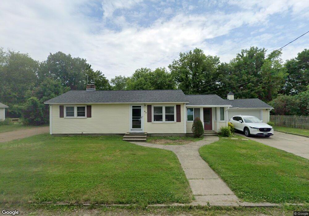
95 Front St Merrimack, NH 03054
Estimated Value: $432,000 - $495,000
2
Beds
2
Baths
1,032
Sq Ft
$444/Sq Ft
Est. Value
About This Home
This home is located at 95 Front St, Merrimack, NH 03054 and is currently estimated at $458,501, approximately $444 per square foot. 95 Front St is a home located in Hillsborough County with nearby schools including Reeds Ferry School, James Mastricola Upper Elementary School, and Merrimack Middle School.
Ownership History
Date
Name
Owned For
Owner Type
Purchase Details
Closed on
Jul 30, 2025
Sold by
Schoof Steven W and Schoof Annette C
Bought by
Steven W & A C Schoof Ret and Schoof
Current Estimated Value
Purchase Details
Closed on
Jun 28, 2010
Sold by
Susen Anne and Susen David
Bought by
Schoof Steve and Schoof Annette
Home Financials for this Owner
Home Financials are based on the most recent Mortgage that was taken out on this home.
Original Mortgage
$211,156
Interest Rate
4.98%
Mortgage Type
Purchase Money Mortgage
Purchase Details
Closed on
May 29, 2008
Sold by
Deutsche Bank Natl T C
Bought by
Susen David and Susen Anne
Home Financials for this Owner
Home Financials are based on the most recent Mortgage that was taken out on this home.
Original Mortgage
$168,600
Interest Rate
5.91%
Mortgage Type
Purchase Money Mortgage
Purchase Details
Closed on
Jan 10, 2007
Sold by
Bernard Martin R
Bought by
Ameriquest Mtg Securit
Create a Home Valuation Report for This Property
The Home Valuation Report is an in-depth analysis detailing your home's value as well as a comparison with similar homes in the area
Home Values in the Area
Average Home Value in this Area
Purchase History
| Date | Buyer | Sale Price | Title Company |
|---|---|---|---|
| Steven W & A C Schoof Ret | -- | -- | |
| Steven W & A C Schoof Ret | -- | -- | |
| Schoof Steve | $214,000 | -- | |
| Schoof Steve | $214,000 | -- | |
| Susen David | $170,000 | -- | |
| Susen David | $170,000 | -- | |
| Ameriquest Mtg Securit | $251,000 | -- | |
| Ameriquest Mtg Securit | $251,000 | -- |
Source: Public Records
Mortgage History
| Date | Status | Borrower | Loan Amount |
|---|---|---|---|
| Previous Owner | Ameriquest Mtg Securit | $211,156 | |
| Previous Owner | Ameriquest Mtg Securit | $168,600 |
Source: Public Records
Tax History Compared to Growth
Tax History
| Year | Tax Paid | Tax Assessment Tax Assessment Total Assessment is a certain percentage of the fair market value that is determined by local assessors to be the total taxable value of land and additions on the property. | Land | Improvement |
|---|---|---|---|---|
| 2024 | $5,957 | $287,900 | $163,500 | $124,400 |
| 2023 | $5,600 | $287,900 | $163,500 | $124,400 |
| 2022 | $5,004 | $287,900 | $163,500 | $124,400 |
| 2021 | $4,943 | $287,900 | $163,500 | $124,400 |
| 2020 | $4,903 | $203,800 | $109,000 | $94,800 |
| 2019 | $4,908 | $203,400 | $109,000 | $94,400 |
| 2018 | $4,906 | $203,400 | $109,000 | $94,400 |
| 2017 | $4,753 | $203,400 | $109,000 | $94,400 |
| 2016 | $4,635 | $203,400 | $109,000 | $94,400 |
| 2015 | $4,751 | $192,200 | $104,000 | $88,200 |
| 2014 | $4,630 | $192,200 | $104,000 | $88,200 |
| 2013 | $4,596 | $192,200 | $104,000 | $88,200 |
Source: Public Records
Map
Nearby Homes
- 1 Pleasant St
- 19 Vista Way
- 10 Kingston Ct Unit 10
- 11 Essex Green Ct
- 22 Essex Green Ct
- 12 Clinton Ct
- 29 Bedford Rd
- 38 Mallard Point
- 490 Charles Bancroft Hwy
- 1 Tallarico St Unit 14
- 0 Tallarico St Unit 3 5032471
- 0 Tallarico St Unit 5 5032751
- 0 Tallarico St Unit 25 5043170
- 0 Tallarico St Unit 10 5044310
- 0 Tallarico St Unit 12 5033131
- 0 Tallarico St Unit Lot 11 5056385
- 22 Kimberly Dr
- 25 Chatfield Dr
- 22 Clay St
- 9 Mustang Dr Unit C